
Stratocumulus cloud facts for kids
Quick facts for kids Stratocumulus clouds |
|
|---|---|

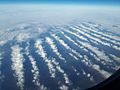
Aerial photograph of Stratocumulus perlucidus clouds over the midwestern United States
|
|
| Abbreviation | Sc |
| Symbol | |
| Genus | Stratocumulus (layer heap) |
| Species |
|
| Variety |
|
| Altitude | 500-2,000 m (2,000-7,000 ft) |
| Classification | Family C (Low-level) |
| Appearance | Thicker, dark gray, and somewhat conjoined heaps of clouds. |
| Precipitation | Uncommon Rain, Snow or Snow pellets |
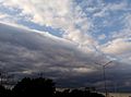
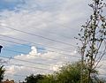
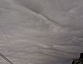
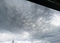
A stratocumulus cloud is a common type of cloud. People sometimes call them cumulostratus. These clouds look like large, dark, rounded clumps. They usually appear in groups, lines, or waves. Each cloud clump is bigger than those found in altocumulus clouds. Stratocumulus clouds are also lower in the sky, usually below 2,000 metres (6,600 ft).
These clouds form when weak air currents create shallow cloud layers. This happens because the air higher up is drier and more stable. This stable air stops the clouds from growing taller. In the past, people in English called this cloud a twain cloud. This was because it seemed like a mix of two different cloud types.
Contents
What are Stratocumulus Clouds?
Stratocumulus clouds are rounded clumps or patches of clouds. They can be white to dark gray. These clouds usually form in groups. Each cloud part can connect with others. Sometimes, they even form a regular pattern in the sky.
Where Do They Appear?
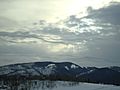
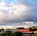
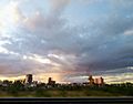
Huge areas of the ocean near the equator and poles are often covered with large sheets of stratocumulus clouds. These clouds can form special patterns that scientists are still studying. In warmer areas, they cover the edges of high-pressure zones. This helps to reduce how much sunlight the ocean absorbs. When these clouds move over land, they can make summer heat or winter cold feel less extreme.
People often say the weather is 'dull' when stratocumulus clouds cover the sky. This usually happens in a warm sector between different weather fronts. It can also happen in areas of high pressure. Sometimes, they stay over one area for several days. If the air over land is wet and warm enough, stratocumulus clouds might grow into other cumulus clouds. They might also get thick enough to cause some light rain. In drier places, they quickly disappear over land. They then look like small cumulus clouds. This often happens in the late morning when the sun's heat breaks them up. They often form again in the evening as the sun's heat goes down.
Do They Bring Rain or Snow?
Most of the time, stratocumulus clouds do not bring any rain. If they do, it is usually only light rain or snow. However, you often see these clouds before or after bad weather. So, they might be a sign that storms are coming. These storms could be thunderstorms or bring gusty winds.
You also often see stratocumulus clouds below other higher clouds. These higher clouds are called cirrostratus and altostratus. They often appear before a warm front. These higher clouds block some of the sun's heat. This makes any cumulus clouds spread out and turn into stratocumulus clouds.

How to Tell Them Apart from Altocumulus Clouds
Stratocumulus clouds look a lot like altocumulus clouds. It can be easy to mix them up. Here is a simple way to tell the difference:
- Point your hand towards the cloud.
- If the cloud clump is about the size of your thumb, it is likely an altocumulus cloud.
- If it is the size of your fist, it is probably a stratocumulus cloud.
This trick might not work if the stratocumulus clouds are broken up into very small pieces.
Cool Things to See in Stratocumulus Clouds
Stratocumulus clouds are the main type of cloud that can create crepuscular rays. These are the beautiful rays of sunlight that seem to spread out from behind the clouds. Thin stratocumulus clouds can also cause a corona effect around the Moon at night. This looks like a colorful ring around the Moon.
How Stratocumulus Clouds Form
Stratocumulus clouds usually form when a stratus cloud rises and breaks apart. They can also form from altostratus and nimbostratus clouds. This happens when evaporating rain condenses into a cloud. Or, it can happen when a nimbostratus cloud gets thinner and breaks up. If a cumulus cloud gets flattened, for example, by strong winds or a temperature inversion, it can also turn into a stratocumulus cloud.
Types of Stratocumulus Clouds
Clouds are grouped into different "species" based on how they look.
Stratocumulus Stratiformis
Stratocumulus Stratiformis clouds are wide, flat sheets. They look a bit lumpy. They show only a little bit of air movement inside them.
Stratocumulus Lenticularis
Stratocumulus Lenticularis clouds are separate, flat, and elongated. They look like seeds or lenses. You often see them in cold countries or in warmer places during winter. Winds passing over hills or mountains can also form them. When this happens, they can be very regular in shape.
Stratocumulus Castellanus
Stratocumulus Castellanus clouds have stronger air movement. This is because the air is becoming more unstable. They are different from other stratocumulus clouds because they have puffy, tower-like shapes on top of the cloud layer. They might look like cumulus congestus clouds. But with stratocumulus castellanus, there is always a clear layer of clouds below the towers. Stratocumulus castellanus can grow into cumulus congestus (and even into cumulonimbus clouds) if conditions are right. Any rain from stratocumulus castellanus is usually not as heavy as from cumulus congestus.
-
Stratocumulus stratiformis
-
Stratocumulus lenticularis
-
Stratocumulus castellanus


How Much Light Passes Through?
Clouds are also grouped by how much light they let through.
Stratocumulus Opacus
Stratocumulus Opacus is a dark layer of clouds that covers the whole sky. You cannot see any breaks in it. However, the cloud sheet is not perfectly smooth. You can still see the bases of separate cloud clumps. This type is the main one that brings rain, but any rain is usually light. If the cloud layer gets so gray that you cannot tell individual clouds apart, it turns into a stratus cloud.
Stratocumulus Perlucidus
Stratocumulus Perlucidus is a layer of stratocumulus clouds with small gaps. These gaps appear in an irregular pattern. Through them, you can see clear sky or higher clouds.
Stratocumulus Translucidus
Stratocumulus Translucidus clouds are separate groups of stratocumulus clouds. You can see clear sky (or higher clouds) between them. Most of the time, they do not bring any rain.
Patterns in Stratocumulus Clouds
Clouds can also be grouped by the patterns they form.
Stratocumulus Undulatus
Stratocumulus Undulatus clouds look like nearly parallel waves or rolls. They can also be separate, elongated clouds. They do not grow much vertically.
Stratocumulus Radiatus
Stratocumulus Radiatus clouds look similar to stratocumulus undulatus. But stratocumulus undulatus clouds move across the wind direction. Stratocumulus radiatus clouds move parallel to the wind direction.
Stratocumulus Duplicatus
Stratocumulus Duplicatus clouds appear as stratocumulus clouds with two or more layers or sheets. You often see Stratocumulus duplicatus with lenticularis clouds.
Stratocumulus Lacunosus
Stratocumulus Lacunosus clouds are very rare. They only form when there are strong localized downdrafts (air moving downwards) pushing through the stratocumulus cloud.
-
Stratocumulus undulatus clouds, seen from an airplane
-
Stratocumulus undulatus asperitas clouds, seen from Earth
-
Stratocumulus radiatus
-

Stratocumulus duplicatus; Stratocumulus stratiformis (right) and Stratocumulus floccus (left)
-
Stratocumulus lacunosus


Special Features of Stratocumulus Clouds
Clouds can have extra features that make them unique.
Stratocumulus Mamma
Stratocumulus Mamma is a type of mammatus cloud. These clouds have pouch-like shapes hanging down from their base.

Stratocumulus Asperitas
Stratocumulus Asperitas is a rare, newly recognized feature. It looks like chaotic, wavy patterns on the underside of a stratocumulus cloud layer. Scientists think these clouds are formed by very strong changes in wind speed and direction.
Stratocumulus Fluctus
Stratocumulus Fluctus is another rare, newly recognized feature. It looks like short-lived "sea waves" forming on top of a stratocumulus cloud. These are caused by differences in wind speed and direction just above and below the cloud.
Rain-Related Features
These features describe what happens with precipitation from the clouds.
Stratocumulus Virga
Stratocumulus Virga is a type of precipitation that evaporates before it reaches the ground. You can see streaks of rain or snow falling, but they disappear in the air.
Stratocumulus Praecipitatio
Stratocumulus Praecipitatio is a type of precipitation that actually reaches the ground. It usually appears as light rain or snow.
-
Stratocumulus stratiformis opacus radiatus praecipitatio

How Other Clouds Can Become Stratocumulus
Sometimes, stratocumulus clouds form from other types of clouds. These are called "mother clouds."
Stratocumulus Cumulomutatus
Stratocumulus Cumulomutatus are flat and elongated stratocumulus clouds. They form in the evening. This happens when the air currents that make cumulus clouds grow taller start to weaken. The cumulus clouds then spread out sideways. They can also form under altostratus clouds that come before a warm weather front. This is when cumulus clouds usually stop growing tall as the sun's heat decreases. Like most other stratocumulus types (except castellanus), you often find them in areas of high pressure.
Stratocumulus Cumulogenitus
Stratocumulus Cumulogenitus clouds form from cumulus or cumulonimbus clouds. This happens when the air movement that builds them up slows down. When they are forming, the puffy tops of the original cumulus clouds can stick out from the stratocumulus cumulogenitus for a while. Eventually, they spread out completely. Stratocumulus cumulogenitus can look like a long sheet or a group of separate, elongated cloud rolls or waves.
Clouds and Climate Change
Scientists are studying how clouds might change with climate change. Some research suggests that if CO2 levels in the air get very high (around 1,200 ppm), stratocumulus clouds in some areas might break up. This could cause the Earth to get much warmer. This is still a topic scientists are actively researching and discussing.
