Suffield Township, Portage County, Ohio facts for kids
Quick facts for kids
Suffield Township
|
|||
|---|---|---|---|
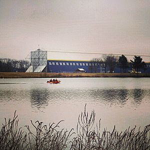
Wingfoot Lake and the Goodyear Airship Hangar
|
|||
|
|||
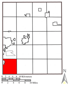
Location within Portage County
|
|||
| Country | United States | ||
| State | Ohio | ||
| County | Portage | ||
| Area | |||
| • Total | 24.7 sq mi (64.0 km2) | ||
| • Land | 22.9 sq mi (59.4 km2) | ||
| • Water | 1.8 sq mi (4.7 km2) | ||
| Elevation | 1,181 ft (360 m) | ||
| Population
(2020)
|
|||
| • Total | 5,973 | ||
| • Density | 260.8/sq mi (100.6/km2) | ||
| Time zone | UTC-5 (Eastern (EST)) | ||
| • Summer (DST) | UTC-4 (EDT) | ||
| ZIP code |
44260
|
||
| Area code(s) | 330, 234 | ||
| FIPS code | 39-75189 | ||
| GNIS feature ID | 1086841 | ||
Suffield Township is one of the eighteen townships in Portage County, Ohio, United States. A township is like a local government area. According to the 2020 census, about 5,973 people live in Suffield Township.
Contents
Where is Suffield Township Located?
Suffield Township is in the southwest part of Portage County. It shares its borders with several other townships and cities.
Neighboring Areas of Suffield
- To the north, you'll find Brimfield Township.
- The northeast corner touches Rootstown Township.
- To the east is Randolph Township.
- South of Suffield is Lake Township in Stark County.
- To the west, it borders Springfield Township in Summit County.
- The northwest corner is next to the city of Tallmadge.
Villages and Hamlets in Suffield
A small part of the village of Mogadore is located in the northwest area of Suffield Township. Also, the small community called Suffield is right in the middle of the township. This area is known as a census-designated place, which means it's a special area defined for collecting census data.
Suffield Township covers an area of about 24 square miles (62 square kilometers). It was originally formed from a historical area called the Connecticut Western Reserve.
Natural Wonders: Flatiron Lake Bog Preserve
One interesting natural spot in Suffield Township is the Flatiron Lake Bog preserve. This special area is 97 acres (about 39 hectares) in size. It's home to a unique type of wetland called a kettle hole bog. This bog formed around 12,000 years ago! It is now protected and cared for by The Nature Conservancy, an organization that works to save important natural places.
Suffield's Name and Early Days
Suffield Township got its name from Suffield, Connecticut. Many of the first people who settled here came from that town. Suffield Township is the only township with this name in the entire state of Ohio.
Post Offices in Suffield's Past
A post office was first opened in Suffield in 1836. It helped people send and receive mail for many years, until it closed in 1966. There was also another small settlement in the southwest part of the township called Mishler. Mishler had its own post office from 1882 until 1917.
Images for kids
See also
 In Spanish: Municipio de Suffield para niños
 | Delilah Pierce |
 | Gordon Parks |
 | Augusta Savage |
 | Charles Ethan Porter |


