
Sunnyhills facts for kids
Quick facts for kids
Sunnyhills
|
|
|---|---|
|
Suburb
|
|

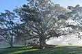
Moreton Bay fig tree in a public park in Sunnyhills on a foggy morning
|
|

Sunnyhills
Location in New Zealand
|
|
| Country | New Zealand |
| Local authority | Auckland |
| Electoral ward | Howick ward |
| Local board | Howick Local Board |
| Area | |
| • Land | 174 ha (430 acre) |
| Population
(June 2023)
|
|
| • Total | 5,870 |
|
|
||
Sunnyhills is a suburb in East Auckland, New Zealand. It is located on the eastern side of the Tāmaki River, close to Pakuranga. This area used to be farmland. Homes started to be built here in the mid-1960s.
Contents
What is Sunnyhills Like?

Sunnyhills is found on the eastern edge of the Tāmaki River. This river is actually a "drowned river valley," which means it's a river valley that has been filled by the sea. Along the shoreline at a place called Sanctuary Point, you can see interesting white volcanic rock deposits. These are at the bottom of the cliffs.
A Look Back: Sunnyhills History
The land where Sunnyhills is now has a long history. It is part of the traditional area of Ngāi Tai ki Tāmaki. This Māori tribe arrived in the area around the year 1300. They came on a special canoe called the Tainui.
Early Māori Life in Sunnyhills
The mouth of the Tāmaki River was known as Te Wai ō Tāiki. This name means "The Waters of Tāiki," named after a Ngāi Tai ancestor. Tāiki and his people settled along the eastern side of the river. They grew many crops in large gardens there.
Ōhuiarangi / Pigeon Mountain was a very important fortified village, called a pā, for Ngāi Tai ki Tāmaki. It was named after an ancestor named Huiārangi. The sides of the mountain and nearby areas were used for stonefield gardens. The mountain was also a key place for catching kererū (New Zealand pigeons).
Later, around the 1700s, a Ngāi Tai leader named Ngāriki built another strong pā. This one was at Te Naupata (Musick Point), which is at the end of the peninsula. It was called Te Waiārohia. Ngāriki's followers also lived at the Ōhuiarangi pā.
Changes and European Settlement
In the 1820s, during a time of wars where Māori tribes used muskets, many Ngāi Tai people went to the Waikato region for safety. When a missionary named William Thomas Fairburn visited in 1833, the area was mostly empty.
In 1836, Fairburn arranged a large land sale with Māori chiefs. This sale covered much of what is now South Auckland and East Auckland. The idea was to stop fighting in the area. However, it's not clear if the chiefs fully understood or agreed to everything. Māori people continued to live on the land as they always had.
Later, in 1854, the government looked into Fairburn's land purchase. A special area was set aside for Ngāi Tai near the Wairoa River. As part of this agreement, Ngāi Tai people agreed to leave their old settlements further west.
How Pakuranga and Sunnyhills Grew
The Pakuranga area was sold by the government in 1843. In 1847, Howick was set up as a military outpost to protect Auckland. Retired British soldiers and their families lived there.
By the late 1800s, the Pakuranga area looked like the English countryside. It had many poplar, oak, and willow trees. Growing wheat was a main way to earn money. But by the 1940s, dairy farms started to take over. By 1956, Pakuranga had grown enough to become its own town within Manukau County.
Pakuranga saw a lot of new growth from the 1950s onwards. Many new housing areas were built. Sunnyhills was one of these new developments. It was built in the mid-1960s. Sunnyhills was praised because its houses had unique designs. They also had modern features like telephone and power cables buried underground. Sunnyhills Primary School opened in October 1970.
Who Lives in Sunnyhills?
Sunnyhills covers about 1.74 square kilometers. As of 2023, it has an estimated population of about 7,000 people. This means there are about 4,000 people living in each square kilometer.
Before 2023, Sunnyhills was a bit bigger. In the 2018 New Zealand census, it had 6,885 people. This was an increase of 270 people since 2013. There were 2,334 households. There were more females (3,603) than males (3,282).
About 1,302 people (18.9%) were under 15 years old. About 1,311 people (19.0%) were 65 or older.
Different Backgrounds
People in Sunnyhills come from many different backgrounds:
- 55.2% were European/Pākehā.
- 6.2% were Māori.
- 3.8% were Pacific peoples.
- 40.1% were Asian.
- 3.2% were other ethnicities.
Some people identify with more than one group. About 47.2% of people in Sunnyhills were born overseas. This is higher than the national average of 27.1%.
Beliefs and Jobs
When asked about religion, 45.4% said they had no religion. 36.6% were Christian. Other religions included Hindu (4.2%), Muslim (1.7%), and Buddhist (2.6%).
Many people in Sunnyhills have higher education. About 30.0% of people aged 15 or older had a university degree or higher. About 46.6% of people aged 15 or older worked full-time.
Schools in Sunnyhills
Sunnyhills has two main schools:
- Sunnyhills Primary School: This school is for students in years 1 to 6. It has about 500 students.
- St Mark's Catholic School: This is a state-integrated Catholic primary school for years 1 to 6. It has about 250 students.
There are also other schools nearby in the Pakuranga area. These include Riverina Primary School, Wakaaranga Primary School, Anchorage Park Primary School, Farm Cove Intermediate, Pakuranga Intermediate, Saint Kentigern College, Pakuranga College, and Edgewater College.
Images for kids
-
Moreton Bay fig tree in a public park in Sunnyhills on a foggy morning
