Howick, New Zealand facts for kids
Quick facts for kids
Howick
|
|
|---|---|
|
Suburb
|
|
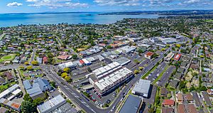
Howick village seen from above
|
|
| Country | New Zealand |
| Local authority | Auckland |
| Electoral ward | Howick ward |
| Local board | Howick Local Board |
| Established | 1847 (European) |
| Area | |
| • Land | 316 ha (781 acre) |
| Population
(June 2023)
|
|
| • Total | 11,690 |
|
|
||
Howick is a suburb located in East Auckland, New Zealand. The area was first settled by the Ngāi Tai ki Tāmaki people. In 1847, Howick was set up as a defensive settlement for Auckland by retired British soldiers called fencibles. For many years, Howick was a small farming area. But after the 1950s, it grew into a busy suburban part of Auckland.
Contents
Exploring Howick's Location
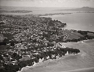
Howick is found on a central peninsula in East Auckland. It sits between the Tāmaki River and the Tāmaki Strait of the Hauraki Gulf. Waipaparoa / Howick Beach is to the north-east of the suburb. It is next to Mellons Bay on one side and Cockle Bay on the other. From Howick Beach, you can see the Tāmaki Strait, Waiheke Island, and Beachlands. The ground around Howick is mostly made of clay and sandstone.
How Howick Got Its Name
Howick was named in 1847 by Governor George Grey. He chose the name after Henry Grey, 3rd Earl Grey, who was also known as Viscount Howick. Earl Grey was a British government official who decided to settle retired soldiers in areas around Auckland.
The local Tāmaki Māori people had their own names for this coastal area. They called the beach and bay Paparoa and Waipaparoa. The swampy inland area where Howick village was built was called Ōwairoa. For a while, European settlers used Howick, Owairoa, and Paparoa names. But by 1923, when the Howick Town Board was formed, the name Howick became the official one.
Howick's Past: A Look Back
Māori History in Howick
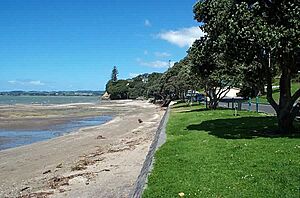
Around the year 1300, the Tainui canoe visited the Tāmaki Strait. Some of its crew settled around East Auckland. These people were the ancestors of today's Ngāi Tai ki Tāmaki tribe. The beach and bay area were traditionally called Paparoa and Waipaparoa. Waipaparoa referred to the larger bay, including the Turanga Creek.
The Howick area was used a lot for farming. Because it was quite open, two fortified villages called pā were built. Paparoa Pā was at the south-eastern end of Howick Beach. Tūwakamana Pā was above Cockle Bay. Besides farming, the Waipaparoa / Howick Beach area was known for catching pioke (small sharks). These sharks were caught in nearby rivers and dried on the beach.
In the 1600s, a warrior named Kāwharu attacked and destroyed Paparoa Pā. He did not stay and live on the land. Even though the wider area was still farmed, the site of Paparoa Pā became a wāhi tapu (a sacred and restricted place) for Ngāi Tai.
In 1836, a missionary named William Thomas Fairburn arranged a large land sale. This sale included most of modern-day South Auckland, East Auckland, and the Pōhutukawa Coast. The church and chiefs hoped this sale would stop fighting in the area. However, it's not clear if the chiefs fully understood or agreed to the sale. Māori people continued to live in the area as before.
Later, the New Zealand government looked into Fairburn's land purchase. They decided it was too big and made it smaller. The land that was taken away was not given back to Ngāi Tai. Instead, in 1854, a special area was set aside for Ngāi Tai near the Wairoa River. As part of this deal, Ngāi Tai agreed not to settle in other parts of the region, including Howick.
Howick's Beginnings as a Settlement
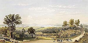
Howick was founded in 1847 as a military outpost to protect Auckland. It was settled by fencibles, who were retired British Army soldiers, and their families. Governor George Grey and other important people chose the spot in October 1847. This place was known to early settlers as Owairoa.
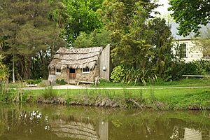
The fencibles arrived between 1847 and 1852. The first ships landed at Waiapaparoa / Howick Beach. Early settlers found it hard to make a living. There were almost no trees for building houses. The soil was mostly clay, which was not good for farming compared to other fencible settlements. In 1849, a visitor described Howick as a costly failure. The settlers were promised houses, but they weren't ready when they arrived. The first homes were built from raupō (a type of reed) with help from Ngāi Tai. By late 1849, most had been replaced with wooden cottages.
The fencible settlers were often poor. They were split between Catholic and Protestant families. All Saints Church was built in Howick in 1847. It was the first Anglican church in Auckland. The government was criticized for not giving the fencibles enough work. Many found jobs building roads or clearing land. Some worked for farmers. Many fencibles lived in Auckland for work but had to return to Howick on Sundays. If they didn't, they could be charged with mutiny.
Howick village grew around the Howick Domain. It became a service center for the farms nearby. Settlers relied on boats and ferries until the Panmure Bridge was built in 1865. Howick was designed to look like an English village. It became known for producing potatoes and butter. In the 1850s and 1860s, people tried to bring English birds like thrushes and blackbirds to the area. This was to make it feel more English and to help control caterpillars in orchards.
By 1854, many fencibles had finished their seven years of service. Most stayed in Howick. Some moved to Auckland or to gold mining towns. Others went to new defensive settlements further south.
In April 1861, news came about the upcoming Invasion of the Waikato. By July 1863, a defensive fort called a blockhouse was built in Howick. 101 fencibles and their sons fought in the war. In September 1863, the Ngāi Tai village of Ōtau was attacked by the British army. The villagers moved to communities closer to the river's mouth. While some Māori tribes were forced to leave, Ngāi Tai were seen as "friendly" by the government. They stayed neutral in the fighting. After 1865, much of Ngāi Tai land was taken by the government. The remaining land was divided up and slowly sold to European farmers.
The first local government in the area was set up in 1862. It was called the Howick Township Road Board.
In 1865, the capital of New Zealand moved from Auckland to Wellington. This caused money problems for Howick residents. Income from butter dropped, and land prices fell sharply. By 1880, the village population had dropped to 220, down from 775 in 1848. The Howick Town Hall was built in 1884. Many social groups, like the Howick Musical Association, were started during this time.
Howick's Growth into a Suburb
Until the 1920s, Howick was known as a quiet, English-style village. By 1921, it had grown enough to become a town district within Manukau County. In the 1930s, a new concrete road connected Howick to Greenlane. This helped Howick become a suburb for people working in areas like Penrose and Ōtāhuhu. From the 1930s to the 1950s, Howick village held fun events called Queens Carnivals. These events included beauty pageants to choose a queen to represent Howick businesses.
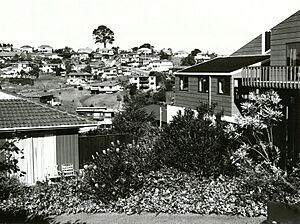
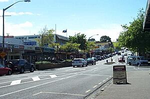
After World War II, many Dutch New Zealanders moved to Howick. The population slowly grew to 1,500 by 1947. In 1952, Howick became its own borough, separate from Manukau County. Howick saw a lot of suburban growth in the 1960s and 1970s. New suburbs were built in the surrounding areas. In the 1980s and 1990s, Howick became a popular place for Asian immigrant communities. A businessman named Kit Wong opened 100 shops at the Meadowlands shopping plaza. Many of these businesses were run by Chinese and Thai immigrants, including restaurants.
Places to Visit in Howick
Museums and History
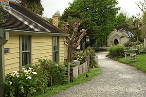
The Howick Historical Village is a living history museum. It is run by the Howick & Districts Historical Society and opened in 1980. The village shows what the fencible settlement of Howick was like. Old historic buildings from around Howick were saved from being torn down in the late 1970s and early 1980s. They were moved to Lloyd Elsmore Park in Pakuranga.
The Polish Heritage Trust Museum has been open in Howick since 2004.
Emilia Maud Nixon Garden of Memories
Behind Howick's library and arts center is a small traditional Māori meeting house called a wharenui. It was built in the mid-1930s. The 'Garden of Memories' was created by a Howick resident named Emilia Maude Nixon. She wanted it to "promote understanding, harmony and goodwill between all people." Nixon planted native trees and traditional Māori food plants. A traditional canoe (waka) was also in the garden. The wharenui was named Torere, after the daughter of Hoturoa, a chief of the Tainui tribe. Māori elders visited the garden for a special ceremony in 1936.
After Nixon passed away in 1962, the Howick Borough Council looked after the garden. The Howick and District Historical Society managed Torere. Over the years, the wharenui was sometimes damaged and not well looked after. The original building was taken down and rebuilt by the Manukau City Council after local government changes in 1989. However, the front and carvings of the wharenui were kept. After Torere was rebuilt, volunteers used the building for classes and activities.
In 2004, Torere was badly damaged by a fire. Fire investigators believed it was likely caused by arson. Some locals thought it was an electrical fault. Rebuilding the wharenui was a debated topic among some locals. However, the project was completed in 2011.
Historic Buildings
The McMillan Homestead is located on Bleakhouse Road and was built in the 1880s.
All Saints' Church is a very old church in Howick. It was built in 1847 and is listed as a Category I heritage building.
Sports and Fun in Howick
Howick is home to two sports clubs. Fencibles United is an association football (soccer) club. The Howick Hornets is a rugby league club.
Howick's Population
Howick covers about 3.16 square kilometers. As of June 2023, , it has an estimated population of 11690 people. This means there are about 3699 people per square kilometer.
| Historical population | ||
|---|---|---|
| Year | Pop. | ±% p.a. |
| 2006 | 9,798 | — |
| 2013 | 10,512 | +1.01% |
| 2018 | 11,067 | +1.03% |
At the 2018 New Zealand census, Howick had 11,067 people. This was an increase of 555 people (5.3%) since the 2013 census. There were 3,822 households. There were 5,325 males and 5,739 females. About 2,199 people (19.9%) were under 15 years old.
The people in Howick come from many different backgrounds:
Many people in Howick (46.1%) were born overseas. This is higher than the national average of 27.1%.
When asked about religion, 46.1% said they had no religion. 39.2% were Christian. Other religions included Hindu (2.6%), Muslim (1.1%), and Buddhist (2.0%).
Of those aged 15 or older, 2,469 people (27.8%) had a university degree or higher. 1,107 people (12.5%) had no formal qualifications. About 4,647 people (52.4%) worked full-time, and 1,239 (14.0%) worked part-time.
Learning in Howick: Schools
Howick Intermediate School is for students in years 7–8. It has a roll of 579 students. Howick Primary School and Owairoa School are primary schools for years 1–6. Howick Primary has 323 students, and Owairoa School has 753 students.
All these schools are coeducational, meaning they have both boys and girls. The student numbers are as of February 2024. .
Our Lady Star of the Sea School is a state-integrated Catholic primary school for years 1–6. It has a roll of 294 students as of February 2024. .
 | Stephanie Wilson |
 | Charles Bolden |
 | Ronald McNair |
 | Frederick D. Gregory |


