Sunset District, San Francisco facts for kids
Quick facts for kids
Sunset District
|
|
|---|---|
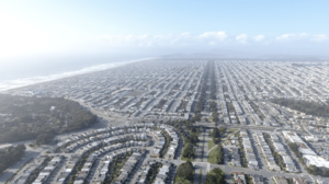
The Outer Sunset from a drone
|
|
| Nickname(s):
The Sunset, The Set, The Avenues
|
|
| Country | |
| State | |
| City-county | San Francisco |
| Time zone | UTC-8 (PST) |
| • Summer (DST) | UTC-7 (PDT) |
| ZIP codes |
94116, 94122, 94132
|
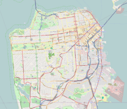
The Sunset District is a large neighborhood in the southwest part of San Francisco, California. It's known for its unique history and its location near the Pacific Ocean. Many people call it The Sunset or The Avenues.
Contents
Exploring the Sunset District
The Sunset District is the biggest neighborhood in San Francisco. To the north, you'll find Golden Gate Park. To the west, there's the Pacific Ocean and Ocean Beach. A smaller part of the Sunset, called Parkside, is in the southeast.
Long ago, this area was mostly sand dunes. People in the 1800s called it the "Outside Lands" because it was undeveloped.
The Avenues: Finding Your Way
The Sunset District and the nearby Richmond District are often called The Avenues. This is because most of their streets run north-south and are numbered.
When the city was first planned, the avenues went from 1st to 49th. The east-west streets were lettered A to X. In 1909, many streets were renamed to avoid confusion. The east-west streets got names like Lincoln Way and Judah. The original 1st Avenue became Arguello Boulevard.
Today, the avenues start at 2nd Avenue and go up to 48th Avenue. There's one special street: what would be 13th Avenue is called Funston Avenue. It's named after Frederick Funston, a U.S. Army general.
The main east-west streets in the Sunset are:
- Lincoln Way (next to Golden Gate Park)
- Hugo (only from Arguello to 7th Avenue)
- Irving
- Judah
- Kirkham
- Lawton
- Moraga
- Noriega
- Ortega
- Pacheco
- Quintara
- Rivera
- Santiago
- Taraval
- Ulloa
- Vicente
- Wawona
- Yorba
- Sloat Boulevard
History of the Sunset
The name "Sunset" has a couple of possible origins. Some say a developer named Aurelius Buckingham came up with it in 1886. Others think it came from the "Sunset City" nickname for the California Midwinter Exposition in Golden Gate Park.
Before 1917, the Sunset was mostly empty sand dunes. People started building there in the 1870s and 1880s, especially after Golden Gate Park was created. After the big 1906 San Francisco earthquake, many small tract homes and row homes were built. These homes replaced a small settlement called Carville. People in Carville lived in old horsecars and cable cars that were left in the dunes!
Building really picked up in the 1930s, turning the Sunset into a neighborhood where people could easily get around by streetcar. After World War II, even more homes were built, and the last of the sand dunes were leveled. Many of these homes were built by Henry Doelger. They often look similar but have small differences.
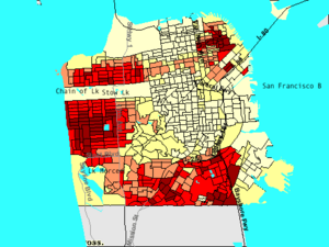
Historically, many Irish and Italian families lived in the Sunset. Starting in the late 1960s, more and more Asian (mostly Chinese) immigrants moved to the area. By 1999, about 60% of the homeowners in the Sunset and Richmond districts were Chinese.
Parts of the Sunset District
The Sunset District is so big that it's often divided into three main parts.
Inner Sunset
The Inner Sunset is the easternmost part. It's bordered by Lincoln Way to the north and 19th Avenue to the west. This area is close to Mount Sutro. The main shopping and dining street is Irving Street, especially between 5th and 12th Avenues.
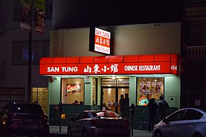
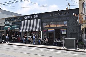
The Inner Sunset has many local businesses. You can find restaurants, bars, bookstores, bakeries, and coffee shops. There are many types of food, including pizza, Mexican, Thai, Korean, Chinese, and Japanese.
This area is one of the wealthier neighborhoods in San Francisco. The average home sale price in the Sunset District is around $1.5 million.
Central Sunset
The Central Sunset is mostly a residential area. It's located between 19th Avenue and Sunset Boulevard. It has many similar-looking homes. You can find shops along Irving Street and Noriega Street.
Important places here include the Sunset Reservoir, which is a large water storage area with a small park. Golden Gate Park is also nearby.
Outer Sunset
The Outer Sunset is the westernmost part, right next to the ocean. It's bordered by Lincoln Way to the north and Ocean Beach to the west. The main shopping streets are Judah, Noriega, and Taraval.
This part of the Sunset is often the foggiest because it's so close to Ocean Beach. Major attractions here include the San Francisco Zoo, Golden Gate Park, Ocean Beach, and Lake Merced.
Fun Things to Do and See
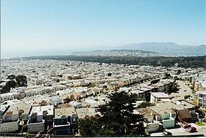
The Sunset District is famous for its fog. Because it's so close to the cold Pacific Ocean, it can be foggy and chilly, especially in summer. The best weather is usually from August to December. You might even find sand on the streets near Ocean Beach!
The Sunset District has many parks and recreation spots:
- The San Francisco Zoo is in the southwest corner, near Lake Merced.
- Near Lake Merced, there are also several golf courses, like the private Olympic Club and the public TPC Harding Park.
- Fort Funston is an old military area now part of the Golden Gate National Recreation Area. It has some of the last remaining sand dunes in the city.
There's a farmers' market every Sunday morning at 1315 8th Avenue. You can buy fresh produce, fish, eggs, and meat from California farms.
Stern Grove is a park with an amphitheater. It's known for its annual summer festival with free concerts.
Three smaller parks are on the eastern edge:
- Grand View Park (also called Turtle Hill) is a small, elevated park.
- Golden Gate Heights Park is just east of 14th Avenue.
- Hawk Hill Park is also east of 14th Avenue.
These parks have some of the last natural sand-dune areas in the city.
Learning in the Sunset
The San Francisco Unified School District runs public schools in the area.
Important schools and universities include:
- The Parnassus campus of the University of California, San Francisco (UCSF), which is a medical center.
- The main campus of San Francisco State University, near Lake Merced.
- Abraham Lincoln High School, in the center of the district.
- St. Ignatius College Preparatory, a private school known for its strong academics.
- Lowell High School, one of the oldest public high schools west of the Mississippi.
Beach Fun
The area near the Pacific Ocean is a popular spot for surfers. They enjoy the waves at Ocean Beach. The water is cold because of ocean currents from Alaska, so surfers usually wear a wetsuit. You can find several surf shops near the beach.
The Sunset also has many playgrounds for kids, including Sunset Playground, Blue Boat Playground, and McCoppin Square.
Weather in the Sunset
The Sunset District has a cool climate, similar to other coastal areas in Northern California. It has mild winters and cool summers. The warmest days are usually in October, and the coldest nights are in December. The Pacific Ocean strongly influences the weather here.
It rains mostly in the winter, and summers are very dry but often foggy.
| Climate data for San Francisco Oceanside, California, 1991–2020 normals, extremes 1958–2021 | |||||||||||||
|---|---|---|---|---|---|---|---|---|---|---|---|---|---|
| Month | Jan | Feb | Mar | Apr | May | Jun | Jul | Aug | Sep | Oct | Nov | Dec | Year |
| Record high °F (°C) | 79 (26) |
77 (25) |
81 (27) |
85 (29) |
82 (28) |
82 (28) |
85 (29) |
89 (32) |
96 (36) |
99 (37) |
90 (32) |
73 (23) |
99 (37) |
| Mean maximum °F (°C) | 66.4 (19.1) |
69.0 (20.6) |
71.0 (21.7) |
71.6 (22.0) |
67.3 (19.6) |
66.1 (18.9) |
65.8 (18.8) |
69.6 (20.9) |
77.3 (25.2) |
83.9 (28.8) |
75.2 (24.0) |
65.4 (18.6) |
86.3 (30.2) |
| Mean daily maximum °F (°C) | 59.0 (15.0) |
60.4 (15.8) |
60.8 (16.0) |
60.4 (15.8) |
59.8 (15.4) |
60.9 (16.1) |
61.8 (16.6) |
63.7 (17.6) |
65.0 (18.3) |
66.4 (19.1) |
63.5 (17.5) |
59.1 (15.1) |
61.7 (16.5) |
| Daily mean °F (°C) | 52.4 (11.3) |
53.5 (11.9) |
54.4 (12.4) |
54.8 (12.7) |
55.4 (13.0) |
56.8 (13.8) |
58.1 (14.5) |
59.5 (15.3) |
60.1 (15.6) |
59.8 (15.4) |
56.5 (13.6) |
52.5 (11.4) |
56.2 (13.4) |
| Mean daily minimum °F (°C) | 45.7 (7.6) |
46.6 (8.1) |
47.9 (8.8) |
49.1 (9.5) |
51.0 (10.6) |
52.7 (11.5) |
54.3 (12.4) |
55.4 (13.0) |
55.3 (12.9) |
53.2 (11.8) |
49.5 (9.7) |
45.8 (7.7) |
50.5 (10.3) |
| Mean minimum °F (°C) | 37.8 (3.2) |
39.7 (4.3) |
40.7 (4.8) |
42.4 (5.8) |
44.8 (7.1) |
46.9 (8.3) |
50.4 (10.2) |
50.0 (10.0) |
49.6 (9.8) |
46.1 (7.8) |
41.7 (5.4) |
36.5 (2.5) |
34.0 (1.1) |
| Record low °F (°C) | 29 (−2) |
29 (−2) |
26 (−3) |
27 (−3) |
35 (2) |
35 (2) |
40 (4) |
40 (4) |
38 (3) |
35 (2) |
26 (−3) |
23 (−5) |
23 (−5) |
| Average precipitation inches (mm) | 3.94 (100) |
4.01 (102) |
2.98 (76) |
1.37 (35) |
0.64 (16) |
0.19 (4.8) |
0.01 (0.25) |
0.05 (1.3) |
0.11 (2.8) |
0.90 (23) |
2.22 (56) |
4.22 (107) |
20.64 (524) |
| Average precipitation days | 10.6 | 10.7 | 10.0 | 6.1 | 3.5 | 1.2 | 0.2 | 0.5 | 0.9 | 3.0 | 6.9 | 12.2 | 65.8 |
| Source: NOAA | |||||||||||||


