Sussex Greensand Way facts for kids
The Sussex Greensand Way is an ancient Roman road in England. It stretches from east to west across the county of Sussex. This old road connected two other important Roman routes: the London to Lewes Way and Stane Street.
Today, most of the Sussex Greensand Way is no longer used as a main road. It follows a natural ridge of "greensand" hills. These hills are north of the famous South Downs. The road was carefully planned by the Romans. It has straight sections and avoids steep slopes. It linked many important Roman country houses, called Roman villas, and their farms. We don't know exactly when the Romans built this road.
Exploring the Roman Road's Path
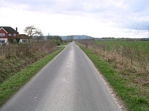
The Sussex Greensand Way begins near Barcombe Mills, north of Lewes. From there, it heads west through East Chiltington. It then passes the south side of Plumpton Racecourse. Here, you can still see a raised part of the road, called an agger, next to the modern entrance road.
The road continues to Streat, a village whose name comes from the Old English word for "Roman road." It goes north of Ditchling and through Keymer. At Hassocks, it crosses another Roman road, the London to Brighton Way. A Roman cemetery was found here.
West of Hassocks, the road turns slightly south. It passes through Bedlam Street, south of Hurstpierpoint. For a short distance, it runs on a clear agger next to the B2117 road. It then continues past Woodmancote to Woods Mill.
The road then crosses the flat area around the River Adur. The Romans built a wooden bridge here near Stretham Manor. From the river, the road goes west to Buncton Manor Farm. It then turns northwest towards West Chiltington. Finally, it crosses the River Arun floodplain to join Stane Street at Hardham. Roman bath house remains have been found near this meeting point. There was also a Roman rest stop, called a mansio, on Stane Street at Hardham.
Why Did the Romans Build This Road?
This Roman road connected many large villa estates along the greensand ridge. It also linked up with other Roman roads that ran north and south. There was a Roman temple at Chanctonbury Ring, and a large cemetery was found near a crossroads at Hassocks.
At first, the road probably wasn't important for military reasons. In the early Roman period, Sussex was a friendly kingdom. But later, when Saxon and Jute raiders attacked the coasts, this inland route might have become a safer way to travel. After the Romans left Britain, it took about 14 years for Saxon settlers to defeat the Romano-British people. These people were based at the fortress of Anderida at Pevensey. So, the road might have been important for moving soldiers during this time.
How the Roman Road Was Constructed
Studies of well-preserved parts of the road show it was built quite simply. It usually had about 3 inches (7.6 cm) of stone and gravel laid on a low agger. In drier areas, the materials were placed directly on the natural ground.
The width of the road varied. In wider spots, it was about 25 feet (7.6 meters) across, with the agger itself being about 40 feet (12 meters) wide. On hillsides, where the road was cut into the slope, it narrowed to about 9 feet (2.7 meters). The road's surface was made of flint stones. It had a slight curve, or camber, of about 8 inches (20 cm) in the middle to help water drain off. You can still see good examples of the agger near Plumpton Racecourse and next to the B2117 road south of Hurstpierpoint.
 | Roy Wilkins |
 | John Lewis |
 | Linda Carol Brown |


