Chanctonbury Ring facts for kids
Quick facts for kids Chanctonbury Ring |
|
|---|---|
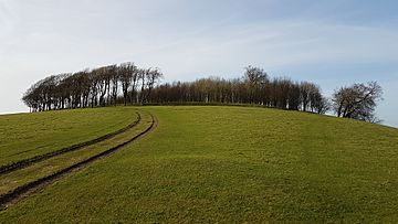
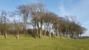
Chanctonbury Ring, March 2017
|
|
| Highest point | |
| Elevation | 242 m (794 ft) |
| Prominence | 215 m (705 ft) |
| Parent peak | Leith Hill |
| Listing | Marilyn |
| Geography | |
| Location | South Downs, England |
| OS grid | TQ139120 |
| Topo map | OS Landranger 198 |
Chanctonbury Ring is an ancient hill fort found on top of Chanctonbury Hill. It's located in the South Downs in West Sussex, England. A long path, now part of the South Downs Way, runs along the hill. This area is special because it has many old features built over 2,000 years. These include round barrows (ancient burial mounds) from the Bronze Age and Saxon times, plus old ditches from the Iron Age and Roman periods.
Chanctonbury Ring is shaped like a circle with a low earth wall and a ditch around it. Experts think it was built in the late Bronze Age or early Iron Age. We don't know for sure why it was built. It might have been used for defense, to keep cattle safe, or even as a religious place. After being used for a few hundred years, it was left empty for about 500 years. Then, during the Roman period, people came back. They built two Roman temples inside the hill fort. One of these temples might have been for a special boar cult (a group that worshipped boars).
The hill fort was left empty again around the late 300s AD. It stayed empty, except for animals grazing, until the mid-1700s. At that time, a landowner planted a circle of beech trees around the edge to make it look nicer. These trees became a famous local landmark. Sadly, most of them were destroyed in the Great Storm of 1987. People have replanted trees many times since then. These replanting efforts have also given archaeologists a chance to dig and learn a lot about the site's long history.
Contents
What is Chanctonbury Ring?
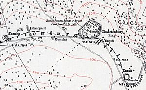
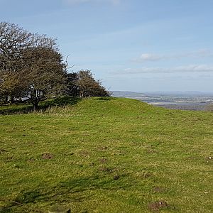
Chanctonbury Ring sits in a very high spot, looking out over the Sussex Weald to the north. It's on the edge of a steep slope. The Ring is in the middle of a long, flat area that doesn't have many trees. The highest point near the Ring is about 241 meters (791 feet) above sea level. An old path, used since ancient times, runs just north of the Ring. This path is now part of the South Downs Way.
The hill fort is mostly round and covers about 1.5 hectares (3.7 acres). The earth wall around it is about 10 meters (33 feet) wide and up to 0.8 meters (2.6 feet) high. It goes around for about 400 meters (1,300 feet). Around the wall is a ditch, about 8 meters (26 feet) wide and 0.7 meters (2.3 feet) deep. The wall was made from chalk, flint, and clay dug from the ditch. These walls and ditches would have been much bigger and deeper a long time ago. They would have offered clear views of other ancient landmarks. Archaeologists call it a "slight univallate hill fort." This means it has a single, low earth wall.
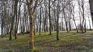
The main entrance to the hill fort was a gap about 6 meters (20 feet) wide on the southeast side. You can still see the remains of a path there. Another gap on the southwest side was probably made much later, after the hill fort was no longer used. The wall and ditch are mostly still there on the south side, even though two small quarries caused some damage. On the north side, the earthworks have worn away, and only small parts of the ditch remain. Today, the circle of beech trees covers the edges and inside of the hill fort.
History of Chanctonbury Ring
Early Times and Building the Fort
Archaeologists have dug at Chanctonbury Ring many times, in 1869, 1909, 1977, and from 1988 to 1991. They found signs that people were here in the Stone Age and early Bronze Age. However, there's no proof that people lived here then. They found tools that were likely used for working with wood. The discovery of burial mounds on Chanctonbury Hill suggests that this hilltop was seen as a special place, maybe because it was so visible. It's possible the top of the hill, where the Ring is now, was used for religious ceremonies. If so, the stone tools found might have been left there as part of these rituals.
At first, people thought the hill fort was built and used during the Early Iron Age, around 600 to 400 BC. This idea came from pottery pieces and old rubbish pits found there. An animal bone found was dated to about 370 BC. However, later studies of the pottery suggest it's even older, possibly from the late Bronze Age, around 700 BC.
Chanctonbury Ring seems to have been left empty around the mid-300s BC. It might have only been used off and on before that. We don't know why it was abandoned. It could be because a much larger hill fort, Cissbury Ring, was built a few miles away. Cissbury Ring might have taken over some of the jobs that Chanctonbury Ring used to do.
The original reason for the site is not clear. Even though we call them "hill forts," these places were used for many things. They could be places to keep animals, trading centers, safe spots, or even permanent homes. Buildings like houses and storage pits were often built inside them. But archaeologists haven't found much evidence of buildings inside Chanctonbury Ring. This might be because it's a very open and windy spot. One idea is that it was used as a center for religious activities.
Roman Temples at the Ring
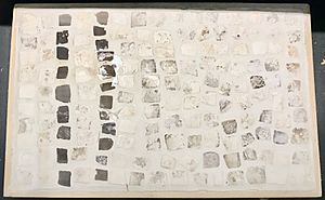
About 500 years after it was first left empty, Chanctonbury Ring was used again as a religious site starting in the mid-1st century AD. At least two Roman-Celtic temples were built inside, probably around the 2nd century. The old earth wall and ditch were used again to create a "sacred area" or temenos. The remains of these temples are mostly buried walls made of flint and mortar. They are only a few centimeters below the ground, so you can't see them on the surface. Some mosaic pieces from Chanctonbury Ring are now at the Horsham Museum.
The bigger of the two temples was built in the center of the fort, at the highest point. It had a rectangular main room, about 9 meters (30 feet) by 7 meters (23 feet). A covered walkway went around it on three sides. This walkway had a chalk floor and was about 3 meters (10 feet) wide. The outside wall of the walkway was painted red. People entered the building from the east, matching the original entrance to the hill fort.
A small rectangular building stood about 5 meters (16 feet) from the northeast corner of this temple. It was about 3 meters (10 feet) by 1 meter (3 feet) and might have been an oven or furnace. A large circular rubbish pit was found nearby. This pit contained many items like roof tiles, window glass, oyster shells, pottery, and coins. Studying these items showed that the temple was used for about 350 years, from the mid-1st to the late 4th centuries AD. We don't know which god or goddess the temple was for.
A second temple was found about 30 meters (98 feet) southwest of the first one. Not much of it remains because it seems to have been taken apart after it was no longer used. It might have been shaped like a polygon, about 8 meters (26 feet) on each side. It also had a rectangular room attached to its eastern side with a floor made of green stone cubes. This temple might have been for a boar cult. This idea comes from finding many bone pieces from pig heads and jaws. A copper boar plaque found nearby might also be connected to this cult.
We don't know why the Romans built temples here. Sometimes, Romans built on sites where Iron Age temples or shrines already existed. However, this is less likely at Chanctonbury Ring because there was a 500-year gap between the hill fort being left empty and then used again. In other places, like Hayling Island, religious use continued from Iron Age to Roman times, but this wasn't the case at Chanctonbury.
The hill fort's earth wall might have been fixed up when the Romans came back. At least one of the two nearby ditches was probably also built during the Roman period. An excavation in 1909 also reported finding a "curious pear-shaped structure," but later digs haven't found any proof of it. The site is connected by a Roman path to the Sussex Greensand Way, an old road that runs along the north side of the Downs.
The 18th Century Trees
After the Romans left, Chanctonbury Ring seems to have been empty and unused for many centuries. The land belongs to the Goring family of Wiston House, who have owned land here for a long time. The famous circle of beech trees was first planted in 1760 by Charles Goring. He was 16 years old when he decided to make the site more beautiful by planting trees around and just inside the old earth walls. The middle of the fort was left open then. People say he carried water up the hill every time he visited to water his trees. Some stories even say his servants carried buckets of water up the hill daily. His family has continued to replant the trees ever since, making sure the fort remains a well-known landmark on the South Downs.
The 20th Century and Beyond
In 1909, the Goring family decided to plant trees inside the fort too. During the preparations, they found many Roman pottery pieces and building rubble. This led to the first archaeological dig of the hill fort. The two temples and many artifacts were discovered. However, the tree roots have caused some damage to the old remains inside the hill fort.
More damage happened during World War II. The hill fort was used as a place for anti-aircraft guns, and four gun positions were built inside it. Training activities during the war also caused damage, including digging practice trenches and rubbish pits.
Chanctonbury Ring was fenced off for several years after 1950. The owner at the time put up barbed wire and a large iron water tank for cattle. This caused problems because it blocked public paths and spoiled the view. Eventually, the fence and tank were removed.
In 1977, the Goring estate started replanting parts of the ring to replace old trees. This gave West Sussex County Council a chance to do another archaeological study of the site in July and August of that year.
The Great Storm of 1987 destroyed over 75% of the trees. It was decided to replant the ring and use the opportunity to study the archaeology again. More archaeological digs took place between 1987 and 1991. These digs helped experts understand earlier findings better and figure out that the hill fort was built even earlier than thought. The newly planted trees are now starting to grow and bring the ring back to its famous look.
Other Interesting Features Nearby
Ancient Sites
Chanctonbury Ring is part of a group of closely related ancient sites on Chanctonbury Hill. These sites date from prehistoric, Roman, and medieval times and are protected. About 400 meters (1,300 feet) to the west is a cross-ditch, about 274 meters (900 feet) long, with a ditch on its western side. A similar crescent-shaped cross-ditch is about the same distance to the east. These two ditches cut across the ridge where the fort lies and were probably part of its defense. The eastern ditch hasn't been dated, but the western one is from the Roman period. This is a surprisingly late example of this type of structure.
Many prehistoric burial mounds (called barrows) and Saxon burial mounds (called hlaews) are near the fort. This shows that the hilltop was an important religious and spiritual place for at least 2,000 years. A well-preserved bowl barrow, a common type of round mound, is located 200 meters (660 feet) west of Chanctonbury Ring.
Three well-preserved saucer barrows and two hlaews are just southeast of Chanctonbury Ring. These are very rare types of burial mounds, with only a few dozen examples known in the whole country. The saucer barrows haven't been dated, but similar ones are from between 1800-1200 BC. These barrows usually contain a buried body or ashes with a few items like pottery or tools. Hlaews were built during Anglo-Saxon or Viking times for important people. They are mounds usually built over graves dug into the ground below. The ones at Chanctonbury Ring haven't been dug up yet.
There might be more poorly preserved burial mounds near the hill fort. One survey found fourteen possible mounds that haven't been recognized before. Some mounds have definitely been lost due to erosion or farming. For example, one about 400 meters (1,300 feet) further west was dug up in the 1950s before it was destroyed. It contained the skeletons of an adult woman and a child, plus parts of a third person. It also had a beautiful early Bronze Age dagger from the Wessex culture, dating to around 1800–1500 BC. The mounds around Chanctonbury Fort usually have a dip in the middle. This means they were probably robbed at some point. Medieval pottery found in the destroyed mound suggests this happened in the Middle Ages. Archaeologists have found very little in the other mounds, likely because of grave robbers.
Dew Pond
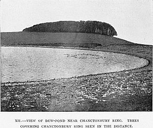
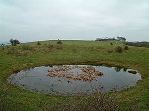
Near the trig point (a survey marker) is Chanctonbury Dew Pond. This pond is a Site of Special Scientific Interest, meaning it's protected for its nature. It was built around 1870 and was fixed up by the Sussex Society of Downsmen in 1970. They still take care of it today.
Legends and Stories
A local legend says that the Devil created Chanctonbury Ring. The story goes that you can call him by running around the clump of trees seven times counter-clockwise. When he appears, he will offer you a bowl of soup in exchange for your soul. Some people think this story comes from old pagan worship, which might have included a ritual dance and a special feast. The link to Chanctonbury comes from an even older pagan site on the land. This story is well-known by word of mouth, with some variations (like the Devil offering porridge or milk instead of soup). However, it might be a fairly new story, first appearing in a book in 1909.
The occultists Aleister Crowley and his friend Victor Benjamin Neuburg, who lived nearby, believed that Chanctonbury Ring was a "place of power" because of its ancient religious meaning. It's not clear if they actually visited it. But Neuberg wrote poems about the site's supposed mystic power and imagined scary Druid sacrifices happening there.
In his 2013 travel book, The Old Ways: A Journey on Foot, Robert McFarlane shares an unsettling experience he had sleeping at Chanctonbury Ring one summer night. He says he was woken up by unearthly screaming at 2 AM.
Another legend claims that the Ring can make women more fertile if they sleep under the trees for one night.
How to Visit
There are two car parks at the bottom of the hill. One is to the northeast on Chanctonbury Ring Road, off the A283 Washington Road. The other is to the west on Washington Bostal, just off the A24 road. The hill is located just off the South Downs Way and offers amazing views to the north.
Images for kids
 | John T. Biggers |
 | Thomas Blackshear |
 | Mark Bradford |
 | Beverly Buchanan |


