
Syracuse, Kansas facts for kids
Quick facts for kids
Syracuse, Kansas
|
|
|---|---|
|
City and County seat
|
|

Downtown Syracuse (2010)
|
|

Location within Hamilton County and Kansas
|
|

|
|
| Country | United States |
| State | Kansas |
| County | Hamilton |
| Founded | 1873 |
| Incorporated | 1887 |
| Named for | Syracuse, New York |
| Area | |
| • Total | 4.10 sq mi (10.62 km2) |
| • Land | 4.10 sq mi (10.62 km2) |
| • Water | 0.00 sq mi (0.00 km2) |
| Elevation | 3,265 ft (995 m) |
| Population
(2020)
|
|
| • Total | 1,826 |
| • Density | 445.4/sq mi (171.94/km2) |
| Time zone | UTC-7 (Mountain (MST)) |
| • Summer (DST) | UTC-6 (MDT) |
| ZIP code |
67878
|
| Area code | 620 |
| FIPS code | 20-69850 |
| GNIS ID | 2396023 |
Syracuse is a city in Hamilton County, Kansas, United States. It is the county seat, which means it's where the main government offices for the county are located. In 2020, about 1,826 people lived there. You can find Syracuse along Highway 50.
Contents
History of Syracuse
Syracuse began as a stop on the Atchison, Topeka and Santa Fe Railway. It was first called Holidayburg or Holliday. This name honored Cyrus K. Holliday, who was the first president of the railway company.
In 1873, a group of settlers arrived from Syracuse, New York. They decided to rename the town Syracuse, just like their old home. In 1886, Syracuse officially became the county seat of Hamilton County.
Syracuse made history on April 5, 1887. It was the first city in the entire United States to elect an all-woman city council! The council included Mrs. N. E. Wheeler (who was the mayor), Caroline Johnson Barber, Mrs. W. A. Swartwood, Mrs. S. P. Nott, Mrs. Charles Coe, and Mrs. G. C. Riggles.
By 1912, Syracuse was a busy town with over a thousand people. It had two banks, a hotel, a flour mill, and several machine shops. There were also two weekly newspapers, four churches, and a high school.
Geography and Nature
Syracuse is located near U.S. Route 50 and the Atchison, Topeka and Santa Fe Railway. It is about 16 miles (26 km) from the Colorado border. The Arkansas River flows just south of the city.
South of the Arkansas River, you'll find sandy hills. These hills are home to the "Syracuse Sand Dunes," a city park that covers 1,300 acres (5.3 km2). The park even has a 40-acre (16 ha) fishing pond!
The city covers a total area of 4.10 square miles (10.62 km2). All of this area is land.
Climate
Syracuse has a semi-arid climate. This means it's usually dry, but not a desert. It gets some rain, but not a lot.
| Climate data for Syracuse, Kansas, 1991–2020 normals, extremes 1893–present | |||||||||||||
|---|---|---|---|---|---|---|---|---|---|---|---|---|---|
| Month | Jan | Feb | Mar | Apr | May | Jun | Jul | Aug | Sep | Oct | Nov | Dec | Year |
| Record high °F (°C) | 82 (28) |
89 (32) |
94 (34) |
100 (38) |
104 (40) |
111 (44) |
114 (46) |
110 (43) |
106 (41) |
99 (37) |
92 (33) |
82 (28) |
114 (46) |
| Mean maximum °F (°C) | 68.6 (20.3) |
75.6 (24.2) |
84.1 (28.9) |
89.3 (31.8) |
95.6 (35.3) |
101.9 (38.8) |
104.4 (40.2) |
101.4 (38.6) |
98.4 (36.9) |
92.4 (33.6) |
79.9 (26.6) |
69.0 (20.6) |
105.3 (40.7) |
| Mean daily maximum °F (°C) | 46.4 (8.0) |
50.6 (10.3) |
60.4 (15.8) |
68.7 (20.4) |
77.9 (25.5) |
88.6 (31.4) |
92.9 (33.8) |
90.2 (32.3) |
83.6 (28.7) |
71.2 (21.8) |
57.4 (14.1) |
47.1 (8.4) |
69.6 (20.9) |
| Daily mean °F (°C) | 30.0 (−1.1) |
33.8 (1.0) |
43.2 (6.2) |
51.9 (11.1) |
62.2 (16.8) |
72.9 (22.7) |
77.9 (25.5) |
75.6 (24.2) |
67.5 (19.7) |
53.8 (12.1) |
40.7 (4.8) |
30.8 (−0.7) |
53.4 (11.9) |
| Mean daily minimum °F (°C) | 13.5 (−10.3) |
17.0 (−8.3) |
26.1 (−3.3) |
35.2 (1.8) |
46.5 (8.1) |
57.2 (14.0) |
63.0 (17.2) |
60.9 (16.1) |
51.4 (10.8) |
36.5 (2.5) |
24.0 (−4.4) |
14.5 (−9.7) |
37.2 (2.9) |
| Mean minimum °F (°C) | −0.4 (−18.0) |
3.1 (−16.1) |
10.1 (−12.2) |
21.2 (−6.0) |
32.8 (0.4) |
45.2 (7.3) |
53.8 (12.1) |
52.8 (11.6) |
37.9 (3.3) |
21.8 (−5.7) |
8.4 (−13.1) |
−1.0 (−18.3) |
−6.4 (−21.3) |
| Record low °F (°C) | −27 (−33) |
−25 (−32) |
−24 (−31) |
8 (−13) |
21 (−6) |
35 (2) |
44 (7) |
40 (4) |
21 (−6) |
4 (−16) |
−8 (−22) |
−21 (−29) |
−27 (−33) |
| Average precipitation inches (mm) | 0.33 (8.4) |
0.37 (9.4) |
0.92 (23) |
1.42 (36) |
2.02 (51) |
2.31 (59) |
3.32 (84) |
2.80 (71) |
1.10 (28) |
1.37 (35) |
0.47 (12) |
0.58 (15) |
17.01 (431.8) |
| Average snowfall inches (cm) | 3.3 (8.4) |
2.1 (5.3) |
3.7 (9.4) |
1.3 (3.3) |
0.9 (2.3) |
0.0 (0.0) |
0.0 (0.0) |
0.0 (0.0) |
0.0 (0.0) |
0.9 (2.3) |
1.6 (4.1) |
3.1 (7.9) |
16.9 (43) |
| Average precipitation days (≥ 0.01 in) | 2.9 | 2.7 | 4.2 | 5.5 | 7.2 | 7.4 | 7.8 | 7.0 | 3.7 | 3.9 | 2.7 | 3.1 | 58.1 |
| Average snowy days (≥ 0.1 in) | 2.2 | 1.7 | 1.6 | 0.5 | 0.0 | 0.0 | 0.0 | 0.0 | 0.0 | 0.4 | 0.9 | 2.0 | 9.3 |
| Source 1: NOAA | |||||||||||||
| Source 2: National Weather Service | |||||||||||||
People of Syracuse
| Historical population | |||
|---|---|---|---|
| Census | Pop. | %± | |
| 1890 | 324 | — | |
| 1900 | 460 | 42.0% | |
| 1910 | 1,126 | 144.8% | |
| 1920 | 1,059 | −6.0% | |
| 1930 | 1,383 | 30.6% | |
| 1940 | 1,226 | −11.4% | |
| 1950 | 2,075 | 69.2% | |
| 1960 | 1,888 | −9.0% | |
| 1970 | 1,720 | −8.9% | |
| 1980 | 1,654 | −3.8% | |
| 1990 | 1,606 | −2.9% | |
| 2000 | 1,824 | 13.6% | |
| 2010 | 1,812 | −0.7% | |
| 2020 | 1,826 | 0.8% | |
| U.S. Decennial Census | |||
2020 Census Information
The 2020 United States census counted 1,826 people living in Syracuse. There were 602 households and 349 families. About 57.8% of the people were white, and 44.0% were of Hispanic or Latino background.
About 24.4% of households had children under 18. The average household had 3 people. The average family had 4.1 people.
About 25.5% of the population was under 18 years old. The median age was 35.5 years.
2010 Census Information
In the census of 2010, there were 1,812 people in Syracuse. There were 715 households and 460 families. About 76.7% of the people were white, and 32.7% were of Hispanic or Latino background.
About 37.1% of households had children under 18. The average household had 2.53 people. The average family had 3.23 people.
The median age in the city was 32.1 years. About 28.7% of residents were under 18.
Education
Students in Syracuse attend schools in the Syracuse USD 494 public school district. The school mascot for Syracuse is the Bulldogs!
Gallery
-
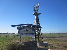
Syracuse welcome sign.
-
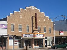
Northrup Theater in downtown Syracuse.
-
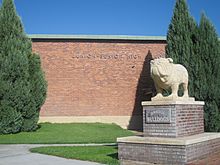
Syracuse High School Bulldog mascot.
-
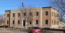
Hamilton County courthouse.
-
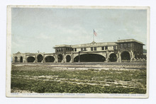
Sequoyah Hotel, early 20th century postcard


_from_SW.JPG)
See also
 In Spanish: Syracuse (Kansas) para niños
