Tabernacle Hill facts for kids
Quick facts for kids Tabernacle Hill |
|
|---|---|

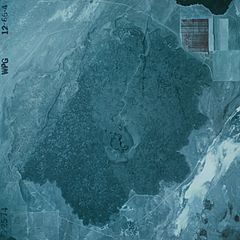
Tabernacle Hill lava flow. Image is about 6 km wide.
|
|
| Highest point | |
| Elevation | 1,493 m (4,898 ft) |
| Geography | |
| Country | United States |
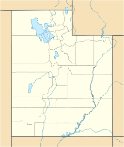
| State | Utah |
| Region | Black Rock Desert volcanic field |
| District | Millard County |
| Range coordinates | 38°54′36″N 112°31′56″W / 38.91000°N 112.53222°W |
| Topo map | USGS Tabernacle Hill, UT |
Tabernacle Hill is a cool landform in west-central Utah, United States. It's like a flat-topped hill called a butte, and it was made by a dormant (sleeping) volcano.
Exploring Tabernacle Hill
Tabernacle Hill is found in the Sevier Desert, which is part of the Pahvant Valley. It's about 11 miles (18 kilometers) southwest of a town called Fillmore.
The main part of Tabernacle Hill is a ring of hills about 0.6 miles (1 kilometer) wide. This ring sits a bit off-center within a larger area of hardened lava, which is about 3 miles (5 kilometers) wide.
How Tabernacle Hill Formed
Tabernacle Hill is part of a bigger area known as the Black Rock Desert volcanic field. This whole area has many features created by volcanoes.
The rocks at Tabernacle Hill are made of two types of volcanic material: basalt and tuff. Basalt is a common dark volcanic rock, and tuff is rock made from volcanic ash. These rocks formed during the late Pleistocene age, which was a long time ago, during the last Ice Age.
Scientists believe that the lava from Tabernacle Hill erupted into a huge ancient lake called Lake Bonneville. At that time, the lake was at a certain level, which geologists call the "Provo level."
Tabernacle Hill is located south of another interesting volcanic feature called The Cinders. The Cinders is known for being the most recent lava flow in all of Utah.
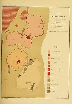
The basalt rocks of The Cinders and Tabernacle Hill were first studied and mapped by two geologists, Grove Karl Gilbert and Israel Russell. They created their map way back in 1890!
 | Laphonza Butler |
 | Daisy Bates |
 | Elizabeth Piper Ensley |


