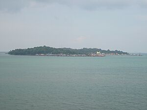
Tanjungpinang facts for kids
Quick facts for kids
Tanjungpinang
|
|||
|---|---|---|---|
|
City
|
|||
| City of Tanjungpinang Kota Tanjungpinang |
|||
| Regional transcription(s) | |||
| • Jawi | تنجوڠ ڤينڠ | ||
| • Chinese | 丹戎檳榔/廖都 | ||
|
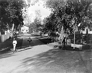
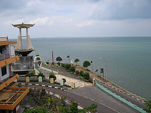
From top, left to right: City view from Dompak Island, house of governor of the Riau Islands, tombs of Riau kings, Raja Haji Fisabilillah Monument, and Sultan Sulaiman Badrul Alamsyah Museum
|
|||
|
|||
| Nickname(s):
Kota Gurindam (lit. 'City of Gurindam')
|
|||
| Motto(s):
Jujur Bertutur, Bijak Bertindak (lit. 'Honest in Speak, Wise in Action')
|
|||

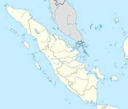
Location within Riau Islands
|
|||
| Country | |||
| Region | Sumatra | ||
| Province | |||
| Settled | Early 3rd century | ||
| Founded | 6 January 1784 | ||
| Incorporated | 21 June 2001 | ||
| Area | |||
| • Total | 812.7 km2 (313.8 sq mi) | ||
| • Land | 144.56 km2 (55.81 sq mi) | ||
| Elevation | 18 m (59 ft) | ||
| Population
(mid 2023 estimate)
|
|||
| • Total | 234,840 | ||
| • Density | 288.963/km2 (748.41/sq mi) | ||
| Time zone | UTC+7 (Indonesia Western Time) | ||
| Area code | (+62) 771 | ||
Tanjungpinang, also known as Tanjung Pinang, is the capital city of the Riau Islands province in Indonesia. It covers about 144.56 square kilometers. Most of the city is on the southern part of Bintan Island. It also includes smaller islands like Dompak Island and Penyengat Island.
In mid-2023, about 234,840 people lived in Tanjungpinang. This makes it the second-largest city in the province, after Batam. Tanjungpinang is a very old city with a rich Malay culture. It used to be the capital of both the Johor Sultanate and the Riau-Lingga Sultanate.
The name Tanjungpinang comes from a "beach tree" that sticks out into the sea. This tree helped sailors find their way to the Bintan River. The city is in a great spot on the south of Bintan Island, right at the mouth of the Bintan River.
Tanjungpinang has ferry and speedboat connections to nearby places. You can travel to Batam, Singapore (which is only 40 km away), and Johor Bahru. The city also has its own airport, Raja Haji Fisabilillah International Airport. It is about 7 km east of the city center.
Over many years, different groups controlled Tanjungpinang. These included Sumatra, Malacca, the Netherlands, Britain, and Japan. Each group influenced the city's culture. Tanjungpinang was also a major center for Malay culture and trade. In the 18th century, it was the capital of the powerful Johor–Riau–Lingga Empire.
Contents
Discovering Tanjungpinang's Past
The name Tanjungpinang comes from a special beach nut tree. This tree stuck out into the sea like a cape. It was a helpful guide for sailors heading to the Bintan River. The Bintan River was the main way to enter Bintan Island. This is where the old Bentan empire was located.
Early Beginnings
Tanjungpinang's story began very long ago, in the early 3rd century. It was a busy trading spot on the important route between India and China. From the 7th to the 13th centuries, an empire called Srivijaya controlled much of the Malay islands. They traded a lot with China.
But then, pirates became a big problem in the area. By the 12th century, Bintan Island was even known as "Pirate Island" by the Chinese.
According to old stories called the Malay Annals, a prince named Seri Teri Buana came to Bintan. He was escaping from his city, Palembang, which had been attacked. He stayed on Bintan for several years, getting stronger. Then, he went on to start the Kingdom of Singapura (Singapore).
About a hundred years later, Singapore was also attacked. Its king then started a new city in Malacca. The Malacca Sultanate (1400–1511) became a huge empire. It included the Riau Archipelago, where Tanjungpinang is. In 1511, the Portuguese took Malacca. The king, Sultan Mahmud Shah, moved his capital to Bintan. From there, he fought against the Portuguese. In 1526, the Portuguese finally destroyed Bintan.
The Johor Sultanate Era
In 1528, a son of Sultan Mahmud Shah, named Alauddin Riayat Shah II, started the Johor Sultanate. Soon, Johor controlled many of the old Malaccan lands, including Bintan. An important trading port called Bandar Riau opened there.
As Bandar Riau grew, the capital of the Johor Sultanate moved there in 1722. This happened because of a war with the Jambi Sultanate. Riau became a major center for trade and Islamic studies, just like Malacca had been.
Later, there was a conflict with the Dutch, who had taken Malacca from the Portuguese. In 1784, a Dutch fleet attacked Riau. But Malay and Bugis fighters bravely fought them off. They even destroyed the Dutch command ship. The Malay forces kept fighting the Dutch and blocked Malacca. However, after a defeat and a problem with who would be the next ruler, their power weakened. The capital moved from Riau to Lingga in 1788. Because of these changes, the Johor Sultanate is sometimes called the Johor–Riau–Lingga Empire.
In 1795, the British took control of Malacca from the Dutch. Both the British and Dutch wanted more power over the Strait of Malacca. During a time when there was no clear ruler (1812–1818), they each chose a different person to be the Sultan of Johor–Riau. This led to the Anglo-Dutch Treaty of 1824. This treaty split Johor–Riau. The land south of the strait, including Tanjungpinang, went to the Dutch. It became the Riau–Lingga Sultanate.
Dutch Rule and Independence
On February 11, 1911, the Dutch removed the sultan from power. He had gone against their rules. The Dutch then officially took over the sultanate. They managed it from Tanjungpinang, calling it the Riau Residency of the Dutch East Indies. They also built a military base in Tanjungpinang.
During World War II, the Japanese army took control. They made Tanjungpinang the main government center for the Riau Islands. After Japan surrendered, the Dutch took control again. But in 1950, the Dutch officially left. Riau was one of the last areas to join Indonesia.
Tanjungpinang was briefly the capital of Riau Province. But in 1960, the capital moved to Pekanbaru. In 2001, a new law made Tanjungpinang an independent city. This happened on June 21, 2001. It was no longer part of Bintan Regency. Then, in 2002, when the Riau Islands Province was created, Tanjungpinang became its capital. It is the second-largest city in the province, after Batam.
How Tanjungpinang is Managed
Tanjungpinang is a city that manages itself. It is separate from the Bintan Regency. The city is divided into four main areas called districts (kecamatan). Here's a look at these districts:
| Name of District (kecamatan) |
Area in km2 |
Pop'n Census 2010 |
Pop'n Census 2020 |
Pop'n Estimate mid 2023 |
No. of Villages |
Post Code |
|---|---|---|---|---|---|---|
| Bukit Bestari | 45.64 | 54,157 | 54,410 | 52,590 | 5 | 29122-124 |
| Tanjungpinang Timur (East Tanjungpinang) | 58.95 | 70,867 | 109,780 | 120,320 | 5 | 29122-125 |
| Tanjungpinang Kota (Downtown Tanjungpinang) | 35.42 | 17,026 | 19,226 | 19,220 | 4 | 29111-115 |
| Tanjungpinang Barat (West Tanjungpinang) | 4.55 | 45,309 | 44,247 | 42,710 | 4 | 29111-113 |
Tanjungpinang's Weather
Tanjungpinang has a tropical rainforest climate. This means it gets a lot of rain all year round.
| Climate data for Tanjungpinang (Raja Haji Fisabilillah International Airport, 2000–2020) | |||||||||||||
|---|---|---|---|---|---|---|---|---|---|---|---|---|---|
| Month | Jan | Feb | Mar | Apr | May | Jun | Jul | Aug | Sep | Oct | Nov | Dec | Year |
| Mean daily maximum °C (°F) | 29.8 (85.6) |
30.6 (87.1) |
31.4 (88.5) |
31.4 (88.5) |
31.5 (88.7) |
31.0 (87.8) |
30.6 (87.1) |
30.6 (87.1) |
30.8 (87.4) |
31.0 (87.8) |
30.2 (86.4) |
30.0 (86.0) |
30.7 (87.3) |
| Mean daily minimum °C (°F) | 24.1 (75.4) |
23.9 (75.0) |
24.0 (75.2) |
24.2 (75.6) |
24.7 (76.5) |
24.4 (75.9) |
24.2 (75.6) |
24.2 (75.6) |
24.0 (75.2) |
24.2 (75.6) |
24.0 (75.2) |
24.2 (75.6) |
24.2 (75.5) |
| Average precipitation mm (inches) | 234.6 (9.24) |
142.6 (5.61) |
216.7 (8.53) |
298.9 (11.77) |
284.4 (11.20) |
230.7 (9.08) |
205.2 (8.08) |
171.1 (6.74) |
212.3 (8.36) |
259.5 (10.22) |
442.8 (17.43) |
348.2 (13.71) |
3,047 (119.97) |
| Average precipitation days | 10.2 | 6.1 | 11.1 | 15.3 | 15.2 | 13.2 | 11.3 | 10.3 | 11.0 | 14.2 | 19.6 | 15.0 | 152.5 |
| Source: Meteomanz | |||||||||||||
People and Beliefs
Religions in Tanjungpinang
| Religion in Tanjungpinang (2023) | ||||
|---|---|---|---|---|
| religion | percent | |||
| Islam | 80.77% | |||
| Buddhism | 11.32% | |||
| Protestantism | 6.25% | |||
| Roman Catholicism | 1.43% | |||
| Confucianism | 0.21% | |||
| Hinduism | 0.02% | |||
Most people in Tanjungpinang follow Islam. About 78.57% of everyone living there is Muslim. Other religions are also practiced. About 13.58% of the people are Buddhist. Christianity is followed by 7.56% of the population. A very small number of people follow Hinduism (0.02%) and Confucianism (0.27%).
Famous Places to See
Tanjungpinang has a special place for Malay music and dance performances. This cultural center often holds festivals and shows. You can see traditional music and dance there. There are also well-known Buddhist temples outside the main city. They are in a small town called Senggarang.
Exploring Penyengat Island
Penyengat Island holds many important historical sites from the Riau–Lingga Sultanate. You can find the old ruler's palace and royal tombs there. One famous tomb belongs to Raja Ali Haji. He wrote the first grammar book for the Malay language. The old vice-royal mosque, called the Masjid Raya, is still used today.


