Taumatawhakatangihangakoauauotamateaturipukakapikimaungahoronukupokaiwhenuakitanatahu facts for kids
Quick facts for kids Taumatawhakatangihangakoauauotamateaturipukakapikimaungahoronukupokaiwhenuakitanatahu |
|
|---|---|
| Taumata | |

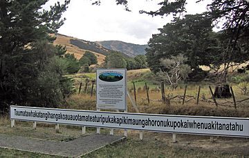
Sign on the hill showing its 85-character name
|
|
| Highest point | |
| Elevation | 305 m (1,001 ft) |
| Naming | |
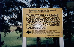
| English translation | The summit where Tamatea, the man with the big knees, the slider, climber of mountains, the land-swallower who travelled about, played his kōauau to his loved one. |
| Language of name | Māori |
| Geography | |
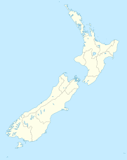
| Location | Hawke's Bay, New Zealand |
Imagine a hill with a name so long it's hard to say! That's Taumatawhakatangihangakoauauotamateaturipukakapikimaungahoronukupokaiwhenuakitanatahu. This famous hill is located near Porangahau in southern Hawke's Bay, New Zealand. It stands about 305 meters (1,000 feet) tall.
People often call it Taumata for short. Its incredibly long name comes from the Māori people. This name is so special because it's known as the longest place name in any English-speaking country. Some even say it might be the longest place name in the whole world! The name, which has 85 characters, is even listed in the Guinness World Records.
Contents
What Does the Long Name Mean?
The very long name "Taumatawhakatangihangakoauauotamateaturipukakapikimaungahoronukupokaiwhenuakitanatahu" tells a story. It means: "The summit where Tamatea, the man with the big knees, the slider, climber of mountains, the land-swallower who travelled about, played his kōauau (a type of flute) to his loved one." It's like a mini-story built right into the name of the place!
Other Versions of the Name
Believe it or not, there are even longer versions of this name! One version has 92 letters. Another, even longer one, has 105 letters. This super long name means: "The hill of the flute playing by Tamatea – who was blown hither from afar, grazed his knees climbing mountains, fell on the earth, and encircled the land – to his beloved one."
The official name of the hill has changed a few times over the years. In 1941, the Honorary Geographic Board of New Zealand gave it a 57-character name. This became the official name in 1948. Today, the official name includes special marks called macrons, which help with pronunciation.
Tamatea: A Famous Explorer
The person mentioned in the hill's name, Tamatea-pōkai-whenua, was a very important figure. His name means "Tamatea the explorer of the land." He was the father of Kahungunu, a famous ancestor of the Ngāti Kahungunu iwi (tribe).
Stories about Tamatea's journeys are told by many Māori tribes. He explored places like the Hokianga and Kaipara harbours in Northland. In the Bay of Plenty region, he had a son named Ranginui. Ranginui is the ancestor of the Ngāti Ranginui tribe in Tauranga.
Legends from the East Coast of the North Island also talk about his travels. He explored areas like Gisborne, Māhia, Wairoa, Napier, and Hastings. He even traveled near Lake Taupo. Some places, like the Ōtamatea River, are named after him.
Even in the South Island, old legends say Tamatea sailed down the east coast. His canoe was said to have been wrecked in the far south. It then turned into the Tākitimu mountain range. After that, Tamatea returned to the North Island. He continued his explorations by traveling along the Whanganui River.
Images for kids
See also
 In Spanish: Taumatawhakatangihangakoauauotamateaturipukakapikimaungahoronukupokaiwhenuakitanatahu para niños


