Taylors Falls, Minnesota facts for kids
Quick facts for kids
Taylors Falls
|
|
|---|---|

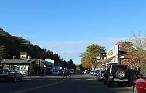
Downtown Taylors Falls on MN95
|
|
| Motto(s):
"Village On The River"
|
|

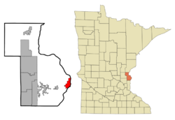
Location of the city of Taylors Falls
within Chisago County, Minnesota |
|
| Country | United States |
| State | Minnesota |
| County | Chisago |
| Area | |
| • Total | 4.236 sq mi (10.97 km2) |
| • Land | 3.941 sq mi (10.21 km2) |
| • Water | 0.295 sq mi (0.76 km2) |
| Elevation | 945 ft (288 m) |
| Population
(2020)
|
|
| • Total | 1,055 |
| • Density | 267.7/sq mi (103.4/km2) |
| Time zone | UTC-6 (Central (CST)) |
| • Summer (DST) | UTC-5 (CDT) |
| ZIP code |
55084
|
| Area code(s) | 651 |
| FIPS code | 27-64318 |
| GNIS feature ID | 2396034 |
| Website | www.taylorsfallsmn.org |
Taylors Falls is a small city in Chisago County, Minnesota, United States. It is located where two main roads, U.S. Highway 8 and Minnesota State Highway 95, meet. In 2020, about 1,055 people lived there.
Contents
History of Taylors Falls
Taylors Falls was first planned out in 1850 or 1851. It officially became a city in 1858. The city was named after Jesse Taylor, who was an important politician in the area before Minnesota became a state. A post office has been open in Taylors Falls since 1851.
During the time when logging was a big industry, Taylors Falls was famous for its huge log jams. These happened when many logs got stuck in the river. The most well-known log jam happened in 1886 on the St. Croix River. It was so big that it became a popular sight for tourists!
Where is Taylors Falls?
Taylors Falls covers about 4.24 square miles (10.98 square kilometers). Most of this area is land, and a small part is water.
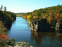
The city is right next to St. Croix Falls, Wisconsin. They are both located at a special place called the Dalles of the St. Croix River. This area has beautiful forests, tall cliffs, and rocky bluffs.
The first state park that crosses two states, called Interstate Park, was created here in 1895. It is shared by Minnesota and Wisconsin, right south of Taylors Falls.
Population Facts
| Historical population | |||
|---|---|---|---|
| Census | Pop. | %± | |
| 1880 | 1,007 | — | |
| 1890 | 567 | −43.7% | |
| 1900 | 535 | −5.6% | |
| 1910 | 454 | −15.1% | |
| 1920 | 570 | 25.6% | |
| 1930 | 527 | −7.5% | |
| 1940 | 552 | 4.7% | |
| 1950 | 520 | −5.8% | |
| 1960 | 546 | 5.0% | |
| 1970 | 587 | 7.5% | |
| 1980 | 623 | 6.1% | |
| 1990 | 694 | 11.4% | |
| 2000 | 951 | 37.0% | |
| 2010 | 976 | 2.6% | |
| 2020 | 1,055 | 8.1% | |
| U.S. Decennial Census | |||
In 2020, the population of Taylors Falls was 1,055 people. This means there were about 268 people living in every square mile. Most of the people living in Taylors Falls are White (about 91.8%). A smaller number of people are Black, Asian, Native American, or from other backgrounds. About 1.3% of the population is Hispanic or Latino.
In 2010, there were 976 people living in Taylors Falls. The average age of people in the city was about 41.7 years old. About 23.7% of the residents were under 18 years old.
Important Buildings and Places
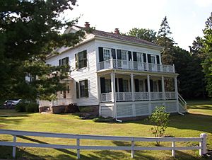
Taylors Falls has several old and important buildings. One is the Folsom House, which is part of the historic Angel Hill District. You can also find the Old Jail and the Taylors Falls Public Library. Taylors Falls is also home to Minnesota's oldest public schoolhouse, which was built way back in 1852.
Fun Things to Do and See
Interstate State Park is a great place to visit in Taylors Falls. It is located on the east side of the city. At the park, you can enjoy beautiful views of the river. You can also go canoeing, camping, fishing, and rock climbing. The park is famous for its "glacial potholes." These are cool, deep holes in the rock that were formed by glaciers long ago. The Minnesota side of Interstate State Park offers many places for rock climbing, from easy to very challenging.
See also
 In Spanish: Taylors Falls (Minnesota) para niños
 | Isaac Myers |
 | D. Hamilton Jackson |
 | A. Philip Randolph |


