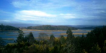
Teja Island facts for kids

View of Isla Teja from shores of Cruces River north of it
|
|
| Geography | |
|---|---|
| Location | Valdivia, Chile |
| Coordinates | 39°48′09″S 73°15′45″W / 39.8026°S 73.2626°W |
| Area | 7.72 km2 (2.98 sq mi) |
| Highest elevation | 66 m (217 ft) |
| Highest point | Northwestern hills |
| Administration | |
|
Chile
|
|
| Region | Los Ríos |
| Province | Valdivia |
| Commune | Valdivia |
| Demographics | |
| Ethnic groups | Chileans, German-Chileans |
Teja Island (in Spanish: Isla Teja) is a cool island in the city of Valdivia, Chile. Three rivers surround it: the Cau-Cau River to the north, the Cruces River to the west, and the Valdivia River to the southeast. It's a busy place with a university and important bridges.
Contents
Discover Teja Island
Teja Island is a key part of Valdivia, a city in Chile. It's known for its unique location, surrounded by three different rivers. This makes it a special spot for both nature and city life. The island is home to many people and important buildings.
Island History
Before the mid-1800s, Teja Island had a different name: Isla Valenzuela. It was named after Francisco de Valenzuela, who settled there in 1552. He was one of the first people to live on the island.
Later, in the second half of the 19th century, the island became famous for making roof tiles and bricks. The Spanish word for roof tile is teja. This is how the island got its current name, Isla Teja.
German Settlers and City Growth
At first, Teja Island was outside the main city of Valdivia. But then, many German immigrants arrived. A lot of them chose to live on the island. This helped the island grow and become more connected to the city.
In 1939, a big step happened. The Pedro de Valdivia Bridge was built. This bridge directly connected Teja Island to downtown Valdivia. It made it much easier for people to travel between the island and the city center.
The Great Chilean Earthquake
In 1960, a very powerful earthquake hit Chile. It was called the Great Chilean earthquake. This earthquake caused a large part of the island's western side to sink. The land along the river went below the water level. This changed the shape of the island.
Important Landmarks
Teja Island is home to some very important places. One of the biggest is the main campus of Universidad Austral de Chile. This university is a major center for learning and research in the region. Many students come here to study.
Connecting Bridges
Another important landmark is the Río Cruces Bridge. This bridge was built in 1987. It made Teja Island a main route for travel. From the island, you can easily reach nearby areas like Niebla, Corral, and Mancera Island. These places are popular for their beaches and history.
Nature and Environment
Teja Island also has special natural areas called wetlands. Wetlands are areas where water covers the soil, or is present near the surface of the soil, all year or for varying periods of time during the year. They are very important for nature. These wetlands are protected by a special rule called the Urban Wetlands Law. This law helps keep these natural areas safe. It protects the plants and animals that live there.
See also
 In Spanish: Isla Teja para niños
 | Aaron Henry |
 | T. R. M. Howard |
 | Jesse Jackson |

