Temerin facts for kids
Quick facts for kids
Temerin
|
||
|---|---|---|
|
Town and municipality
|
||
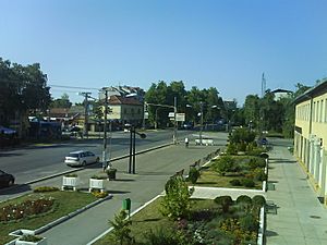
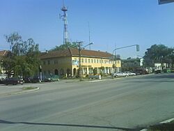
Town center of Temerin
|
||
|
||
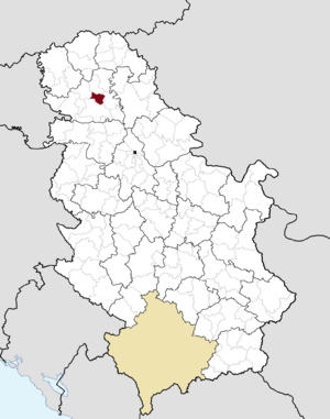
Location of the municipality of Temerin within Serbia
|
||
| Country | ||
| Province | ||
| District | South Bačka | |
| Settlements | 3 | |
| Area | ||
| • Municipality | 170 km2 (70 sq mi) | |
| Elevation | 83 m (272 ft) | |
| Population
(2011 census)
|
||
| • Town | 19,661 | |
| • Municipality | 28,287 | |
| Time zone | UTC+1 (CET) | |
| • Summer (DST) | UTC+2 (CEST) | |
| Postal code |
21235
|
|
| Area code | +381 21 | |
| Car plates | NS | |
Temerin (Serbian Cyrillic: Темерин; Hungarian: Temerin) is a town and municipality in the South Bačka District of Vojvodina, Serbia. The town itself has about 19,613 people. The whole municipality, which includes the town and nearby villages, has a population of around 28,287.
Contents
What's in a Name?
The town is called Temerin in Serbian, Hungarian, and Croatian. In German, it's known as Temeri.
Where is Temerin Located?
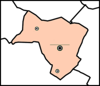
Temerin is in the southeast part of the Bačka plain. It shares borders with several other municipalities: Žabalj to the east, Srbobran to the north, Vrbas to the west, and Novi Sad to the south.
Being close to Novi Sad, a big economic city in Vojvodina, has helped Temerin grow a lot. The municipality covers about 170 square kilometers. It's shaped like an uneven four-sided figure, stretching from northwest to southeast.
Most of Temerin's borders are straight, man-made lines. The only natural border is on the northeast, following the Jegrička river. The land is mostly flat, like a plain. The Jegrička river flows through the northern part of the municipality. Hot, mineral-rich water has been found deep underground here. The soil is very fertile, mostly a type called chernozem, which is great for farming.
A Look Back: Temerin's History
Early Days
Temerin was first mentioned in writing in 1332. At that time, it was part of the Kingdom of Hungary. After a big battle in 1526, it became part of a Serb state led by Emperor Jovan Nenad. Soon after, the Ottoman Empire took control until the late 1600s.
Records from 1560/61 show that Temerin had Serb residents. The local leader was Radica Stepana, and there were 20 houses that paid taxes. By the end of the Ottoman rule, Temerin had no people living there.
Under Habsburg Rule
From the late 1600s, the area became part of the Habsburg monarchy. People started living in Temerin again in the early 1700s. In 1722, it was a Serb settlement with 183 Serb homes and three Orthodox priests. The number of Serb homes grew to 215 by 1786.
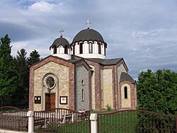
Local Serbs built an Orthodox church between 1746 and 1749. It was dedicated to Christ's ascension. This church was made of bricks, which was unusual for villages at the time, where churches were often made of wood.
One famous person from Temerin was Lukijan Mušicki, a writer and bishop, born in 1777. He helped Vuk Stefanović Karadžić create the modern Serbian alphabet by adding the letter "đ".
In 1796, the government sold Temerin to Count Sándor Szécsen. Hungarian settlers started arriving in 1782, and Germans in 1787. The count tried to make the Serbs his peasants. This led to many Serbs trying to move away between 1796 and 1800.
In 1799, 178 Serb families decided to leave. By spring 1800, 210 families (1,610 people) moved out. They took their houses and church apart and rebuilt them about 20 kilometers east, creating a new village called Đurđevo. They named it after St. George's Day, the day they moved.
For the next 120 years, Temerin had very few Serbs. Count Szécsen brought Hungarian farmers to settle there. He also built a large palace, called "Kaštel," which is now a technical high school.
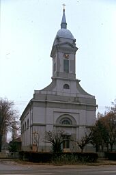
The Szécsen family later sold Temerin to a grain merchant. In 1799, Temerin was officially declared a town and allowed to hold four livestock fairs each year. A Catholic Church was built in 1804.
From the 1700s to 1848, Temerin was part of the Batsch-Bodrog County in the Habsburg Kingdom of Hungary. During the 1848–49 revolution, Temerin was burned down, and many settlers moved north. Most returned after a few months.
On July 2, 1899, a railway line connecting Novi Sad, Temerin, and Bečej opened. This helped Temerin's industry grow, with a brick factory and steam mills starting up. Temerin became an important trading center. In 1900, Temerin had 9,581 people, mostly speaking Hungarian.
After 1918
In 1918, Temerin became part of the Kingdom of Serbs, Croats and Slovenes (later called Yugoslavia). This brought big changes. Large land properties were divided up. Farmers from Novi Sad and other areas were settled in Temerin.
In 1920, a new settlement was created south of Temerin. It was named Staro Đurđevo (Old Đurđevo) in 1929, remembering the old Serb settlement. It started with 42 families and now has over 1,100 homes and about 4,000 people.
Temerin got electricity in 1927, between the two World Wars.
From 1941 to 1944, during World War II, Temerin was occupied by Hungary. During this time, people from Staro Đurđevo and Sirig were forced out of their homes, and Hungarian families from Bukovina moved in. In January 1942, some inhabitants were killed during events known as the Novi Sad Raid.
In 1944, the Hungarian families moved back to Hungary, and the original settlers of Staro Đurđevo and Sirig returned. Since 1944, Temerin has been part of Yugoslav Vojvodina, which later became part of Serbia. After World War II, Hungarians were the largest ethnic group in Temerin. However, by 2002, Serbs became the largest group. The town's population grew from 11,438 in 1948 to 19,613 in 2011.
Towns and Villages
The Municipality of Temerin includes three main settlements: Temerin, Bački Jarak, and Sirig. The area is also divided into four land registration zones: Temerin, Bački Jarak, Sirig, and Kamendin. Within Temerin town, there are three somewhat separate areas: old Temerin, Staro Đurđevo (also called Kolonija), and Telep. There's also an inhabited area called Kamendin, which is part of Sirig village.
Who Lives in Temerin?
| Historical population | ||
|---|---|---|
| Year | Pop. | ±% p.a. |
| 1948 | 15,257 | — |
| 1953 | 16,157 | +1.15% |
| 1961 | 18,336 | +1.59% |
| 1971 | 19,643 | +0.69% |
| 1981 | 22,557 | +1.39% |
| 1991 | 24,939 | +1.01% |
| 2002 | 28,275 | +1.15% |
| 2011 | 28,287 | +0.00% |
According to the 2011 census, the Temerin municipality has 28,287 residents. It's a diverse community with 16 different nationalities. Both Serbian and Hungarian languages are used officially by the local government.
The population of Temerin has grown a lot over the past few centuries, increasing by 72%.
Migrations have greatly changed who lives in Temerin. In 1800, 1,610 Serbs from 210 families left Temerin to start a new village, now called Đurđevo. This left Temerin with almost no Serbs until 1920. That's when new settlers created Staro Đurđevo, which is now a local community within Temerin municipality. It has grown to over 4,000 people.
Bački Jarak was mostly German until 1944. In 1946-1947, Serb settlers, mainly from Bosnia and Herzegovina, moved there. Sirig also saw many new settlers, with 63% of its residents being descendants of these colonists.
The wars in former Yugoslavia in the 1990s also brought many changes. Temerin became a temporary home for 9,650 refugees. About 4,950 of them still live there, staying with relatives or in shelters. These changes increased the population to about 30,000 by 1999.
Ethnic Groups in Temerin
The municipality of Temerin has a mix of ethnic groups. According to the 2011 census:
- Serbs make up 67.56% (19,112 people)
- Hungarians make up 26.37% (7,460 people)
- Other groups and those who didn't declare make up 6.06% (1,715 people)
All three settlements in the municipality (Temerin, Bački Jarak, and Sirig) have a Serb majority.
How Temerin Makes Money
The table below shows how many people work in different types of jobs in Temerin as of 2017. This gives us a picture of the local economy.
| Activity | Total |
|---|---|
| Agriculture, forestry and fishing | 436 |
| Mining | - |
| Processing industry | 2,154 |
| Distribution of power, gas and water | 37 |
| Distribution of water and water waste management | 194 |
| Construction | 320 |
| Wholesale and retail, repair | 1,297 |
| Traffic, storage and communication | 228 |
| Hotels and restaurants | 185 |
| Media and telecommunications | 38 |
| Finance and insurance | 78 |
| Property stock and charter | 4 |
| Professional, scientific, innovative and technical activities | 196 |
| Administrative and other services | 17 |
| Administration and social assurance | 241 |
| Education | 334 |
| Healthcare and social work | 304 |
| Art, leisure and recreation | 50 |
| Other services | 114 |
| Total | 6,229 |
Getting Around Temerin
Temerin has a good location for transportation. Three important roads run through the municipality from north to south. The main one is international road E-75, which goes from Novi Sad to Subotica and then into Hungary.
Another important road is M-22 (now E-5), which runs in a similar direction and passes through the village of Sirig. A regional road (R-120) also goes through Novi Sad, Bački Jarak, and Temerin, leading to Bečej and other towns.
At Sirig and Temerin, these roads cross with another regional road (R-104). This road connects Odžaci, Zmajevo, Sirig, Temerin, and Žabalj. From here, a main road crosses the Tisa river to Zrenjanin and other towns in Banat. A railway line from Novi Sad also passes through Bački Jarak and Temerin, continuing to Žabalj, Bečej, and Senta.
Temerin's Natural Environment
The Land and Its Shape
The land in Temerin is mostly flat, with only very small changes in height. It's part of the southern loessial ridge of Bačka. The land is between 81 and 83 meters (about 266 to 272 feet) above sea level. The flat landscape is only broken by small hills and valleys of smaller streams.
Weather and Climate
Temerin is in the Pannonian plain, which means it has a continental climate. This type of climate is far from large seas like the Adriatic or Atlantic. Mountains like the Dinarics and Alps block humid air from reaching the area. This results in very dry, cold winters and very hot summers.
Rivers and Waterways
There are no longer any natural rivers flowing freely in Temerin. All the streams have been turned into canals and are part of the DTD hydrosystem. This system helps with watering farms.
The Jegrička is the largest stream in the southern Bačka area and flows through Temerin. It's about 64.5 kilometers (40 miles) long and flows into the Tisa river. The Jegrička enters Temerin from the west and flows for about 18 kilometers (11 miles) through the municipality. It passes about 1 kilometer north of Sirig and 2 kilometers north of Temerin.
Soil Types
The soil in Temerin is very fertile. The most common type is chernozem, which is a rich, dark soil. There are also some swampy dark soils and solonchak, which are partly or fully salty.
Plants and Vegetation (Flora)
The area of Temerin used to have a lot of grassy plains, like steppes. But farming grew a lot in the 18th and 19th centuries, so most of the wild grasslands disappeared. Now, the main plants grown are cereals (like wheat), industrial plants, and vegetables. Fruits and grapevines are less common.
Along rivers and roads, you can still find wild plants like poppy, chamomile, nettle, and mustard. Near riverbeds, there's a lot of cane, cattail, and water lilies. There aren't many large forests, but you can see small groups of black locust and poplar trees around farms. Pine trees have also been planted near motels.
Animals and Wildlife (Fauna)
The animal world in Temerin used to be much more diverse. But changes in farming have reduced the number of wild animals.
In fields, you might find field mice, rats, polecats, weasels, hamsters, and moles. For larger animals, important for hunting, there are roe deer, foxes, and hares. Game birds include pheasants, partridges, wild ducks, and geese. Many other birds like sparrows, swallows, woodpeckers, and storks also live here.
There are many insects, such as mosquitoes, bees, wasps, and butterflies. Common farm pests include potato beetles and grain weevils.
In and around the water, you can find various fish like carp, bream, and pike, as well as snails, frogs, and snakes. Many domestic animals are also raised in the area.
Warm Mineral Waters
Hot, mineral-rich waters were first found in Temerin in 1914. A well was drilled 417 meters (1,368 feet) deep, providing water at 27°C (80.6°F). In 1968, another deeper well was drilled to 2,004.5 meters (6,576 feet).
Tests in 1979 showed that the water is slightly basic and contains minerals like sodium, hydro-carbonate, and chlorine. It also has healing ingredients like iodine, bromine, fluorine, lithium, and strontium. The water contains methane gas, which was used to heat the water and buildings.
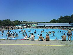
Today, this warm mineral spring is used in modern spa baths. There's also a well near the Olympic pool that provides water for an outdoor hot pool, with a temperature of 37°C (98.6°F). People from nearby towns also visit these pools. This natural resource is planned to be used to develop health, sports, and tourism in the future.
See also
 In Spanish: Temerin para niños
 | Selma Burke |
 | Pauline Powell Burns |
 | Frederick J. Brown |
 | Robert Blackburn |


