Tenmile Creek (West Fork River tributary) facts for kids
Quick facts for kids Tenmile Creek |
|
|---|---|

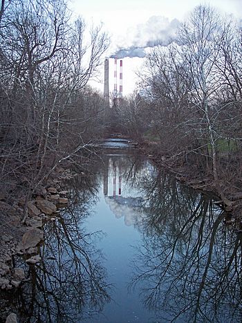
Tenmile Creek in Lumberport in 2006
|
|
|
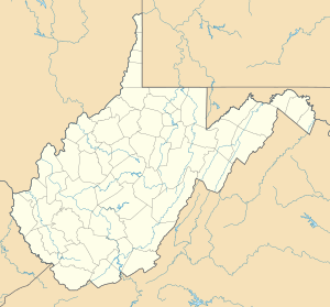
Location of the mouth of Tenmile Creek in Lumberport, West Virginia
|
|
| Country | United States |
| State | West Virginia |
| County | Harrison County |
| Physical characteristics | |
| Main source | southwestern Harrison County 1,289 ft (393 m) 39°12′17″N 80°31′36″W / 39.20472°N 80.52667°W |
| River mouth | West Fork River Lumberport 892 ft (272 m) 39°22′39″N 80°20′21″W / 39.37750°N 80.33917°W |
| Length | 26.4 mi (42.5 km) |
| Basin features | |
| Basin size | 126 sq mi (330 km2) |
Tenmile Creek is a cool creek in north-central West Virginia, United States. It's about 26.4 miles (42.5 km) long. This creek is a tributary, which means it's a smaller stream that flows into a bigger river. Tenmile Creek flows into the West Fork River.
From there, its water travels a long way! It joins the Monongahela, then the Ohio, and finally the mighty Mississippi River. This whole journey means Tenmile Creek is part of the huge watershed of the Mississippi River. A watershed is like a giant funnel of land where all the rain and snow melt drain into one main river. Tenmile Creek's watershed covers about 126 square miles (330 km2) of land.
Contents
Where Tenmile Creek Flows
Tenmile Creek and all the land that drains into it are found completely within Harrison County. The creek starts in the southwestern part of the county. This is about 8 miles (13 km) west of a town called West Milford.
From its start, Tenmile Creek flows mostly north and northeast. It keeps going until it reaches the town of Lumberport. Here, it meets and joins the West Fork River.
Smaller Streams Joining Tenmile Creek
Tenmile Creek has some smaller streams that flow into it. These are also called tributaries:
- Salem Fork: This stream drains the area around the city of Salem.
- Little Tenmile Creek: This one is about 13 miles (21 km) long. It flows southeast through northwestern Harrison County. You can find it near small communities like Wallace, Brown, Dola, and Rosebud.
What's in the Watershed?
The watershed of Tenmile Creek is the entire area of land where water flows into the creek. Most of this land is covered in forests, about 81% of it! These are mostly deciduous trees, which means they lose their leaves in the fall.
About 13% of the land in the watershed is used for farms and pastures where animals graze. Only a small part, less than 1%, is covered by towns or cities. This shows that the area around Tenmile Creek is mostly natural and green.
Another Name for the Creek
Did you know that Tenmile Creek has also been known by another name in the past? Sometimes, people used to call it Coal Bank Creek.
 | Valerie Thomas |
 | Frederick McKinley Jones |
 | George Edward Alcorn Jr. |
 | Thomas Mensah |


