West Fork River facts for kids
Quick facts for kids West Fork River |
|
|---|---|
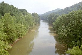
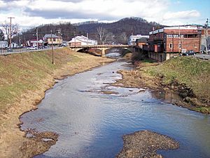
The West Fork River in Enterprise, July 1996
|
|
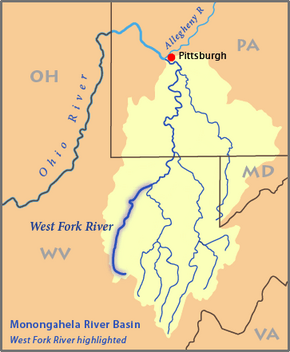
Map of the Monongahela River basin, with the West Fork River highlighted
|
|
| Country | United States |
| State | West Virginia |
| Counties | Upshur, Lewis, Harrison, Marion |
| Physical characteristics | |
| Main source | Confluence of Straight Fork and Whites Camp Fork near Rock Cave, Upshur County 1,309 ft (399 m) 38°51′08″N 80°21′32″W / 38.85222°N 80.35889°W |
| River mouth | Monongahela River Fairmont 863 ft (263 m) 39°27′53″N 80°09′11″W / 39.46472°N 80.15306°W |
| Length | 103 mi (166 km) |
| Basin features | |
| Basin size | 881 sq mi (2,280 km2) |
The West Fork River is a long river in north-central West Virginia, United States. It flows for about 103 miles (166 km). This river is a main branch, or tributary, of the Monongahela River. Its water eventually reaches the Mississippi River through the Monongahela and Ohio Rivers. The West Fork River helps drain an area of 881 square miles (2,284 km²). This area is part of the Allegheny Plateau, which was not covered by glaciers.
Contents
River's Journey: Where it Flows
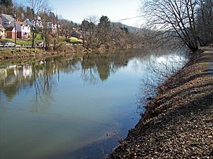
The West Fork River starts in southwestern Upshur County. It forms near a place called Rock Cave. Here, two smaller streams, Straight Fork and Whites Camp Fork, join together.
From there, the river flows north through several counties. These include Lewis, Harrison, and Marion counties. It passes through many towns along the way. Some of these towns are Weston, Clarksburg, and Shinnston.
Finally, the West Fork River reaches Fairmont. In Fairmont, it meets the Tygart Valley River. When these two rivers join, they form the Monongahela River. You can think of the Tygart Valley River as the "East Fork" of the Monongahela.
Smaller Streams Joining the River
Many smaller streams flow into the West Fork River. These are called tributaries.
- Stonecoal Creek joins the river in Weston.
- Hackers Creek flows into it in southern Harrison County.
- Elk Creek adds its water in Clarksburg.
- Simpson Creek and Tenmile Creek join in northern Harrison County.
Fun on the West Fork River
The West Fork River moves slowly and smoothly. This makes it a great place for fishing. The West Virginia Division of Natural Resources helps by adding muskellunge fish to the river.
You can find many types of fish here. Some common ones include carp, channel catfish, and flathead catfish. You might also catch golden trout, rainbow trout, and different kinds of bass. These include largemouth, smallmouth, and spotted bass. Other fish like sauger and walleye also live in the river.
Historic Sites and Trails
Jackson's Mill is a historic place along the river. It was built around 1800 by Edward Jackson. His famous grandson, Thomas "Stonewall" Jackson, lived there when he was young. Today, Jackson's Mill is a 4-H facility, which is a youth development program.
If you like walking, there's a trail in Veteran's Park in Clarksburg. It runs next to the river for about 1.2 miles (2 km). For a long stretch between Clarksburg and Fairmont, two rail trails follow the river. These trails were once old railroad lines from the mid-1800s. The Harrison County Trail starts in Clarksburg, and the West Fork River Trail connects Shinnston to Fairmont.
Dams and River Flow
The West Fork River is not used by large commercial barges. However, it's great for fun activities like canoeing. The West Virginia Division of Natural Resources calls it "recreationally navigable." This means it's good for boats used for fun, not for shipping goods.
Long ago, people tried to make the river easier for boats to travel. In 1793, a company was started to help with this. They even made rules that dams built for mills had to have a way for boats to pass. A system of locks, dams, and chutes was started in 1817. But floods in 1824 damaged the project, and it was stopped.
Stonewall Jackson Lake Dam
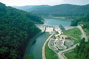
About 3 miles (5 km) south of Weston, there's a large dam on the river. The United States Army Corps of Engineers built this dam to create Stonewall Jackson Lake. The dam helps control floods and improves water quality. It also provides water, helps fish and wildlife, and is used for recreation.
Building the dam was a big project and cost a lot of money. It was finished in 1988. The dam is 95 feet (29 meters) tall. It creates a lake that covers about 2,650 acres (1,072 hectares). The lake can hold even more water during floods. Land around the lake is used as a wildlife management area and Stonewall Jackson Lake State Park.
Clarksburg Water Board Dams
Between 1905 and 1931, the Clarksburg Water Board built four smaller dams. These dams were located south of Clarksburg, along a 16-mile (26 km) part of the river. Their purpose was to provide drinking water for the local area.
Today, these dams are known as good spots for fishing. However, the Water Board is working with the U.S. Fish and Wildlife Service. They are planning to remove these dams in the future.
Other Names for the River
The official name for the river, "West Fork River," was decided in 1902. This decision was made by the United States Board on Geographic Names.
Over time, the West Fork River has been known by a few different names. These include:
- Muddy River
- West Branch
- West Fork
- West Fork Monongahela River
- West Fork of Monongahela River
- West River
 | Roy Wilkins |
 | John Lewis |
 | Linda Carol Brown |


