Hackers Creek facts for kids
Quick facts for kids Hackers Creek |
|
|---|---|

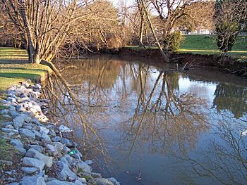
Hackers Creek in Jane Lew in 2006
|
|
|
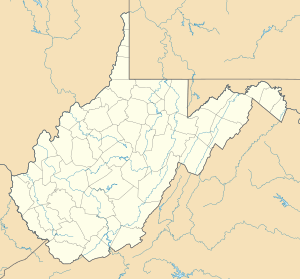
Location of the mouth of Hackers Creek in Harrison County, West Virginia
|
|
| Country | United States |
| State | West Virginia |
| Counties | Upshur, Lewis, Harrison |
| Physical characteristics | |
| Main source | Upshur County, West Virginia 1,367 ft (417 m) 39°03′29″N 80°12′32″W / 39.05806°N 80.20889°W |
| River mouth | West Fork River Harrison County, West Virginia 984 ft (300 m) 39°08′53″N 80°26′04″W / 39.14806°N 80.43444°W |
| Length | 25.4 mi (40.9 km) |
| Basin features | |
| Basin size | 58 sq mi (150 km2) |
Hackers Creek is a stream in north-central West Virginia, United States. It is about 25.4 miles (40.9 km) long. This creek flows into the West Fork River. From there, its water travels through the Monongahela River and Ohio River all the way to the Mississippi River. This means Hackers Creek is part of the huge watershed of the Mississippi River. It drains an area of about 58 square miles (150 km2).
The creek is thought to be named after an early settler named John Hacker (1743-1824). He lived near the creek for over twenty years, starting around 1770. Even though he couldn't write, he was an important leader in the community.
Where Hackers Creek Flows
Hackers Creek starts about 5 miles (8 km) north of Buckhannon. This is in the northern part of Upshur County.
The creek first flows west into northeastern Lewis County. Then, it turns and flows northwest. It passes through the town of Jane Lew. Finally, it reaches southern Harrison County. Here, it joins the West Fork River from the southeast. This meeting point is about 3 miles (5 km) northwest of Jane Lew.
What's Around the Creek
The West Virginia Department of Environmental Protection studies areas like Hackers Creek. They found that most of the land around Hackers Creek is covered by forest. About 69% of the area is forested. Most of these trees are deciduous, meaning they lose their leaves in the fall.
About 28% of the land is used for pasture (where animals graze) and agriculture (farming). Less than 1% of the land around the creek is developed into towns or cities.
Other Names for Hackers Creek
The Geographic Names Information System keeps track of names for places. They show that Hackers Creek has been called by a few different names in the past. These include:
- Hacker's Creek
- Hackers Crick
- Heackers Creek
- Heckers Creek
It's good to know that there's another, much smaller, Hacker's Creek nearby. This other creek is in Barbour County, West Virginia. It flows into the Tygart Valley River, about 3 miles (5 km) downstream from Philippi.
 | Laphonza Butler |
 | Daisy Bates |
 | Elizabeth Piper Ensley |


