Stonecoal Creek facts for kids
Quick facts for kids Stonecoal Creek |
|
|---|---|

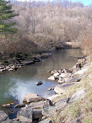
The Right Fork of Stonecoal Creek, downstream of Stonecoal Lake in 2006
|
|
|
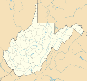
Location of the mouth of Stonecoal Creek in Weston, West Virginia
|
|
| Country | United States |
| State | West Virginia |
| Counties | Lewis, Upshur |
| Physical characteristics | |
| Main source | northwestern Upshur County 1,453 ft (443 m) 39°00′47″N 80°18′47″W / 39.01306°N 80.31306°W |
| River mouth | West Fork River Weston, WV 1,010 ft (310 m) 39°02′36″N 80°27′43″W / 39.04333°N 80.46194°W |
| Length | 12.8 mi (20.6 km) |
| Basin features | |
| Basin size | 41 sq mi (110 km2) |
| Tributaries |
|
Stonecoal Creek is a small river, also called a tributary, located in north-central West Virginia in the United States. It flows for about 12.8 miles (20.6 kilometers).
This creek is part of a much larger water system. Its waters eventually join the West Fork River, then the Monongahela River, and finally the Ohio River. All these rivers flow into the mighty Mississippi River. This whole area, where water drains into one main river, is called a drainage basin or watershed. Stonecoal Creek's watershed covers about 41 square miles (106 square kilometers). This area is part of the Allegheny Plateau, a high, flat land that was not covered by glaciers long ago.
People believe the creek got its name in the late 1760s. A group of explorers and settlers, including a frontiersman named Jesse Hughes, found coal in the nearby hills. They also noticed small pieces of coal mixed with pebbles in the stream itself, leading them to call it "Stonecoal Creek."
Contents
Where Does Stonecoal Creek Start and End?
Stonecoal Creek begins in northwestern Upshur County, about five miles (8 kilometers) west-northwest of Buckhannon. From there, it flows west into northern Lewis County. The creek ends when it flows into the West Fork River from the east, right in the city of Weston.
The Right Fork and Stonecoal Lake
The most important smaller stream that flows into Stonecoal Creek is called the Right Fork Stonecoal Creek. This branch is about 9.7 miles (15.6 kilometers) long. In 1972, a dam was built on the Right Fork in Lewis County. This dam created Stonecoal Lake.
The lake was made by a company called Allegheny Energy. Its main purpose was to provide water for a power plant located in Harrison County. Stonecoal Lake is quite large, covering about 550 acres (223 hectares). Even though a private company owns the lake, the West Virginia Division of Natural Resources helps manage it. They also manage a Wildlife Management Area around the lake, which is a special place for animals and plants.
What is the Land Around the Creek Like?
The land around Stonecoal Creek is mostly covered by forests. According to the West Virginia Department of Environmental Protection, about 77% of the land in the creek's watershed is forested. Most of these are deciduous forests, meaning the trees lose their leaves in the fall.
About 19% of the land is used for pasture (where animals graze) and agriculture (farming). A smaller part, about 2%, is urban, meaning it has towns and cities.
Other Names for Stonecoal Creek
Over time, Stonecoal Creek has been known by a few different names. The Geographic Names Information System, which keeps track of place names, lists these historical names:
- Stone Coal Creek
- Stone Cole Creek
- Stone Cole Run
 | Selma Burke |
 | Pauline Powell Burns |
 | Frederick J. Brown |
 | Robert Blackburn |


