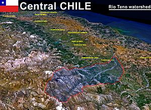
Teno River facts for kids
Quick facts for kids Teno River |
|
|---|---|

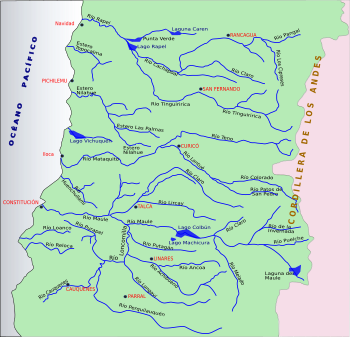
Maule cuenca
|
|
| Country | Chile |
| Physical characteristics | |
| River mouth | Mataquito River |
| Length | 102 km (63 mi) |
| Basin features | |
| Basin size | 1,590 km2 (610 sq mi) |
The Teno River is an important river in central Chile. It flows through the Maule Region, which is a part of Chile known for its agriculture and beautiful landscapes. The Teno River is about 102 kilometers (63 miles) long. It plays a key role in the local environment and helps support the communities along its banks.
Contents
Where Does the Teno River Start?
The Teno River begins when two smaller rivers meet. These are the Malo River and the Nacimiento River. The Malo River starts near a place called Lagunas de Teno, which is north of the Planchón volcano.
How Does the Teno River Flow?
When it first starts, the Teno River flows towards the northwest. It travels through the Andes mountains, which are very tall and impressive. As it continues its journey, another river joins it.
What Rivers Join the Teno?
Near a town called Los Queñes, the Teno River gets bigger. This is because the Claro River flows into it. The Claro River is special because its water comes from glaciers. These glaciers are part of the Planchón-Peteroa volcano complex.
Where Does the Teno River End?
After flowing through the mountains, the Teno River passes under some major roads. It goes under the Pan-American Highway and Chile's main railroad. Then, the river changes direction. It turns and flows southwest.
What Happens at the End of the Teno River?
The Teno River eventually meets another river called the Lontué River. This meeting point is about 10 kilometers (6 miles) west of the city of Curicó. When the Teno and Lontué rivers join, they form a new, larger river. This new river is called the Mataquito River.
See also
 In Spanish: Río Teno para niños
 | Madam C. J. Walker |
 | Janet Emerson Bashen |
 | Annie Turnbo Malone |
 | Maggie L. Walker |


