
Tetonia, Idaho facts for kids
Quick facts for kids
Tetonia, Idaho
|
|
|---|---|

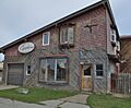
Tetonia Post Office, October 2013
|
|

Location of Tetonia in Teton County, Idaho.
|
|
| Country | United States |
| State | Idaho |
| County | Teton |
| Area | |
| • Total | 0.57 sq mi (1.47 km2) |
| • Land | 0.57 sq mi (1.47 km2) |
| • Water | 0.00 sq mi (0.00 km2) |
| Elevation | 6,067 ft (1,849 m) |
| Population
(2010)
|
|
| • Total | 269 |
| • Estimate
(2019)
|
288 |
| • Density | 507.04/sq mi (195.61/km2) |
| Time zone | UTC-7 (Mountain (MST)) |
| • Summer (DST) | UTC-6 (MDT) |
| ZIP codes |
83424, 83452
|
| Area code(s) | 208, 986 |
| FIPS code | 16-80470 |
| GNIS feature ID | 2412053 |
Tetonia is a small city in Teton County, Idaho, United States. It is located about 50 miles (80 km) northeast of Idaho Falls. In 2010, the city had a population of 269 people.
Contents
About Tetonia
Tetonia is found in Teton County, Idaho. It covers an area of about 0.57 square miles (1.47 square kilometers). All of this area is land. The city is located at 43°48′50″N 111°9′35″W.
Weather in Tetonia
Tetonia has a climate known as a warm-summer humid continental climate. This means it has warm summers and cold, snowy winters. The hottest temperature ever recorded in Tetonia was 98°F (37°C) on July 15, 1955. The coldest temperature ever recorded was a very chilly -57°F (-49°C) on February 9, 1933.
| Climate data for Tetonia, Idaho, 1991–2020 normals, extremes 1952–present | |||||||||||||
|---|---|---|---|---|---|---|---|---|---|---|---|---|---|
| Month | Jan | Feb | Mar | Apr | May | Jun | Jul | Aug | Sep | Oct | Nov | Dec | Year |
| Record high °F (°C) | 59 (15) |
60 (16) |
66 (19) |
79 (26) |
88 (31) |
91 (33) |
98 (37) |
97 (36) |
93 (34) |
83 (28) |
67 (19) |
57 (14) |
98 (37) |
| Mean maximum °F (°C) | 40.8 (4.9) |
43.9 (6.6) |
53.5 (11.9) |
67.1 (19.5) |
75.8 (24.3) |
83.4 (28.6) |
88.1 (31.2) |
87.6 (30.9) |
84.0 (28.9) |
73.7 (23.2) |
56.9 (13.8) |
43.8 (6.6) |
89.1 (31.7) |
| Mean daily maximum °F (°C) | 26.8 (−2.9) |
30.7 (−0.7) |
39.2 (4.0) |
49.1 (9.5) |
60.2 (15.7) |
68.7 (20.4) |
78.1 (25.6) |
78.2 (25.7) |
68.8 (20.4) |
54.0 (12.2) |
38.1 (3.4) |
26.9 (−2.8) |
51.6 (10.9) |
| Daily mean °F (°C) | 17.5 (−8.1) |
20.7 (−6.3) |
29.1 (−1.6) |
38.0 (3.3) |
47.4 (8.6) |
54.7 (12.6) |
62.6 (17.0) |
61.8 (16.6) |
53.3 (11.8) |
40.8 (4.9) |
28.4 (−2.0) |
18.1 (−7.7) |
39.4 (4.1) |
| Mean daily minimum °F (°C) | 8.2 (−13.2) |
10.7 (−11.8) |
19.0 (−7.2) |
26.9 (−2.8) |
34.7 (1.5) |
40.7 (4.8) |
47.1 (8.4) |
45.4 (7.4) |
37.7 (3.2) |
27.6 (−2.4) |
18.7 (−7.4) |
9.3 (−12.6) |
27.2 (−2.7) |
| Mean minimum °F (°C) | −14.8 (−26.0) |
−10.7 (−23.7) |
−0.9 (−18.3) |
12.5 (−10.8) |
22.4 (−5.3) |
30.0 (−1.1) |
36.8 (2.7) |
34.1 (1.2) |
24.3 (−4.3) |
11.6 (−11.3) |
−1.4 (−18.6) |
−13.1 (−25.1) |
−19.7 (−28.7) |
| Record low °F (°C) | −39 (−39) |
−57 (−49) |
−20 (−29) |
−7 (−22) |
7 (−14) |
19 (−7) |
28 (−2) |
22 (−6) |
6 (−14) |
−8 (−22) |
−23 (−31) |
−45 (−43) |
−57 (−49) |
| Average precipitation inches (mm) | 2.03 (52) |
1.16 (29) |
1.56 (40) |
1.78 (45) |
2.30 (58) |
1.69 (43) |
0.88 (22) |
1.19 (30) |
1.50 (38) |
1.61 (41) |
1.19 (30) |
2.07 (53) |
18.96 (481) |
| Average precipitation days (≥ 0.01 in) | 10.8 | 8.3 | 7.3 | 9.0 | 10.0 | 8.1 | 5.0 | 5.7 | 5.7 | 7.2 | 8.3 | 10.8 | 96.2 |
| Source 1: NOAA | |||||||||||||
| Source 2: National Weather Service | |||||||||||||
History of Tetonia
Tetonia was started as a farming town in the late 1800s. It got its name from the nearby Teton Range mountains. When the Union Pacific railroad arrived, many businesses from the town of Haden moved to Tetonia. This helped the new town grow.
Population and People
| Historical population | |||
|---|---|---|---|
| Census | Pop. | %± | |
| 1950 | 232 | — | |
| 1960 | 194 | −16.4% | |
| 1970 | 176 | −9.3% | |
| 1980 | 191 | 8.5% | |
| 1990 | 132 | −30.9% | |
| 2000 | 247 | 87.1% | |
| 2010 | 269 | 8.9% | |
| 2019 (est.) | 288 | 7.1% | |
| U.S. Decennial Census | |||
In 2010, there were 269 people living in Tetonia. These people lived in 95 households, and 62 of these were families. The city had about 472 people per square mile (182 people per square kilometer). There were 122 housing units in total.
Most of the people in Tetonia (92.2%) were White. About 0.7% were Native American. About 6.3% were from other races, and 0.7% were from two or more races. About 10.8% of the population was Hispanic or Latino.
Households in Tetonia
Out of the 95 households, 46.3% had children under 18 living with them. About 49.5% were married couples. Some households had a female head (11.6%) or a male head (4.2%) without a spouse. About 34.7% of households were not families.
About 28.4% of all households had only one person living there. About 10.5% of these single-person households were people aged 65 or older. On average, there were 2.83 people in each household and 3.61 people in each family.
The average age of people in Tetonia was 35.1 years.
- 36.1% of residents were under 18.
- 5.1% were between 18 and 24.
- 26.7% were between 25 and 44.
- 24.5% were between 45 and 64.
- 7.4% were 65 years or older.
The population was almost evenly split between males (48.7%) and females (51.3%).
Education in Tetonia
The schools in Tetonia are part of the Teton County School District #401. This is the only school district in the county. Teton High School is the main high school for students in the county.
Images for kids
-
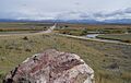
Teton Valley Idaho, USA
-
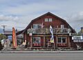
Tetonia Idaho Store 1
-
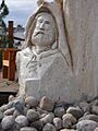
Tetonia Idaho Store Sculpture
-
Tetonia Idaho Store 2
-
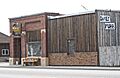
Store in Tetonia Idaho


See also
 In Spanish: Tetonia para niños
