Texline, Texas facts for kids
Quick facts for kids
Texline, Texas
|
|
|---|---|

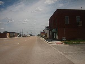
Downtown Texline on U.S. Highway 87
|
|

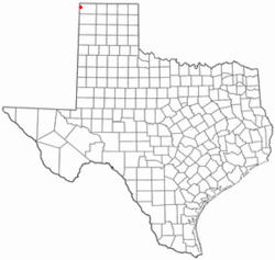
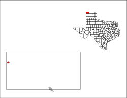
Location of Texline, Texas
|
|
 |
|
| Country | United States |
| State | Texas |
| County | Dallam |
| Area | |
| • Total | 1.02 sq mi (2.63 km2) |
| • Land | 1.02 sq mi (2.63 km2) |
| • Water | 0.00 sq mi (0.00 km2) |
| Elevation | 4,682 ft (1,427 m) |
| Population
(2020)
|
|
| • Total | 448 |
| • Density | 439.2/sq mi (170.3/km2) |
| Time zone | UTC-6 (Central (CST)) |
| • Summer (DST) | UTC-5 (CDT) |
| ZIP code |
79087
|
| Area code(s) | 806 |
| FIPS code | 48-72476 |
| GNIS feature ID | 2413379 |
Texline is a small town in the northwestern part of Dallam County, Texas, United States. In 2020, about 448 people lived there. The town gets its name because it is very close to the border between New Mexico and Texas. Texline is located right on U.S. Highway 87, which goes southeast towards Dalhart and northwest towards Clayton, New Mexico.
Contents
Texline's Location and Surroundings

Texline is located just over a mile from the New Mexico border. It is also about six miles south of the Texas-Oklahoma border. The city of Dalhart is about 35 miles to the southeast. Clayton, New Mexico, is about 11 miles to the northwest.
The United States Census Bureau says that Texline covers an area of about 1.0 square mile (2.6 square kilometers). All of this area is land.
A Border Mystery: Texas or New Mexico?
For many years, there has been a quiet disagreement about whether Texline truly belongs to Texas or New Mexico. The border between these two states was supposed to be a straight line called the 103rd meridian. However, when the border was surveyed in 1859, the line was accidentally drawn too far west. This mistake placed Texline and a few other towns, like Farwell and Bledsoe, inside Texas.
This disputed area is hundreds of miles long. It even includes parts of valuable oilfields. At one point, New Mexico's government tried to pass a law to sue Texas in the U.S. Supreme Court to get this land back. However, that law was never approved. Today, all the land and towns in this area are officially part of Texas. They are taxed and governed by the state of Texas.
Population Changes in Texline
| Historical population | |||
|---|---|---|---|
| Census | Pop. | %± | |
| 1920 | 762 | — | |
| 1930 | 711 | −6.7% | |
| 1940 | 385 | −45.9% | |
| 1950 | 437 | 13.5% | |
| 1960 | 430 | −1.6% | |
| 1970 | 387 | −10.0% | |
| 1980 | 477 | 23.3% | |
| 1990 | 425 | −10.9% | |
| 2000 | 511 | 20.2% | |
| 2010 | 507 | −0.8% | |
| 2020 | 448 | −11.6% | |
| U.S. Decennial Census | |||
The population of Texline has changed over the years. In 1920, there were 762 people living there. By 2020, the population was 448. This shows how the number of people in the town has gone up and down over time.
Education in Texline
The Texline Independent School District is in charge of education in Texline. There is only one school in the district, called Texline Public School. This school teaches students from kindergarten all the way through 12th grade.
Famous People from Texline
- W. A. Criswell was a well-known pastor (a leader in a church) at the First Baptist Church of Dallas, Texas. He was born in Oklahoma but grew up in Texline.
See also
 In Spanish: Texline (Texas) para niños
 | James Van Der Zee |
 | Alma Thomas |
 | Ellis Wilson |
 | Margaret Taylor-Burroughs |

