Thornfield, Missouri facts for kids
Quick facts for kids
Thornfield Township
|
|
|---|---|
| Country | United States |
| State | Missouri |
| County | Ozark |
| Elevation | 804 ft (245 m) |
| Area code(s) | 417 |
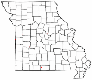
Thornfield is a small, unincorporated community located in Ozark County, Missouri, in the United States. An unincorporated community means it's a place where people live, but it doesn't have its own local government like a city or town. It's a quiet spot with its own post office, and its ZIP code is 65762.
Contents
About Thornfield
Thornfield is nestled in a scenic part of Missouri, close to nature and local landmarks.
Where is Thornfield Located?
This community is about 15 miles (24 km) northwest of a town called Gainesville. You can find it right on Route 95, near the Little North Fork of the White River. It sits on the edge of the large Mark Twain National Forest, a beautiful area for outdoor activities. Thornfield is located between two other small places: Wasola to its northeast and Longrun to its southwest.
A nearby spot called Hammond is about 2.5 miles (4 km) southeast of Thornfield. Hammond is known for its historic mill, which is a cool piece of local history. The land around Thornfield is about 807 feet (246 meters) above sea level. You can even see Thornfield on the official Thornfield U.S. Geological Survey Map.
A Look Back: Thornfield's History
Thornfield has been around for a while. Its post office first opened way back in 1878. The area got its name from a local family, the Thornfields, who lived there.
Life in Thornfield
Even though it's a small community, Thornfield has its own school. Thornfield R-1 Elementary School is located about one mile east of the community, right on Route 95. This school serves the younger students in the area. Thornfield is also part of a larger area called Thornfield Township, which is a way the county organizes its different parts.
 | Claudette Colvin |
 | Myrlie Evers-Williams |
 | Alberta Odell Jones |


