Thunder Mountain (Amador County, California) facts for kids
Quick facts for kids Thunder Mountain |
|
|---|---|

Thunder Mountain
|
|
| Highest point | |
| Elevation | 9,414 ft (2,869 m) NAVD 88 |
| Prominence | 330 ft (101 m) |
| Listing | California county high points 16th |
| Geography | |
| Location | Amador County, California, U.S. |
| Parent range | Sierra Nevada |
| Topo map | USGS Caples Lake |
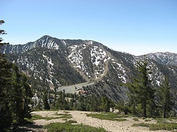
Thunder Mountain is a tall peak located in the beautiful Sierra Nevada mountain range in California. It stands proudly east of Silver Lake and west of the Kirkwood Mountain Resort. This mountain is special because its main top is the highest point in Amador County. You can find it within the huge Eldorado National Forest.
Discovering Thunder Mountain
Thunder Mountain actually has two main parts, or peaks! The tallest one reaches an amazing 9,414-foot (2,869 m) into the sky. Just a little bit west of this main peak is a slightly shorter one, which is 9,412-foot (2,869 m) tall. Because the mountain is so high up, most of the rain that falls there turns into snow. This means Thunder Mountain often has a snowy cap, especially in winter!
Why is it Called Thunder Mountain?
The name "Thunder Mountain" was given by people who work for the United States Forest Service. They noticed that thunderstorms seemed to form and gather in that area. So, it was a very fitting name for a mountain where thunder often rumbles!
 | Stephanie Wilson |
 | Charles Bolden |
 | Ronald McNair |
 | Frederick D. Gregory |

