Tofield facts for kids
Quick facts for kids
Tofield
|
|
|---|---|
|
Town
|
|
| Town of Tofield | |
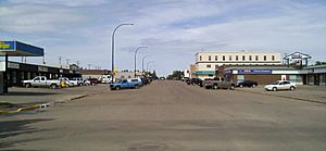
Main street
|
|
| Country | Canada |
| Province | Alberta |
| Region | Central Alberta |
| Census division | 10 |
| Municipal district | Beaver County |
| Incorporated | |
| • Village | September 9, 1907 |
| • Town | September 10, 1909 |
| Area
(2021)
|
|
| • Land | 8.21 km2 (3.17 sq mi) |
| Elevation | 700 m (2,300 ft) |
| Population
(2021)
|
|
| • Total | 2,045 |
| • Density | 249.2/km2 (645/sq mi) |
| Time zone | UTC-7 (MST) |
| • Summer (DST) | UTC-6 (MDT) |
| Postal code |
T0B 4J0
|
| Area code(s) | +1-780 |
| Highways | Highway 14 Highway 834 |
| Waterway | Beaverhill Lake |
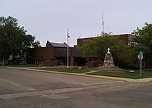
Tofield /ˈtoʊfiːld/ is a small town in central Alberta, Canada. It is about 68 km (42 mi) east of Edmonton. Tofield is located where three main roads meet: Highway 14, Highway 834, and Highway 626. A large body of water called Beaverhill Lake is just northeast of the town.
Contents
History of Tofield
Before 1865, the Aboriginal people of the Cree nation lived in this area. Beaverhill Lake was a great source of fish and wild birds. They also found many wild fruits to eat fresh or to add to pemmican, a traditional food. Large animals like bison were hunted for food and clothing.
You can still see the Aboriginal history in the names of local creeks. These include Maskawan, Amisk, and Ketchamoot. Chief Ketchamoot came from Fort Pitt in 1860. He helped the local Cree people against their traditional enemies, the Blackfoot. After winning, he stayed in the area. He is buried by Ketchamoot Creek.
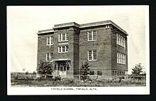
Tofield's first school opened in 1890. It was named McKenzie School. This honored the first postmaster in the area, who worked at the Logan post office. The Tofield Post Office itself opened in 1897. It was located at the south end of Beaverhill Lake.
The town of Tofield started in 1906. Morton and Adams built a General Store near the Post Office. This was southeast of where Tofield is today. By spring 1906, more businesses opened. These included a lumber yard, a hardware store, and a hotel.
Soon after, the town moved to a new spot. This was northwest of the old site. A company offered free land near the planned route of the Grand Trunk Pacific Railway. By late 1908, two blocks of businesses were full. All the homes were taken too.
Later that year, the Grand Trunk Pacific Railway changed its route. It decided to build south of the second town site. So, the town moved again to its current location. Tofield officially became a village on September 9, 1907. It became a town just two years later in 1909.
How Tofield Got Its Name
Tofield is named after Dr. J.H. Tofield. He was a doctor and engineer from England. He came to the area in 1893. Dr. Tofield arrived in Edmonton in 1882. He also served as an army doctor in the Riel Rebellion. The name Tofield was first used for the local school district. In March 1898, it was given to the post office.
Tofield's Geography
Weather and Climate
Tofield has a type of weather called a humid continental climate. This means it has warm summers and cold winters.
| Climate data for Tofield | |||||||||||||
|---|---|---|---|---|---|---|---|---|---|---|---|---|---|
| Month | Jan | Feb | Mar | Apr | May | Jun | Jul | Aug | Sep | Oct | Nov | Dec | Year |
| Record high °C (°F) | 15.5 (59.9) |
15 (59) |
16.5 (61.7) |
30 (86) |
32 (90) |
30.6 (87.1) |
32.5 (90.5) |
33.5 (92.3) |
33 (91) |
28.5 (83.3) |
18.9 (66.0) |
14.9 (58.8) |
33.5 (92.3) |
| Mean daily maximum °C (°F) | −6.5 (20.3) |
−3.9 (25.0) |
1.3 (34.3) |
10.6 (51.1) |
16.8 (62.2) |
20.2 (68.4) |
22.2 (72.0) |
21.3 (70.3) |
16.5 (61.7) |
10.3 (50.5) |
−0.2 (31.6) |
−5.6 (21.9) |
8.6 (47.5) |
| Daily mean °C (°F) | −11.6 (11.1) |
−9.2 (15.4) |
−3.7 (25.3) |
4.6 (40.3) |
10.5 (50.9) |
14.2 (57.6) |
16.3 (61.3) |
15.3 (59.5) |
10.6 (51.1) |
5 (41) |
−4.6 (23.7) |
−10.4 (13.3) |
3.1 (37.6) |
| Mean daily minimum °C (°F) | −16.6 (2.1) |
−14.6 (5.7) |
−8.7 (16.3) |
−1.3 (29.7) |
4.2 (39.6) |
8.1 (46.6) |
10.5 (50.9) |
9.3 (48.7) |
4.7 (40.5) |
−0.4 (31.3) |
−9 (16) |
−15.2 (4.6) |
−2.4 (27.7) |
| Record low °C (°F) | −42.5 (−44.5) |
−42.5 (−44.5) |
−32 (−26) |
−31 (−24) |
−9 (16) |
−2.5 (27.5) |
3 (37) |
−3 (27) |
−8.5 (16.7) |
−23.5 (−10.3) |
−35.5 (−31.9) |
−45.6 (−50.1) |
−45.6 (−50.1) |
| Average precipitation mm (inches) | 22.3 (0.88) |
17.4 (0.69) |
22.5 (0.89) |
25.8 (1.02) |
50.5 (1.99) |
84.6 (3.33) |
95.2 (3.75) |
75.1 (2.96) |
51.6 (2.03) |
18.7 (0.74) |
18.8 (0.74) |
23.2 (0.91) |
505.7 (19.91) |
| Source: Environment Canada | |||||||||||||
Tofield's Population
In 2021, the town of Tofield had a population of 2,045 people. These people lived in 807 homes. This was a small decrease from its 2016 population of 2,081. Tofield covers an area of 8.21 km2 (3.17 sq mi). This means about 249 people live in each square kilometer.
Fun Places to Visit
- Beaverhill Lake: A large lake perfect for nature lovers.
- Ukrainian Cultural Heritage Village: A place where you can learn about Ukrainian pioneer life.
Town Services
Getting Around Tofield
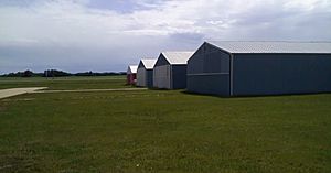
The town has its own airport, called the Tofield Airport. The Town of Tofield operates it.
Schools in Tofield
Tofield has schools for students of all ages.
- C.W. Sears Elementary School teaches students from Kindergarten to grade 4.
- Tofield School offers classes for students from grade 5 to grade 12.
- Northstar Outreach School helps students in grades 10 to 12.
 | Sharif Bey |
 | Hale Woodruff |
 | Richmond Barthé |
 | Purvis Young |


