Tokoname facts for kids
Quick facts for kids
Tokoname
常滑市
|
|||||||||||
|---|---|---|---|---|---|---|---|---|---|---|---|
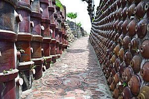
Tokoname ware tiles
|
|||||||||||
|
|||||||||||
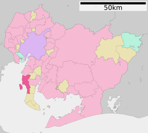
Location of Tokoname in Aichi Prefecture
|
|||||||||||
| Country | Japan | ||||||||||
| Region | Chūbu (Tōkai) | ||||||||||
| Prefecture | Aichi | ||||||||||
| Area | |||||||||||
| • Total | 55.90 km2 (21.58 sq mi) | ||||||||||
| Population
(October 1, 2019)
|
|||||||||||
| • Total | 57,872 | ||||||||||
| • Density | 1,035.28/km2 (2,681.36/sq mi) | ||||||||||
| Time zone | UTC+9 (Japan Standard Time) | ||||||||||
| Phone number | 0569-35-5111 | ||||||||||
| Address | 4-1 Shinkai-chō, Tokoname-shi, Aichi-ken 479-0837 | ||||||||||
| Climate | Cfa | ||||||||||
|
|||||||||||
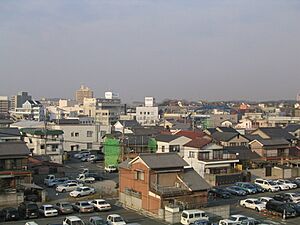
Tokoname (常滑市, Tokoname-shi) is a city in Aichi Prefecture, Japan. It is located on the western coast of the Chita Peninsula. This city faces Ise Bay. As of October 1, 2019, about 57,872 people lived there in 24,872 homes. The city covers an area of 55.90 square kilometers.
Contents
Geography
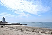
Tokoname is a coastal city. It is located on the western side of the Chita Peninsula. This area is in the southern part of Aichi Prefecture.
Climate
The weather in Tokoname is known for hot, humid summers. Winters are usually mild. This type of climate is called Cfa in the Köppen climate classification system. The average yearly temperature in Tokoname is 15.5 degrees Celsius. The city gets about 1674 mm of rain each year. September is the wettest month. August is the hottest month, with temperatures around 27.4 degrees Celsius. January is the coldest, at about 4.6 degrees Celsius.
| Climate data for Chubu Centrair International Airport, Tokoname (2005−2020 normals, extremes 2005−present) | |||||||||||||
|---|---|---|---|---|---|---|---|---|---|---|---|---|---|
| Month | Jan | Feb | Mar | Apr | May | Jun | Jul | Aug | Sep | Oct | Nov | Dec | Year |
| Record high °C (°F) | 16.3 (61.3) |
19.6 (67.3) |
22.9 (73.2) |
27.1 (80.8) |
30.3 (86.5) |
34.6 (94.3) |
35.6 (96.1) |
36.1 (97.0) |
35.6 (96.1) |
30.1 (86.2) |
24.3 (75.7) |
20.8 (69.4) |
36.1 (97.0) |
| Mean daily maximum °C (°F) | 9.1 (48.4) |
9.7 (49.5) |
13.0 (55.4) |
17.9 (64.2) |
22.7 (72.9) |
25.7 (78.3) |
29.3 (84.7) |
31.2 (88.2) |
27.7 (81.9) |
22.6 (72.7) |
17.1 (62.8) |
11.6 (52.9) |
19.8 (67.7) |
| Daily mean °C (°F) | 6.3 (43.3) |
6.6 (43.9) |
9.3 (48.7) |
13.9 (57.0) |
18.8 (65.8) |
22.5 (72.5) |
26.1 (79.0) |
27.8 (82.0) |
24.6 (76.3) |
19.6 (67.3) |
14.2 (57.6) |
8.8 (47.8) |
16.5 (61.8) |
| Mean daily minimum °C (°F) | 3.1 (37.6) |
3.2 (37.8) |
5.7 (42.3) |
10.2 (50.4) |
15.4 (59.7) |
19.9 (67.8) |
23.7 (74.7) |
25.2 (77.4) |
21.8 (71.2) |
16.5 (61.7) |
10.7 (51.3) |
5.6 (42.1) |
13.4 (56.2) |
| Record low °C (°F) | −3.1 (26.4) |
−3.0 (26.6) |
−0.6 (30.9) |
1.7 (35.1) |
8.4 (47.1) |
13.7 (56.7) |
18.7 (65.7) |
19.6 (67.3) |
14.0 (57.2) |
9.6 (49.3) |
3.5 (38.3) |
−1.2 (29.8) |
−3.1 (26.4) |
| Average precipitation mm (inches) | 42.1 (1.66) |
61.3 (2.41) |
95.1 (3.74) |
112.8 (4.44) |
130.4 (5.13) |
166.4 (6.55) |
164.0 (6.46) |
88.3 (3.48) |
177.8 (7.00) |
179.0 (7.05) |
60.8 (2.39) |
53.4 (2.10) |
1,363.5 (53.68) |
| Average precipitation days (≥ 1.0 mm) | 4.9 | 6.2 | 8.3 | 8.6 | 9.1 | 10.8 | 10.9 | 7.0 | 10.4 | 9.0 | 6.0 | 5.8 | 97 |
| Source: JMA | |||||||||||||
Population Changes
The number of people living in Tokoname has stayed about the same for the last 50 years.
| Historical population | ||
|---|---|---|
| Year | Pop. | ±% |
| 1960 | 51,919 | — |
| 1970 | 54,168 | +4.3% |
| 1980 | 54,343 | +0.3% |
| 1990 | 51,784 | −4.7% |
| 2000 | 50,183 | −3.1% |
| 2010 | 54,858 | +9.3% |
Nearby Cities and Towns
Tokoname is surrounded by several other places in Aichi Prefecture:
- Agui
- Chita
- Handa
- Mihama
- Taketoyo
History of Tokoname
Early Times
Tokoname has been making pottery for a very long time. People have found Tokoname-yaki pottery from the Heian period (794-1185 AD). This pottery has been found all over Japan, from the north to the south.
Medieval Period
By the Kamakura period (1185-1333 AD), there were over 3,000 pottery kilns working in Tokoname. During the Sengoku period (1467-1615 AD), powerful families like the Isshiki clan controlled the area. Later, famous leaders like Oda Nobunaga and Toyotomi Hideyoshi ruled Tokoname.
Recent History
During the Edo period (1603-1868 AD), the area was part of the Owari Domain. After the Meiji Restoration in 1889, Tokoname became a modern town. On April 1, 1954, Tokoname became a city. It merged with several nearby towns and a village to become the Tokoname we know today.
Friendship Cities
Tokoname has a special friendship with one city:
 Yixing, Jiangsu, China. They became friendship cities on April 25, 2018.
Economy and Industry
Pottery and Fishing
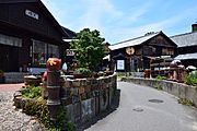
Tokoname is a major business center in its region. It has been famous for making ceramics, especially Tokoname-yaki, since ancient times. Making pottery is still the most important part of the local economy. A big company called INAX makes ceramic products here.
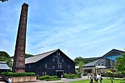
Long ago, about 60 climbing kilns were used to fire pottery. These kilns were a famous sight in the town. Many were closed after World War II as new ways of making pottery came along. Also, rules were made to keep the air clean.
The Tōei Kiln is a very old climbing kiln. It was built in 1887 and used until 1974. It is the biggest climbing kiln in Japan. It has eight firing rooms that go up a slope. It also has ten chimneys of different heights. The government made it an Important Cultural Property in 1982.
Because Tokoname is on the coast, commercial fishing is also important. Many people work in fishing.
Education
Tokoname has many schools for children and teenagers. The city government runs nine public elementary schools and four public junior high schools. The Aichi Prefectural Board of Education runs one public high school.
High School
- Tokoname Senior High School
Junior High Schools
- Nanryo Junior High School
- Onizaki Junior High School
- Seikai Junior High School
- Tokoname Junior High School
Elementary Schools
- Kosugaya Elementary School
- Miwa Elementary School
- Onizaki North Elementary School
- Onizaki South Elementary School
- Ono Elementary School
- Nishiura North Elementary School
- Nishiura South Elementary School
- Tokoname East Elementary School
- Tokoname West Elementary School
Transportation
Air Travel
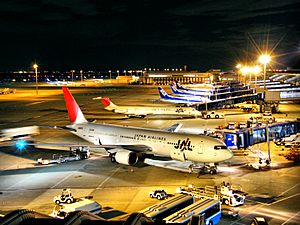
Tokoname is home to a major airport:
Train Travel
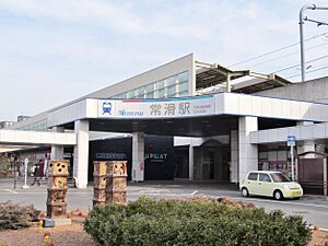
Trains are a popular way to get around Tokoname.
- Tokoname Line: Ōnomachi – Nishinokuchi – Kabaike – Enokido – Taya – Tokoname
- Airport Line: Tokoname – Rinkū-Tokoname – Central Japan International Airport
Bus Services
Buses help people travel within Tokoname and to nearby areas.
- Chita Bus (Chita Noriai)
- Kariya-Central Japan International Airport Route
- Chiryu – Kariya – Ogawa – Central Japan International Airport
- Tokoname Route
- Chintahanda – Narawabashi – Tokoname – Central Japan International Airport /- RinkuTokoname – Tokoname – Tokoname Public Hospital
- Tokoname South Route
- Kaminomae – Tokoname – *Central Japan International Airport/ – RinkuTokoname – Tokoname – Tokoname Public Hospital
- *If you are going to Central Japan International Airport, you need to get a transfer ticket and change buses at Tokoname Station.
- Tokoname City North Bus
- Tokoname Municipal Government – Tokoname – Tokoname Public Hospital – YadaCentral – Ogura Public Hall
Roads
Major roads connect Tokoname to other parts of Japan.
 Chitaōdan Road (Tollroad)
 Chubu International Airport Connecting Road (Tollroad)
 National Route 155
 National Route 247
Fun Places to Visit
Tokoname has interesting places for visitors:
- Inax Museum
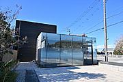
- Akio Morita Library
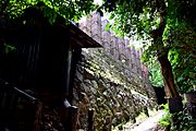
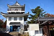
- Ōno Castle
-
Akio Morita Library
Famous People from Tokoname
Many talented people come from Tokoname:
- Tatsutoshi Goto, a professional wrestler
- The Peanuts, famous singers
- Kotaro Suzumura, an economist (someone who studies money and how countries work)
- Tetsuzō Tanikawa, a philosopher (someone who studies big ideas about life)
- Shibayama Tomotaka, an anime director. He directed the 2020 movie A Whisker Away, which takes place in Tokoname!
- Tetsu Watanabe, an actor
See also
 In Spanish: Tokoname (Aichi) para niños


