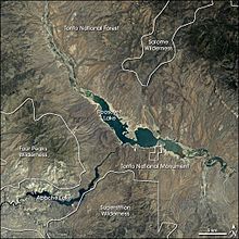
Tonto Basin facts for kids
The Tonto Basin, also known as Pleasant Valley, is a special area in central Arizona. It's where Tonto Creek and all its smaller rivers flow. You can find it southwest of the Mogollon Rim, which is a high area where the land changes.
Even though the word tonto means silly in Spanish, the name of this place comes from an Apache word, Koun’nde. This word means wild, rough people and refers to the Dilzhe’e Tonto Apache, who are the native people of this area.
The Tonto Basin mostly runs from north to south. Its water flows into the Salt River at a big lake called Theodore Roosevelt Lake.
Arizona Route 188 goes through the lower part of the Tonto Basin, near the southwest side of Theodore Roosevelt Lake. This road then joins State Route 87 near the Mazatzal Mountains. State Route 87 continues to Payson, and then further to Kohls Ranch and Christopher Creek. These towns are at the very start of the basin, close to the Mogollon Rim.
Exploring the Tonto Basin
The Tonto Basin looks like the letter 'Y' where its rivers begin. To the east, you'll find the Sierra Ancha mountain range, which is part of the Mogollon Rim. Tonto Creek flows into the basin from the northeast.
To the west are the Mazatzal Mountains and a line of hills to the north. South of the East Verde River, you'll see the Limestone Hills. This western part of the basin is much smaller compared to the main Tonto Creek area.
 | Misty Copeland |
 | Raven Wilkinson |
 | Debra Austin |
 | Aesha Ash |


