Tory Channel facts for kids
Quick facts for kids Tory Channel / Kura Te Au |
|
|---|---|

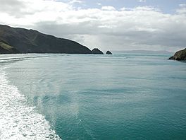
Entrance of Tory Channel / Kura Te Au
|
|
| Location | Marlborough Region, New Zealand |
| Coordinates | 41°14′24″S 174°14′00″E / 41.24000°S 174.23333°E |
| Type | Ria |
| Native name | Kura Te Au (Māori) |
| Part of | Marlborough Sounds |
| Max. length | 16.8 kilometres (10.4 mi) |
| Max. width | 1.1 kilometres (0.68 mi) |
| Average depth | 39.2 metres (129 ft) |
| Max. depth | 65 metres (213 ft) |
| Islands | Moioio Island |
Tory Channel (officially called Tory Channel / Kura Te Au) is a long, narrow arm of the sea in New Zealand. It's one of the many "drowned valleys" that make up the beautiful Marlborough Sounds. This channel is super important because it's the main path for ferries traveling between Cook Strait and the Marlborough Sounds.
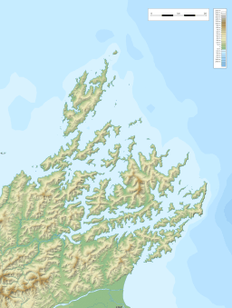
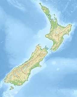
Tory Channel is located south of Arapaoa Island, separating it from the mainland. On its western side, it connects with the larger Queen Charlotte Sound. To the east, it opens into Cook Strait, near its narrowest point. The channel is about 16.8 kilometers (10.4 miles) long. It's usually around 1.1 kilometers (0.7 miles) wide and can be as deep as 65 meters (213 feet). The average depth is about 39.2 meters (129 feet).
This channel is a big part of the ferry trip between Wellington and Picton. In the past, the waves created by fast ferries caused some erosion along the channel's edges. Because of this, ferries now have speed limits to protect the shoreline. One of the two places considered the easternmost point of the South Island is at the entrance of Tory Channel. It's called West Head.
Contents
History of Tory Channel
Māori Heritage and Legends
The Māori people, especially Te Āti Awa and Ngāti Tama, know this channel as Kura Te Au. It was a very important place for finding food, called mahinga kai. It was also a settlement for Te Āti Awa. The channel was like a main road for Te Āti Awa. Today, these tribes still watch over and protect it in environmental courts.
The name Kura Te Au means "the red current." This name comes from the sea sometimes looking red. This happens because of tiny sea creatures like plankton and krill. A famous Māori legend tells us why the water turned red. It says that the great explorer Kupe fought and killed a giant, mythical octopus named Te Wheke-a-Muturangi here. The octopus's blood flowed through the channel, making the water red.
European Exploration and Whaling
The famous explorer James Cook visited this area many times. He anchored his ship, HMS Resolution, in a nearby bay he named Ship Cove. Cook first saw Tory Channel on November 5, 1774, during a small boat trip.
Later, in 1827, John Guard set up the first permanent whaling station on Arapaoa Island. Whalers hunted whales in Tory Channel for their baleen (a filter-feeding system in whales) and whale oil. In 1840, Tory Channel was carefully mapped. It was named after the ship Tory. This ship was a pioneer vessel that brought British settlers to Wellington.
Whaling stations were already working in Te Awaiti Bay around this time. From 1911 to 1964, the Perano family hunted whales from Whekenui Bay. They would spot Humpback whales migrating through Cook Strait from the hills at the channel's entrance. The Perano Whaling Station was the last place in New Zealand where whales were hunted. It closed in 1964.
In August 2014, the channel's name was officially changed to Tory Channel / Kura Te Au. This change recognized both its European and Māori names.
Tidal Power Plans
There have been ideas to use the strong tides in Tory Channel to make electricity. A company called Energy Pacifica once planned to put up to ten underwater tidal stream turbines near the Cook Strait entrance. Each turbine could produce a lot of power.
They believed Tory Channel had strong tidal flows, moving at about 3.6 meters (11.8 feet) per second. The area also had good deep water and was close to the electricity network. Other plans imagined even more turbines, up to 50! However, there were some questions about how strong the currents really were. Also, the area is about 15 kilometers (9.3 miles) from the main power station at Ōraumoa / Fighting Bay. In 2013, it was thought that making money from such a project might be difficult.
See also
- Ocean power in New Zealand
- In Spanish: Canal Tory para niños
 | Aurelia Browder |
 | Nannie Helen Burroughs |
 | Michelle Alexander |


