Tsala Apopka Lake facts for kids
Quick facts for kids Tsala Apopka Lake |
|
|---|---|

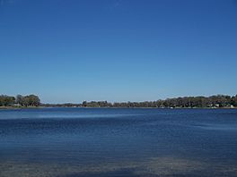
Southern section near Floral City
|
|
| Location | Citrus County, Florida |
| Coordinates | 28°52′31″N 82°18′9″W / 28.87528°N 82.30250°W |
| Type | chain |
| Primary inflows | Withlacoochee River |
| Primary outflows | Withlacoochee River |
| Basin countries | United States |
| Surface area | 19,111 acres (77.34 km2) |
| Surface elevation | 36 ft (11 m) |
| Settlements | Hernando, Inverness, Floral City |
Tsala Apopka Lake is a special group of lakes found in Citrus County, Florida. It's located in a curve of the Withlacoochee River. This area has been known for a long time as the Cove of the Withlacoochee.
The lake system is made up of many lakes, swamps, and marshy areas. It also has many islands. The total open water area is about 19,111 acres (77.34 km2). The entire area, including land and water, covers about 63,000 acres (250 km2). It is bordered by State Road 200 to the north and State Road 48 to the south. The Withlacoochee River is to the east, and US 41 is to the west. About a quarter of this area is covered by forests with live oak trees.
How the Lake's Water is Managed
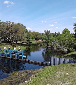
Today, special structures help control how water flows through the lake system. These structures divide the lakes into three main sections, or "pools": Floral City, Hernando, and Inverness. Long ago, water moved freely between the Withlacoochee River and Tsala Apopka Lake through natural wetlands.
Now, most of the water flows into the lakes from the Withlacoochee River through canals. This water first enters the Floral City Pool. From there, some water goes into the Inverness Pool, and some flows back into the Withlacoochee River through other canals. Most of the water leaving the Inverness Pool then goes into the Hernando Pool. Finally, the water from the Hernando Pool flows back into the Withlacoochee River.
A Look Back in Time
The Cove of the Withlacoochee was home to Indigenous peoples of Florida for many hundreds of years. By 1984, experts had found 30 old sites in the area. These sites showed that people from the Deptford, Weeden Island, and Safety Harbor groups lived here.
In 1539, the de Soto expedition traveled through the middle part of the Cove. They were on their way to a Timucua town called Ocale. One old site, Duval Island (8Ci5), might be where the town of Tocaste was located, as mentioned in de Soto's travel records. Another site, Tatham Mound (8Ci203), held the remains of people who died from sword wounds. It also contained the remains of at least 77 people who seemed to die at the same time. This might have been due to a disease brought by the de Soto expedition.
The area was also home to many Seminole people before and during the Second Seminole War. The Wild Hog Scrub site (8Ci198) is thought to be Powell's Town. This was the home of Osceola when the Second Seminole War began. The Cove was a key place for military actions in the first year of the war. Large U.S. forces attacked the Seminoles there in December 1835, February–March 1836, and October–November 1836.
 | James Van Der Zee |
 | Alma Thomas |
 | Ellis Wilson |
 | Margaret Taylor-Burroughs |


