Hernando, Florida facts for kids
Quick facts for kids
Hernando
|
|
|---|---|

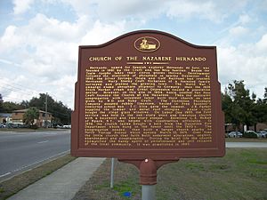
Site of the former Hernando Church of the Nazarene along US 41
|
|
| Motto(s):
Go Bucs
|
|

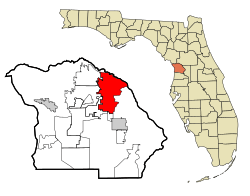
Location in Citrus County and the state of Florida
|
|
| Country | |
| State | |
| County | Citrus |
| Area | |
| • Total | 35.54 sq mi (92.05 km2) |
| • Land | 31.71 sq mi (82.14 km2) |
| • Water | 3.83 sq mi (9.91 km2) |
| Elevation | 56 ft (17 m) |
| Population
(2020)
|
|
| • Total | 9,284 |
| • Density | 292.75/sq mi (113.03/km2) |
| Time zone | UTC-5 (Eastern (EST)) |
| • Summer (DST) | UTC-4 (EDT) |
| ZIP code |
34442
|
| Area code(s) | 352 |
| FIPS code | 12-29425 |
| GNIS feature ID | 0283922 |
Hernando is a community in Citrus County, Florida, in the United States. It's a place where the government counts people, called a census-designated place. About 9,284 people lived there in 2020. It used to be a city, but it changed back to a community in the 1970s. Hernando is part of the larger Homosassa Springs area.
Contents
Exploring Hernando's Location
Hernando is found in the northeastern part of Citrus County. It's located at coordinates 28.929498 degrees North and 82.374340 degrees West.
Neighboring Communities
Hernando shares its borders with several other places:
- To the northwest, you'll find Citrus Springs.
- To the west is Pine Ridge.
- Citrus Hills is to the southwest.
- To the south, there's Inverness Highlands North.
- The northern border is with Marion County.
Lakes and Waterways
The eastern part of Hernando reaches into Tsala Apopka Lake. This lake is actually a group of lakes and wet areas. They are all connected to the Withlacoochee River system.
Land and Water Size
Hernando covers a total area of about 35.5 square miles (92.1 square kilometers). Most of this area, about 31.7 square miles (82.1 square kilometers), is land. The rest, about 3.8 square miles (10.0 square kilometers), is water.
Who Lives in Hernando?
Let's look at how Hernando's population has grown over the years.
| Historical population | |||
|---|---|---|---|
| Census | Pop. | %± | |
| 1990 | 2,103 | — | |
| 2000 | 8,253 | 292.4% | |
| 2010 | 9,054 | 9.7% | |
| 2020 | 9,284 | 2.5% | |
| U.S. Decennial Census | |||
Population Details from 2000
In the year 2000, there were 8,253 people living in Hernando. There were 3,730 households, which are groups of people living together.
Most people in Hernando were White (about 95.58%). There were also African American (2.27%), Native American (0.29%), and Asian (0.52%) residents. About 1.64% of the population was Hispanic or Latino.
Households and Families
About 18.5% of households had children under 18 living with them. More than half of the households (55.8%) were married couples. About 32.6% of households were not families, meaning people lived alone or with roommates.
The average household had 2.21 people. The average family had 2.62 people.
Age Groups
The population in Hernando was spread out by age:
- 17.2% were under 18 years old.
- 4.9% were between 18 and 24.
- 20.8% were between 25 and 44.
- 29.1% were between 45 and 64.
- 28.0% were 65 years or older.
The average age of people in Hernando was 51 years. For every 100 females, there were about 97 males.
Getting Around and Having Fun
Hernando has important roads and fun activities for residents and visitors.
Main Roads
U.S. Route 41 is the main road that goes through Hernando. It heads south about 5 miles (8 km) to Inverness, which is the county seat. Going north on US 41, you'll reach Dunnellon about 12 miles (19 km) away.
Two other roads also end in Hernando at US 41:
- State Road 200
- County Road 486, also known as West Norvell Bryant Highway.
Water Activities
Hernando is located along the northern edge of the Tsala Apopka chain of lakes. People in Hernando have a long history of using airboats (fan boats). These boats are great for exploring the huge swampy areas to the east.
The Citrus County Airboat Alliance is a local group in Hernando. They work to protect the environment and support airboat users. Fishing and hunting are also popular outdoor activities in the Hernando community.
Biking Trails
Hernando is home to a 46-mile (74 km) bike trail called the Withlacoochee State Trail. This trail used to be a railroad line built in the early 1900s. You can find the Hernando Trailhead at the corner of US 41 and CR 486.
Past Attractions
Until 2006, Hernando was where the Ted Williams Museum was located.
Schools in Hernando
The schools in Hernando are part of the Citrus County Schools system.
Elementary Schools
Some elementary schools that serve parts of Hernando include:
- Central Ridge Elementary
- Hernando Elementary
Middle Schools
Middle schools serving sections of Hernando are:
High Schools
High schools that serve the Hernando area include:
- Citrus High School
- Lecanto High School
See also
 In Spanish: Hernando (Florida) para niños
 | George Robert Carruthers |
 | Patricia Bath |
 | Jan Ernst Matzeliger |
 | Alexander Miles |

