Tupper Lake, New York facts for kids
Quick facts for kids
Tupper Lake, New York
|
|
|---|---|
| Country | United States |
| State | New York |
| County | Franklin |
| Government | |
| • Type | Town Council |
| Area | |
| • Total | 130.10 sq mi (336.97 km2) |
| • Land | 117.35 sq mi (303.93 km2) |
| • Water | 12.75 sq mi (33.03 km2) |
| Elevation | 1,696 ft (516 m) |
| Population
(2020)
|
|
| • Total | 5,147 |
| Time zone | UTC−5 (Eastern (EST)) |
| • Summer (DST) | UTC−4 (EDT) |
| ZIP Code |
12986
|
| Area code(s) | 518 |
| FIPS code | 36-033-75676 |
| GNIS feature ID | 978671 |
Tupper Lake is a town located in the southwest part of Franklin County, New York. In 2020, about 5,147 people lived there. The town also contains a smaller area called the Village of Tupper Lake. Before July 2004, the town was known as "Altamont." This was changed to avoid confusion with another village named Altamont in Albany County.
Contents
History of Tupper Lake
Early Days and Lumber Business
In 1850, a company called Pomeroy Lumber Company started cutting down trees in the area. They cleared a space near Raquette Pond, which later became the Village of Tupper Lake. In the 1890s, many buildings were put up. However, a big fire in 1899 destroyed 169 of them.
As the lumber business grew, the nearby village of Faust became an important spot for trains. It was a hub for the Mohawk and Malone Railway and later the New York Central Railroad. This helped the Village of Tupper Lake to grow and become successful.
The Junction and Railroads
In the 1940s, the villages of Faust and Tupper Lake joined together. The area that used to be Faust is now known as "The Junction." People in Tupper Lake still call it that today. It got this name because many train lines met there. These lines went to Malone, Remsen, and the original Tupper Lake village.
The only reminder of the old village of Faust is the Faust Motel on Main Street. A large building called the Faust Roundhouse, where trains were repaired, burned down in the 1940s.
The first train station in Tupper Lake Junction was built in 1895. It was used for over 60 years and stood for 80 years before being torn down in 1975. In 2007, a local group called Next Stop Tupper Lake worked to bring back train service. They raised money to build a new station. A copy of the 1895 station was finished in 2008. The Adirondack Railroad started offering train rides from this station again in spring 2023. As of July 2024, new platforms and other train facilities were being built.
The Oval Wood Dish Company
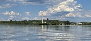
The Oval Wood Dish Corporation mill was located between the villages of Faust and Tupper Lake. It was first owned by the Sisson family. The area around the mill, including houses for workers, was called "Sissonville." Over time, these buildings fell apart and were taken down. A tall smokestack with the letters "OWD" still stands in the middle of town. It reminds everyone of Tupper Lake's past as a lumber town.
Changing the Town Name
The town was first created in 1890 from the town of Waverly. It was the last town to be formed in Franklin County. In 1913, a part of St. Lawrence County was added to the town.
To avoid confusion with another town named Altamont in Albany County, the town council decided to change the name. On July 16, 2004, they officially changed the town's name from "Altamont" to "Tupper Lake." This also helped connect the town more closely with the Village of Tupper Lake.
Modern Tupper Lake
Logging is still an industry in Tupper Lake today. However, the winter season, when roads are frozen and can support heavy logging equipment, has been getting shorter.
Tupper Lake is also home to the Empire Professional Baseball League's Tupper Lake Riverpigs. They play their games at Tupper Lake Municipal Park.
Geography of Tupper Lake
Land and Water Areas
The town of Tupper Lake covers about 337 square kilometers (130 square miles). Most of this area, about 304 square kilometers (117 square miles), is land. The rest, about 33 square kilometers (12.75 square miles), is water.
The town is located inside the beautiful Adirondack Park. Its southern border touches Hamilton County. The western border is next to St. Lawrence County. Tupper Lake also shares borders with other towns like Harrietstown, Piercefield, Santa Clara, Waverly, and Hopkinton.
Lakes and Rivers
Tupper Lake is a large body of water in the southwestern part of the town. It even goes into St. Lawrence County. This lake includes Simon Pond and Raquette Pond. The Village of Tupper Lake is located right on Raquette Pond.
The Raquette River flows through the area, heading northwest towards the St. Lawrence River. The water in Raquette Pond is held back by a structure called Setting Pole Dam. This dam is on the river near the southwestern edge of the town. There's also a bend in the river near The Wild Center in the eastern part of town.
Other important bodies of water in the town are Little Wolf Pond, Big Wolf Pond, Lake Madeline, Duck Lake, and Gull Pond. The town's public beach is located on Little Wolf Pond.
Mountains and Roads
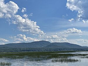
Mount Morris is a mountain south of the village. It used to be the location of the Big Tupper Ski Area. The small community of Moody is at the base of this mountain. Coney Mountain and Goodman Mountain are also found in the southwestern part of the town.
New York State Route 3 and New York State Route 30 meet in the Village of Tupper Lake. These highways then run together through the eastern part of the town. The Adirondack Trail Scenic Byway and Olympic Trail Scenic Byway also pass through Tupper Lake, offering scenic drives.
Population Information
| Historical population | |||
|---|---|---|---|
| Census | Pop. | %± | |
| 1900 | 3,045 | — | |
| 1910 | 4,691 | 54.1% | |
| 1920 | 4,927 | 5.0% | |
| 1930 | 6,097 | 23.7% | |
| 1940 | 6,537 | 7.2% | |
| 1950 | 6,849 | 4.8% | |
| 1960 | 6,546 | −4.4% | |
| 1970 | 6,698 | 2.3% | |
| 1980 | 6,318 | −5.7% | |
| 1990 | 6,199 | −1.9% | |
| 2000 | 6,137 | −1.0% | |
| 2010 | 5,971 | −2.7% | |
| 2020 | 5,147 | −13.8% | |
| U.S. Decennial Census | |||
In 2000, there were 6,137 people living in the town. These people lived in 2,429 households. About 32% of these households had children under 18 living there. The average household had 2.38 people.
The population was spread out by age. About 24.6% of the people were under 18 years old. About 16.7% were 65 years or older. The average age in the town was 38 years.
Communities and Locations
- Derrick – A small community in the northern part of the town.
- Duck Lake – A lake located near the southern border of the town.
- Kildare – A community near the western town line, to the northwest of Tupper Lake village.
- Lake Madeleine – A lake near the southern town boundary, north of Duck Lake.
- Litchfield Park – A place in the southwestern corner of Tupper Lake.
- Massawepie
- Moody – A community south of Tupper Lake village on Route 30. It was the first settled area in the town.
- Piercefield Flow – A wider part of the Raquette River at the western town line.
- Raquette Pond – A part of Tupper Lake next to Tupper Lake village. It's a wider section of the Raquette River, created by a dam.
- Simon Pond – A part of Tupper Lake located south of Tupper Lake village.
- Tupper Lake – This is the main village located in the south-central part of the town.
- Tupper Lake Junction – This area, once known as Faust, is part of the Village of Tupper Lake on Main Street, close to the railroad.
- Wolf Pond – A lake north of Tupper Lake village. There are actually two ponds: Little Wolf Pond and Big Wolf Pond, which are connected.
See also
In Spanish: Tupper Lake (Nueva York) para niños


