Tuxpan facts for kids
Quick facts for kids
Tuxpan
|
||
|---|---|---|
|
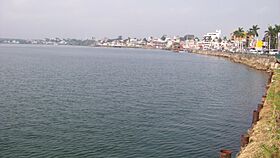
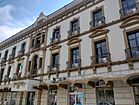
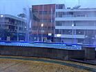
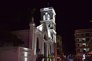
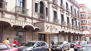
Top: Tuxpan city skyline from Tuxpan River; Middle: Reforma Hotel, fountains at Downtown; Bottom: Cathedral of the Assumption, Tuxpan port facilities
|
||
|
||
| Country | ||
| State | Veracruz | |
| Area | ||
| • Total | 1,061.9 km2 (410.0 sq mi) | |
| Elevation | 10 m (30 ft) | |
| Population
(2020)
|
||
| • Total | 154,600 | |
| • Seat | 89,557 | |
| Time zone | UTC-6 (CST) | |
| • Summer (DST) | UTC-5 (CDT) | |
| Website | http://tuxpanveracruz.gob.mx/ | |
| Historical population | ||
|---|---|---|
| Year | Pop. | ±% |
| 1995 | 127,622 | — |
| 2000 | 126,616 | −0.8% |
| 2005 | 134,394 | +6.1% |
| 2010 | 143,362 | +6.7% |
| 2015 | 161,829 | +12.9% |
| 2020 | 154,600 | −4.5% |
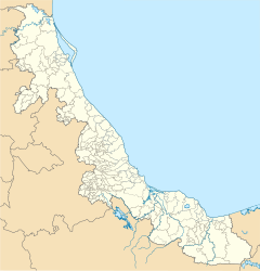
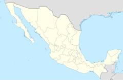
Tuxpan (also called Túxpam) is a city and a municipality in the Mexican state of Veracruz. Its full name is Túxpam de Rodríguez Cano, named after Enrique Rodríguez Cano. In 2020, the city had about 89,557 people, and the whole municipality had 154,600 people. The area of the municipality is about 1,051.89 square kilometers.
Tuxpan includes smaller towns. The biggest ones are Alto Lucero with over 20,000 people and Santiago de la Peña with over 8,000 people. There is also a beach community nearby. In the 1870s, some families from the Southern U.S. moved here.
Contents
What Does the Name Tuxpan Mean?
The name Tuxpan or Túxpam comes from the ancient Nahuatl language. It is pronounced like "TOOSH-pan." The name literally means "Place of Rabbits." This is because "tochtli" means "rabbit" and "-pan" means "place."
How Tuxpan Makes Money
Tuxpan is very important for Mexico's trade. It is the closest port to Mexico City. This makes it a key place for goods coming into and leaving Mexico.
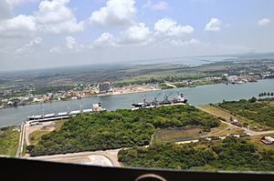
Today, Tuxpan is mainly a grain port. It handles a lot of soybeans and maize (corn). The port also has links to oil pipelines. These pipelines move oil products to and from large tanker ships. These ships are run by Pemex, which is Mexico's state-owned oil company. Pemex also has a factory in Tuxpan that builds and fixes oil rigs. These rigs are used in the Gulf of Mexico.
Where is Tuxpan Located?
The city of Tuxpan is built along the Tuxpan River. This river flows into the Gulf of Mexico about 11 kilometers (7 miles) away.
What is Tuxpan's Climate Like?
Tuxpan has a tropical climate. This means it has warm winters and hot summers.
| Climate data for Túxpam de Rodríguez Cano (1951–2010) | |||||||||||||
|---|---|---|---|---|---|---|---|---|---|---|---|---|---|
| Month | Jan | Feb | Mar | Apr | May | Jun | Jul | Aug | Sep | Oct | Nov | Dec | Year |
| Record high °C (°F) | 41.0 (105.8) |
44.0 (111.2) |
45.8 (114.4) |
43.0 (109.4) |
42.0 (107.6) |
41.8 (107.2) |
41.8 (107.2) |
43.5 (110.3) |
48.8 (119.8) |
41.2 (106.2) |
41.8 (107.2) |
37.5 (99.5) |
48.8 (119.8) |
| Mean daily maximum °C (°F) | 25.0 (77.0) |
26.7 (80.1) |
29.2 (84.6) |
31.7 (89.1) |
32.7 (90.9) |
33.2 (91.8) |
33.0 (91.4) |
33.6 (92.5) |
33.1 (91.6) |
31.5 (88.7) |
28.7 (83.7) |
26.2 (79.2) |
30.4 (86.7) |
| Daily mean °C (°F) | 20.7 (69.3) |
22.1 (71.8) |
24.5 (76.1) |
27.0 (80.6) |
28.1 (82.6) |
28.7 (83.7) |
28.6 (83.5) |
28.9 (84.0) |
28.4 (83.1) |
26.7 (80.1) |
24.1 (75.4) |
22.0 (71.6) |
25.8 (78.4) |
| Mean daily minimum °C (°F) | 16.4 (61.5) |
17.6 (63.7) |
19.9 (67.8) |
22.3 (72.1) |
23.5 (74.3) |
24.2 (75.6) |
24.2 (75.6) |
24.2 (75.6) |
23.8 (74.8) |
22.0 (71.6) |
19.5 (67.1) |
17.8 (64.0) |
21.3 (70.3) |
| Record low °C (°F) | 0.8 (33.4) |
7.0 (44.6) |
8.8 (47.8) |
9.0 (48.2) |
8.5 (47.3) |
11.5 (52.7) |
19.8 (67.6) |
14.0 (57.2) |
16.0 (60.8) |
9.0 (48.2) |
6.8 (44.2) |
4.5 (40.1) |
0.8 (33.4) |
| Average precipitation mm (inches) | 39.5 (1.56) |
50.0 (1.97) |
38.6 (1.52) |
54.1 (2.13) |
78.9 (3.11) |
207.5 (8.17) |
170.8 (6.72) |
179.9 (7.08) |
266.4 (10.49) |
132.2 (5.20) |
87.1 (3.43) |
50.6 (1.99) |
1,355.6 (53.37) |
| Average precipitation days (≥ 0.1 mm) | 8.4 | 7.3 | 7.4 | 6.8 | 6.7 | 12.0 | 13.1 | 13.9 | 14.0 | 11.2 | 8.0 | 8.6 | 117.4 |
| Average relative humidity (%) | 81 | 83 | 82 | 82 | 77 | 82 | 82 | 80 | 82 | 83 | 85 | 86 | 82 |
| Mean monthly sunshine hours | 112 | 132 | 174 | 168 | 209 | 203 | 211 | 225 | 155 | 174 | 139 | 98 | 2,000 |
| Source 1: Servicio Meteorológico National (humidity 1981–2000) | |||||||||||||
| Source 2: Deutscher Wetterdienst (sun, 1961–1990) | |||||||||||||
Transportation in Tuxpan
The Port of Tuxpan
| Port of Tuxpam | |
|---|---|
 |
|
| Location | |
| Coordinates | 20°57′34.59″N 97°19′47.4″W / 20.9596083°N 97.329833°W |
The Port of Tuxpan is sometimes called "Puerto de Tuxpan." It is big enough to handle very large cargo ships.
Because the port in Veracruz became very busy, Tuxpan is now the main base for the Mexican Navy's Gulf fleet. This means it is home to several warships. These include three frigates named Allende, Abasolo, and Victoria. These ships were first built in the 1960s for the United States Navy. Mexico bought them in the 1990s.
Tuxpan is also famous for a historic event. The yacht Granma left from this port in 1956. On board were Fidel Castro, his brother Raúl, Che Guevara, and other fighters. They sailed from Mexico to Cuba to start the Cuban Revolution. There is a small museum near the river that has photos and items from this journey.
Learning and Education in Tuxpan
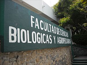
The Universidad Veracruzana has two campuses in Tuxpan.
- The first campus is the Biological and Agricultural Sciences Faculty. It opened in 1975. Here, students can study subjects like Biology, Veterinary Medicine, and Agricultural Engineering.
- The second campus is the Accountancy Faculty. It opened in 1990. This campus offers courses related to business and administration.
Sister City
Tuxpan has a sister city:
See also
 In Spanish: Túxpam de Rodríguez Cano para niños
 | Janet Taylor Pickett |
 | Synthia Saint James |
 | Howardena Pindell |
 | Faith Ringgold |


