Viburnum, Missouri facts for kids
Quick facts for kids
Viburnum, Missouri
|
|
|---|---|

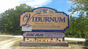
Viburnum Missouri welcome sign
|
|

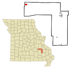
Location of Viburnum, Missouri
|
|
| Country | United States |
| State | Missouri |
| County | Iron |
| Area | |
| • Total | 1.73 sq mi (4.47 km2) |
| • Land | 1.72 sq mi (4.45 km2) |
| • Water | 0.01 sq mi (0.03 km2) |
| Elevation | 1,253 ft (382 m) |
| Population
(2020)
|
|
| • Total | 667 |
| • Density | 388.47/sq mi (150.01/km2) |
| Time zone | UTC-6 (Central (CST)) |
| • Summer (DST) | UTC-5 (CDT) |
| ZIP code |
65566
|
| Area code(s) | 573 |
| FIPS code | 29-76012 |
| GNIS feature ID | 2397133 |
Viburnum is a small city located in Iron County, Missouri, in the United States. In 2020, about 667 people lived there. The city is part of an area known as the New Lead Belt, which means it's historically important for lead mining. The current Mayor of Viburnum is Johnny Setzer.
Contents
History of Viburnum
Viburnum got its start with a post office that opened in 1907. This post office served the community for many years, closing in 1955. The city was named after the Viburnum plant. This plant group includes common shrubs like black haw and arrowwood.
Where is Viburnum Located?
Viburnum is located in a part of Missouri that has both land and some water. The city is about four miles north of a town called Bixby. It is also about 20 miles west of Belgrade.
The total area of Viburnum is about 1.73 square miles (4.47 square kilometers). Most of this area, about 1.72 square miles (4.45 square kilometers), is land. A very small part, about 0.01 square miles (0.03 square kilometers), is water.
People of Viburnum
The number of people living in Viburnum has changed over the years. Here's a look at the population counts from different U.S. Census surveys:
| Historical population | |||
|---|---|---|---|
| Census | Pop. | %± | |
| 1960 | 590 | — | |
| 1970 | 520 | −11.9% | |
| 1980 | 836 | 60.8% | |
| 1990 | 743 | −11.1% | |
| 2000 | 825 | 11.0% | |
| 2010 | 693 | −16.0% | |
| 2020 | 667 | −3.8% | |
| U.S. Decennial Census | |||
Viburnum Population in 2010
In 2010, the census showed that 693 people lived in Viburnum. These people lived in 278 households, and 199 of these were families. The city had about 403 people per square mile (156 people per square kilometer). There were also 328 housing units, which are places where people can live.
Most of the people in Viburnum in 2010 were White (98.12%). A small number were Black or African American (0.43%), or Native American (0.58%). Some people were from other races or from two or more races. About 1.15% of the population identified as Hispanic or Latino.
Out of the 278 households, about 34.2% had children under 18 living with them. More than half, 53.6%, were married couples living together. About 12.9% of households had a female head with no husband, and 5.0% had a male head with no wife. About 28.4% of households were not families.
The average age of people in Viburnum in 2010 was 39 years old. About 25.5% of residents were under 18. About 17.6% were 65 years old or older. The city had slightly more females (51.1%) than males (48.9%).
Education in Viburnum
Viburnum has a public library where residents can borrow books and use other resources. It is a part of the Ozark Regional Library system.
See also
 In Spanish: Viburnum (Misuri) para niños
 | Claudette Colvin |
 | Myrlie Evers-Williams |
 | Alberta Odell Jones |

