Victoria River (lake Mégantic) facts for kids
Quick facts for kids Victoria River |
|
|---|---|

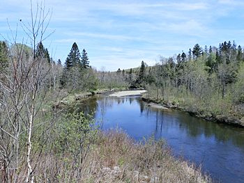
Rivière Victoria près du lac Mégantic.
|
|
| Native name | Rivière Victoria |
| Country | Canada |
| Province | Quebec |
| Region | Estrie |
| MRC | Le Granit Regional County Municipality |
| Physical characteristics | |
| Main source | Lake Noël Val-Racine 534 metres (1,752 ft) 45°26′42″N 71°05′20″W / 45.444929°N 71.088961°W |
| River mouth | Lake Mégantic, Chaudière River Marston 388 metres (1,273 ft) 45°32′24″N 70°55′43″W / 45.539944°N 70.928746°W |
| Length | 21.2 kilometres (13.2 mi) |
| Basin features | |
| Progression | Chaudière River, St. Lawrence River |
| River system | St. Lawrence River |
| Basin size | 140.5 kilometres (87.30 mi) |
| Tributaries |
|
The Victoria River is a cool river in Quebec, Canada. It's also known as rivière Victoria in French. This river flows into the Chaudière River, which then flows into the mighty St. Lawrence River. So, you could say it's a small part of a much bigger water system!
The Victoria River winds its way through a few towns. These include Val-Racine, Piopolis, and Marston. All these towns are in the Le Granit Regional County Municipality. This area is part of the Estrie region in Quebec.
Contents
Where the River Flows
The Victoria River has some interesting neighbors. These are other rivers and streams nearby.
- To the north, you'll find Gunn Creek and the Glen River.
- To the east, there's Lake Mégantic, Quinion stream, and the Bergeron River.
- To the south, you'll see Fromagerie stream, Déloge stream, the Chesham River, and the Bergeron River.
- To the west, there's the rivière au Saumon and Turcotte stream.
The River's Beginning
The Victoria River starts its journey from a small lake called Noël Lake. This lake is about 0.4 kilometres (0.25 mi) long. It sits at an elevation of 534 metres (1,752 ft) above sea level.
Noël Lake is located about 2.4 kilometres (1.5 mi) east of the top of Mont Saint-Joseph. This mountain is part of the larger Mont Mégantic area. The lake is also about 5.1 kilometres (3.2 mi) north of the village of Notre-Dame-des-Bois. It's also 3.9 kilometres (2.4 mi) southwest of the village of Val-Racine.
The River's Path
The Victoria River flows for about 21.2 kilometres (13.2 mi). It starts by flowing north, then turns east. Here's how its journey unfolds:
- First, it flows about 3.5 kilometres (2.2 mi) north. It picks up water from small streams coming from the side of Mont Mégantic. It crosses a road about 1.0 kilometre (0.62 mi) south of Val-Racine.
- Then, it goes 1.3 kilometres (0.81 mi) northeast. It crosses another road about 0.5 kilometres (0.31 mi) east of Val-Racine.
- Next, it flows 3.1 kilometres (1.9 mi) northeast until another stream joins it from the west.
- It then turns east for 1.5 kilometres (0.93 mi) until it reaches a road.
- After that, it travels 2.7 kilometres (1.7 mi) northeast. This part of the river marks the border between Val-Racine and Piopolis.
- It continues eastward for 1.2 kilometres (0.75 mi). This section is the border between Piopolis and Marston.
- The river then flows 6.5 kilometres (4.0 mi) eastward. Along the way, it collects water from lac McKenzie (Marston). It reaches Route 263.
- Finally, it flows 1.4 kilometres (0.87 mi) more eastward until it meets its end.
Where the River Ends
The Victoria River empties into the western side of Victoria Bay. This bay is part of Lake Mégantic in the town of Marston. This meeting point is southeast of the village of Marsboro. It's also southeast of the main town of Lac-Mégantic and north of Piopolis.
There's a bridge built near where the Victoria River joins the lake. It's at the bottom of a hill called "Côte du Bois." This bridge connects the old part of Piopolis with Marsboro.
Why "Victoria River"?
The name "Victoria River" was given to this waterway around the mid-1800s. It was named to honor Queen Victoria. She was the Queen of the United Kingdom and ruled for a very long time, from 1837 to 1901.
The name "Rivière Victoria" was officially recognized on December 5, 1968. This was done by the Commission de toponymie du Québec, which is the official group that names places in Quebec.
 | Georgia Louise Harris Brown |
 | Julian Abele |
 | Norma Merrick Sklarek |
 | William Sidney Pittman |


