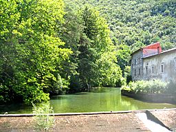
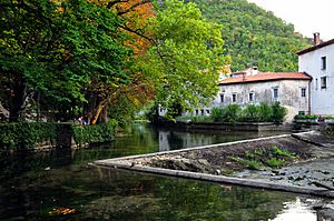
Vipava (river) facts for kids
The Vipava river flows through two countries: western Slovenia and northeastern Italy. In Slovenia, it is called Vipava. In Italy, it is known as Vipacco, and in the Friulian language, it is called Vipau.
Long ago, in the year 394, a famous battle called the Battle of the Frigidus happened near this river. The ancient Romans called the river Frigidus, which means 'cold'.
Quick facts for kids Vipava |
|
| River | |
| Country | |
|---|---|
| Municipalities | Vipava, Ajdovščina, Nova Gorica, Renče–Vogrsko, Miren–Kostanjevica, Savogna d'Isonzo |
| Source | |
| - location | Vipava, Slovenia |
| - elevation | 110 m (361 ft) |
| - coordinates | 46°50′41″N 13°57′52″E / 46.84472°N 13.96444°E |
| Mouth | Soča |
| - location | Savogna d'Isonzo, Slovenia |
| - coordinates | 45°53′57″N 13°33′14″E / 45.89917°N 13.55389°E |
| Length | 49 km (30 mi) |
| Basin | 760 km² (293 sq mi) |
| Discharge | |
| - average | 17.3 m³/s (611 cu ft/s) |
About the Vipava River
The Vipava River is about 49 kilometers (30 miles) long. Most of it, about 44 kilometers (27 miles), flows through Slovenia. The last 5 kilometers (3 miles) are in Italy.
The area of land that drains into the Vipava River is called its drainage basin. This basin covers about 760 square kilometers (293 square miles). About 598 square kilometers (231 square miles) of this basin are in Slovenia.
The river flows through the southern part of the Vipava Valley. This valley stretches from a village called Podnamos in Slovenia to Savogna d'Isonzo in Italy.
River's Journey
The Vipava River begins near the town of Vipava in western Slovenia. Its source is about 110 meters (361 feet) above sea level.
From its start, the Vipava flows towards the northwest. It continues in this direction through the Vipava Valley. The river passes through several municipalities in Slovenia. These include Vipava, Ajdovščina, Nova Gorica, Renče–Vogrsko, and Miren–Kostanjevica.
The river then crosses the border into Italy. It enters the Italian comune (a type of municipality) of Savogna d'Isonzo. This is in the Friuli-Venezia Giulia region. Finally, the Vipava River joins the Soča River.
The Vipava River does not have many large tributaries. It is mainly fed by very small streams.
Images for kids
Related pages
See also
 In Spanish: Río Vipava para niños
 | Georgia Louise Harris Brown |
 | Julian Abele |
 | Norma Merrick Sklarek |
 | William Sidney Pittman |


