Virginia Mountains facts for kids
Quick facts for kids Virginia Mountains |
|
|---|---|
| Highest point | |
| Peak | Tule Peak |
| Elevation | 2,659 m (8,724 ft) |
| Geography | |
| Country | United States |
| State | Nevada |
| District | Washoe County |
| Range coordinates | 39°58.6′N 119°44.7′W / 39.9767°N 119.7450°W |
| Topo map | USGS Tule Peak and Pyramid SW 7.5 minute quads |
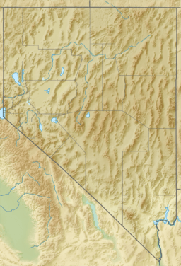
The Virginia Mountains are a group of mountains located entirely in Washoe County, Nevada. This mountain range stretches for about 22 miles (35 km) from north to south.
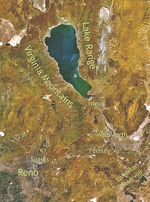
The mountains are surrounded by other natural features. To the north, you'll find Astor Pass and Terraced Hills. Pyramid Lake is to the east, and Mullen Pass and the Pah Rah Range are to the south. On the west side are Honey Lake Valley, Winnemucca Valley, and Dogskin Mountain. Part of the eastern side of the Virginia Mountains is inside the Pyramid Lake Indian Reservation.
The tallest point in the range is Tule Peak, which stands at 8,724 feet (2,659 meters) high. Other cool spots in the mountains include Needle Rock, a place called "Monkey Condos," the colorful Painted Hills, and Mahogany Flat. Mahogany Flat is about 7,800 feet (2,377 meters) high and is near the middle of the range.
The town of Sutcliffe is right next to the Virginia Mountains, on the shore of Pyramid Lake. Nevada State Route 445 is a road that runs along the eastern side of the mountains, following the lake. It then goes southwest through Mullen Pass, which is a gap between the Virginia Mountains and the Pah Rah Range.
How the Virginia Mountains Formed
The Virginia Mountains were created by powerful forces deep within the Earth. Imagine the Earth's crust as a giant puzzle with many pieces. These pieces, called plates, are always moving. Sometimes, they push against each other, causing the land to fold and rise.
Folding and Faulting
The Virginia Mountains are like a giant fold in the Earth's crust that has also partly collapsed. This fold generally runs north to south. However, it bends towards the southeast at its southern end. This bending and folding happened because of the movement of the Earth's plates.
There are also many cracks in the Earth's crust here, called faults. Some of these faults run northwest and are part of a larger system called the Walker Lane. This system involves big sections of land sliding past each other.
Shaping the Landscape
The way the Virginia Mountains look today is a result of several things. First, the layers of volcanic rocks that make up the mountains were bent and folded. Second, large faults caused parts of the land to move up or down, or slide sideways. Finally, erosion from wind and water, especially in this dry area, has carved out valleys and shaped the peaks over a very long time.
Most of the streams and valleys in the Virginia Mountains follow these fault lines. This means that the cracks in the Earth's crust largely control where water flows and where valleys form. Many valleys in the range were created by these faults. The higher parts of the mountains show signs of being very old land surfaces that have been worn down over ages.
 | John T. Biggers |
 | Thomas Blackshear |
 | Mark Bradford |
 | Beverly Buchanan |


