Pah Rah Range facts for kids
Quick facts for kids Pah Rah Range |
|
|---|---|

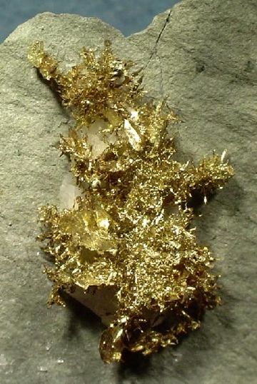
Gold from Olinghouse district
|
|
| Highest point | |
| Peak | Virginia Peak |
| Elevation | 2,547 m (8,356 ft) |
| Geography | |
| Country | United States |
| State | Nevada |
| District | Washoe County |
| Range coordinates | 39°45.3′N 119°27.7′W / 39.7550°N 119.4617°W |
| Topo map | USGS Nixon, Wadsworth and Spanish Springs Valley 15 minute quads |
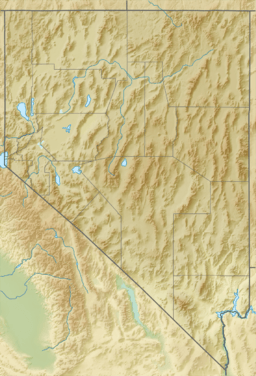
The Pah Rah Range is a group of mountains in western Nevada, located in Washoe County. It sits just northeast of the city of Reno. This mountain range is shaped like a hook, with its main eastern part stretching about 20 miles (32 km) from northwest to southeast.
The Pah Rah Range forms natural borders for several areas. The Cottonwood Creek in Warm Springs Valley is surrounded by the mountains on three sides. To the south and east, the Truckee River creates a boundary. Pyramid Lake is found to the northeast of the range. The Spanish Springs Valley, north of Reno, marks the southwest edge. To the north, a narrow passage called Mullen Pass separates the Pah Rah Range from the Virginia Mountains.
The tallest peaks in the Pah Rah Range include Pond Peak (8,035 feet or 2,449 meters), Virginia Peak (8,357 feet or 2,547 meters), and Pah Rah Peak (8,249 feet or 2,514 meters). In the southwest, Spanish Springs Peak is the highest at 7,404 feet (2,257 meters). Both Pond Peak and Virginia Peak are home to several radio towers. Virginia Peak also has a special doppler radar station, which helps forecast weather.
Several important roads run near the Pah Rah Range. Interstate 80 follows the Truckee River basin to the south. Nevada State Route 445 goes through the Spanish Springs Valley to the west. Nevada State Route 446 crosses Mullen Pass to the north. And Nevada State Route 447 follows the lake shore and the Truckee Valley on the east side.
The eastern part of the Pah Rah Range is part of the Pyramid Lake Indian Reservation.
The name "Pah Rah" comes from the Paiute language. It roughly means "Lake Mountain," referring to Pyramid Lake, which is next to the range. Some people think this name might fit the Virginia Mountains better. This confusion likely happened because early surveyors in the area made a mistake.
Contents
Olinghouse Mining District
The Olinghouse mining district is a historic area in the southeastern foothills of the Pah Rah Range. It is about 8 miles (13 km) west-northwest of Wadsworth, Nevada. The district and the old town were named after Elias Olinghouse, who lived there and ran a mule transport service. The Olinghouse post office was open from October 1903 to July 1923.
Gold Mining in Olinghouse
Mines in the Olinghouse district once produced gold. This gold came from both placer deposits (gold found in loose sand or gravel) and veins (gold found in cracks in rocks). The gold was often found with granite porphyry dikes. These dikes are rock formations that cut through older rock. The area's rocks are mostly basalt and andesite from the Oligocene to Miocene periods. People also looked for gold as collector's items in the late 1990s and early 2000s.
Wildlife of the Pah Rah Range
The Pah Rah Range is home to many different animals.
Mammals
Some bighorn sheep have been seen in the foothills of the range near Sparks. It is believed they came from a group of bighorns that were moved to the nearby Virginia Range.
Birds
 | Emma Amos |
 | Edward Mitchell Bannister |
 | Larry D. Alexander |
 | Ernie Barnes |


