Waco, Georgia facts for kids
Quick facts for kids
Waco, Georgia
|
|
|---|---|
| Motto(s):
"Small town, big horizons"
|
|

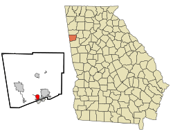
Location in Haralson County and the state of Georgia
|
|
| Country | United States |
| State | Georgia |
| County | Haralson |
| Area | |
| • Total | 1.83 sq mi (4.75 km2) |
| • Land | 1.83 sq mi (4.75 km2) |
| • Water | 0.00 sq mi (0.00 km2) |
| Elevation | 1,389 ft (423 m) |
| Population
(2020)
|
|
| • Total | 536 |
| • Density | 292.10/sq mi (112.76/km2) |
| Time zone | UTC-5 (Eastern (EST)) |
| • Summer (DST) | UTC-4 (EDT) |
| ZIP code |
30182
|
| Area code(s) | 770 |
| FIPS code | 13-79808 |
| GNIS feature ID | 0333338 |
Waco is a small city in Haralson County, Georgia, United States. It is located close to the Alabama state line. In 2010, the city had 516 people living there. This number grew to 536 people by the 2020 census.
Contents
History of Waco
Waco became an official city in 1885. The Georgia General Assembly helped make this happen. The name "Waco" comes from the Muskogean language. It means "heron," which is a type of bird.
Geography and Location
Waco is located in a great spot in Georgia. The city of Bremen is right next to Waco, to its south and east.
Main Roads in Waco
U.S. Route 78 goes right through the middle of Waco. If you go east on this road, it's about 2.5 miles to Bremen. If you go northwest, it's about 7 miles to Tallapoosa.
Interstate 20 also runs along the southern edge of Waco. You can get into Waco from Exit 9, which is Atlantic Avenue. I-20 is a major highway. It goes east about 48 miles to Atlanta, a very big city. If you go west on I-20, it's about 98 miles to Birmingham, Alabama.
Size of Waco
The United States Census Bureau says that Waco covers about 4.8 square kilometers (or 1.8 square miles). All of this area is land, with no large bodies of water inside the city limits.
Population of Waco
The number of people living in Waco has changed over the years. Here's a look at the population from different census counts:
| Historical population | |||
|---|---|---|---|
| Census | Pop. | %± | |
| 1890 | 357 | — | |
| 1900 | 345 | −3.4% | |
| 1910 | 326 | −5.5% | |
| 1920 | 333 | 2.1% | |
| 1930 | 208 | −37.5% | |
| 1940 | 304 | 46.2% | |
| 1950 | 328 | 7.9% | |
| 1960 | 381 | 16.2% | |
| 1970 | 431 | 13.1% | |
| 1980 | 471 | 9.3% | |
| 1990 | 461 | −2.1% | |
| 2000 | 469 | 1.7% | |
| 2010 | 516 | 10.0% | |
| 2020 | 536 | 3.9% | |
| U.S. Decennial Census | |||
People in Waco: 2020 Census
The 2020 United States census counted 536 people living in Waco. There were 200 households and 151 families in the city.
The table below shows the different groups of people living in Waco based on the 2020 census.
| Race | Num. | Perc. |
|---|---|---|
| White (non-Hispanic) | 490 | 91.42% |
| Black or African American (non-Hispanic) | 17 | 3.17% |
| Native American | 2 | 0.37% |
| Asian | 3 | 0.56% |
| Other/Mixed | 18 | 3.36% |
| Hispanic or Latino | 6 | 1.12% |
See also

- In Spanish: Waco (Georgia) para niños
 | Isaac Myers |
 | D. Hamilton Jackson |
 | A. Philip Randolph |

