Washington Boro, Pennsylvania facts for kids
Quick facts for kids
Washington Boro, Pennsylvania
|
|
|---|---|

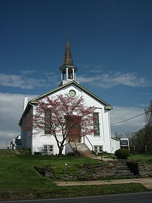
Washington Boro Methodist Church
|
|
| Country | United States |
| State | Pennsylvania |
| County | Lancaster |
| Township | Manor |
| Area | |
| • Total | 1.93 sq mi (5.00 km2) |
| • Land | 1.93 sq mi (4.99 km2) |
| • Water | 0 sq mi (0.0 km2) |
| Elevation | 281 ft (86 m) |
| Population
(2010)
|
|
| • Total | 729 |
| • Density | 378/sq mi (146.1/km2) |
| Time zone | UTC-5 (Eastern (EST)) |
| • Summer (DST) | UTC-4 (EDT) |
| ZIP code |
17582
|
| Area code(s) | 717 |
| FIPS code | 42-81360 |
| GNIS feature ID | 1193613 |
Washington Boro is a small community in Pennsylvania, United States. It's located in Lancaster County along the Susquehanna River. This area is called a census-designated place (CDP). A CDP is a special area that looks like a town but isn't officially governed as one.
Washington Boro has its own ZIP code, which is 17582. Students here go to schools in the Penn Manor School District. Two important roads, Pennsylvania Routes 441 and 999, end here. In 2010, about 729 people lived in Washington Boro.
Contents
History of Washington Boro
Early Trading Post
Long ago, in 1718, a fur trader named Martin Chartier and his son Peter Chartier set up a trading post near this spot. They were French-Canadian. A trading post was a place where people could trade goods, often furs, with Native Americans.
In 1925, a special stone monument was put up to mark this important historical place. It was placed there by the Pennsylvania Historical Commission and the Lancaster County Historical Society.
From Borough to Township
The community of Washington Boro was first settled in 1810. It was officially made a "borough" in 1827. A borough is a type of self-governing town. People sometimes called it "Borough of Washington" or "Washingtonboro."
This area was very important for river trade and jobs related to the river. It was close to where the first animal-powered ferry crossed the lower Susquehanna River. This ferry, called Wright's Ferry, connected what are now Columbia and Wrightsville.
Over time, river trade became less important. Because of this, the Borough of Washington stopped being a separate government. On December 31, 1973, it became part of Manor Township.
Geography of Washington Boro
Washington Boro is located in the western part of Lancaster County. It sits on the eastern side of the Susquehanna River. Across the river, in York County, is a place called Leibharts Corner.
The Susquehanna River near Washington Boro has a large dam called the Safe Harbor Dam. This dam is about 7 miles (11 km) southeast of the community. The dam creates a large body of water known as Lake Clarke. In colonial times, this area of the Susquehanna was known as the Conejohela Flats.
Roads and Travel
Pennsylvania Route 441 starts in Washington Boro. It goes north along the river for about 4 miles (6 km) to Columbia. Pennsylvania Route 999 also starts here. It heads northeast for about 10 miles (16 km) to Lancaster, which is the main city of the county.
The total area of Washington Boro is about 5.0 square kilometers (1.9 square miles). A very small part of this area, about 0.09%, is water.
Attractions and Community Life
Local Buildings and Services
Washington Boro has several old hotels that used to welcome travelers. Today, these buildings are private homes. The community also has a volunteer fire department. It was first called Goodwill Fire Company No. 1 and started in 1917. Later, around 2011, it joined with three other fire companies to form Blue Rock Fire Rescue.
The building that used to be the Patriotic Sons of America Lodge is now used as a community hall. This is a place where people can gather for events.
Festivals and Events
Washington Boro is known for its annual Tomato Festival, which takes place every July. The Washington Boro United Methodist Church also hosts its own Tomato Feast in August. These events celebrate the local harvest and bring the community together.
See also
 In Spanish: Washington Boro para niños
 | Delilah Pierce |
 | Gordon Parks |
 | Augusta Savage |
 | Charles Ethan Porter |


