Washoe Valley, Nevada facts for kids
Quick facts for kids
Washoe Valley, Nevada
|
|
|---|---|
| Country | United States |
| State | Nevada |
| Area | |
| • Total | 5.04 sq mi (13.05 km2) |
| • Land | 5.04 sq mi (13.05 km2) |
| • Water | 0.00 sq mi (0.00 km2) |
| Elevation | 5,086 ft (1,550 m) |
| Population
(2020)
|
|
| • Total | 3,074 |
| • Density | 609.92/sq mi (235.49/km2) |
| Time zone | UTC-8 (Pacific (PST)) |
| • Summer (DST) | UTC-7 (PDT) |
| ZIP code |
89701, 89704
|
| Area code(s) | 775 |
| FIPS code | 32-82250 |
| GNIS feature ID | 2629982 |
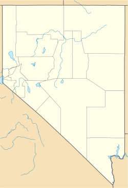
Washoe Valley is a special area in Washoe County, Nevada, United States. It's called a census-designated place (CDP). This means it's a place that the government counts for population, but it's not officially a city or town.
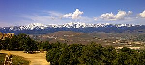
Washoe Valley is very similar to the community of New Washoe City. In 2020, about 3,074 people lived here. It's part of the larger Reno–Sparks area. The name "Washoe Valley" comes from the beautiful valley it sits in. This valley is located between the cities of Reno and Carson City, and it's centered around Washoe Lake.
Contents
Where is Washoe Valley?
The Washoe Valley CDP is located at 39°17′46″N 119°46′33″W / 39.29611°N 119.77583°W. This is just east of Washoe Lake. The main road that goes through the community is Eastlake Boulevard. This road connects north and south to U.S. Route 395. Route 395 is the main highway that runs through the entire valley.
The United States Census Bureau says that the CDP covers an area of about 13.1 square kilometers (about 5.04 square miles). All of this area is land.
Who Lives in Washoe Valley?
| Historical population | |||
|---|---|---|---|
| Census | Pop. | %± | |
| 2010 | 3,019 | — | |
| 2020 | 3,074 | 1.8% | |
| U.S. Decennial Census | |||
In 2010, there were 3,019 people living in Washoe Valley. These people lived in 1,249 homes. About 868 of these were families. The population density was about 592 people per square mile (228 people per square kilometer). There were 1,311 houses or apartments in total.
Most of the people living in Washoe Valley were White (93.6%). There were also smaller groups of African American, Native American, and Asian people. About 5.1% of the population was Hispanic or Latino.
About 25.1% of the homes had children under 18 living there. Most homes (58.4%) were married couples. About 7.6% of homes had a single mom with no husband. About 30.5% of homes were not families.
The average home had 2.42 people. The average family had 2.84 people.
Age of Residents
The people in Washoe Valley are spread out in age:
- 18.1% were under 18 years old.
- 5.3% were between 18 and 24 years old.
- 18.3% were between 25 and 44 years old.
- 43.2% were between 45 and 64 years old.
- 15.4% were 65 years old or older.
The average age of people in Washoe Valley was 50.0 years old. For every 100 females, there were about 96.9 males.
Income in Washoe Valley
From 2007 to 2011, the average yearly income for a household was about $75,323. For families, the average income was about $85,375. Men who worked full-time earned about $58,889 per year. Women who worked full-time earned about $36,083 per year.
The income per person in the CDP was about $33,186. A small number of families (3.7%) and people (6.2%) lived below the poverty line. This included 6.4% of those under 18 and 3.1% of those 65 or older.
Famous People from Washoe Valley
- Greg LeMond - A famous professional cyclist.
See also
 In Spanish: Washoe Valley para niños
 | Misty Copeland |
 | Raven Wilkinson |
 | Debra Austin |
 | Aesha Ash |


