West Branch Christina River facts for kids
Quick facts for kids West Branch Christina River |
|
|---|---|
| Other name(s) | Tributary to Christina River |
| Country | United States |
| State | Delaware Maryland |
| County | New Castle (DE) Cecil (MD) |
| Physical characteristics | |
| Main source | Big Elk Creek and Christina River divides about 0.1 miles southeast of Appleton, Maryland 298 ft (91 m) 39°41′44″N 075°48′41″W / 39.69556°N 75.81139°W |
| River mouth | Christina River Newark, Delaware 79 ft (24 m) 39°39′33″N 075°43′02″W / 39.65917°N 75.71722°W |
| Length | 4.96 mi (7.98 km) |
| Basin features | |
| Progression | south then east |
| River system | Christina River |
| Basin size | 6.20 square miles (16.1 km2) |
| Tributaries |
|
| Bridges | Jackson Hall School Road, Barksdale Road, Vieves Way, Winchester Drive, Chestnut Drive, W Creek Village Drive, DE 2, Otts Chapel Road, Sandy Drive |
The West Branch Christina River is a small but important river in the United States. It flows for about 4.96 miles (8 kilometers) and is a branch of the larger Christina River. This river helps carry water through parts of New Castle County, Delaware.
Sometimes, this river has also been called Persimmon Branch. This name comes from historical records kept by the Geographic Names Information System.
Where the River Flows
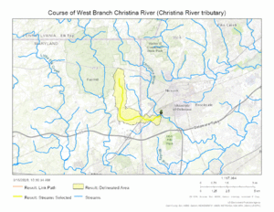
The West Branch Christina River starts in Cecil County, Maryland. It begins where the lands that drain into Big Elk Creek and the Christina River meet.
From there, the river flows south, then turns east. It eventually crosses into New Castle County, Delaware. The river then joins the main Christina River near the city of Newark, Delaware.
River's Surroundings
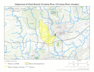
The area that the West Branch Christina River drains is about 6.20 square miles. This means all the land where rain and snow melt will eventually flow into this river.
This area gets about 46.2 inches of rain each year. About 25.1% of the land around the river is covered by forests.
Maps
 | Emma Amos |
 | Edward Mitchell Bannister |
 | Larry D. Alexander |
 | Ernie Barnes |


