Quick facts for kids
Wheeler Island

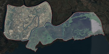
USGS aerial imagery of Wheeler Island
|
Location in Sacramento-San Joaquin River Delta
Show map of Sacramento-San Joaquin River Delta
Location in San Francisco Bay Area
Show map of San Francisco Bay Area
Location in California
Show map of California
Location in the United States
Show map of the United States
|
| Geography |
| Location |
Northern California |
| Coordinates |
38°05′06″N 121°56′15″W / 38.08500°N 121.93750°W / 38.08500; -121.93750 (Wheeler Island) |
| Adjacent bodies of water |
Suisun Bay |
| Administration |
|
|
| State |
 California California |
| County |
Solano |
Wheeler Island is a small island located in Suisun Bay, California. It is part of Solano County. The island's exact location is at coordinates 38°05′06″N 121°56′15″W.
Island History
Wheeler Island has appeared on maps for a long time. An early survey map from 1850 showed islands in this area. This map was made by Cadwalader Ringgold. Another map from 1854 by Henry Lange also showed islands. These older maps labeled parts of what is now Wheeler Island as "Davis Island" and "Warrington Island."
Where is Wheeler Island?
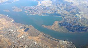
Wheeler Island is in Suisun Bay. This bay is an important part of the larger San Francisco Bay Area. The island is surrounded by other islands and bodies of water. These include Grizzly Bay, Honker Bay, Van Sickle Island, Dutton Island, Simmons Island, and Hammond Island.


