White Cap Mountain (Piscataquis County, Maine) facts for kids
Quick facts for kids White Cap Mountain |
|
|---|---|

Evening view from Millinocket area
|
|
| Highest point | |
| Elevation | 3,654 ft (1,114 m) |
| Prominence | 2,604 ft (794 m) |
| Listing | #15 New England Fifty Finest |
| Geography | |
| Topo map | USGS Big Shanty Mountain |
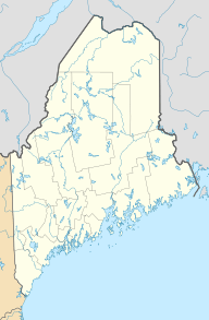
White Cap Mountain is a cool mountain located in Piscataquis County, Maine. It stands tall among other mountains. To its east is Hay Mountain. To the south, you'll find Big Spruce Mountain. Little Spruce Mountain is to the southeast.
About White Cap Mountain
White Cap Mountain is a well-known peak in Maine. It reaches an elevation of 3,654 feet (1,114 meters). This makes it one of the higher mountains in the state. The mountain is a popular spot for outdoor activities.
Where the Water Flows
The water from White Cap Mountain is part of a big system. It flows into the Pleasant River. This river is a smaller stream that joins the Piscataquis River. Eventually, all this water makes its way to the Penobscot River. From there, it flows into Penobscot Bay and then into the ocean.
- Water from the east side of White Cap flows into B Inlet Brook.
- This brook then goes into B Pond and Guernsey Brook.
- Finally, it reaches the East Branch of the Pleasant River.
- Water from the north and northwest sides flows into West Branch Ponds.
- These ponds connect to the West Branch of the Pleasant River.
- The south side of the mountain drains into Greenwood Brook.
- This brook also joins the West Branch of the Pleasant River.
The Appalachian Trail
A very famous hiking path crosses White Cap Mountain. It's called the Appalachian Trail. This trail is super long, stretching about 2,170 miles (3,490 km). It goes all the way from Georgia to Maine.
The Appalachian Trail runs right along the top of White Cap Mountain. It follows a ridge of hills for about four miles. Hikers on this trail get to enjoy amazing views from the summit. It's a challenging but rewarding part of the journey.
 | Chris Smalls |
 | Fred Hampton |
 | Ralph Abernathy |


