White Cloud, Michigan facts for kids
Quick facts for kids
White Cloud, Michigan
|
|
|---|---|

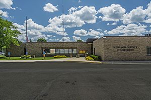
Newaygo County Courthouse
|
|

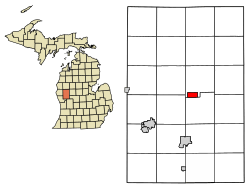
Location of White Cloud, Michigan
|
|
| Country | United States |
| State | Michigan |
| County | Newaygo |
| Area | |
| • Total | 1.99 sq mi (5.15 km2) |
| • Land | 1.93 sq mi (5.01 km2) |
| • Water | 0.06 sq mi (0.14 km2) |
| Elevation | 873 ft (266 m) |
| Population
(2020)
|
|
| • Total | 1,479 |
| • Density | 765.13/sq mi (295.38/km2) |
| Time zone | UTC-5 (Eastern (EST)) |
| • Summer (DST) | UTC-4 (EDT) |
| ZIP code |
49349
|
| Area code(s) | 231 |
| FIPS code | 26-86680 |
| GNIS feature ID | 1622135 |
White Cloud is a city in Michigan, a state in the United States. It's a small town located right by the White River. In 2020, about 1,479 people lived here. White Cloud is also the main town, or county seat, for Newaygo County.
This city is known as a "Trail Town." This means outdoor activities are a big part of life here! The 4,600-mile North Country Trail runs nearby. You can also visit Mill Pond Park, which has a beach and playground. White Cloud County Park and Campground are also popular spots. The North Country Trail Association officially recognized White Cloud as a "Trail Town."
Contents
About White Cloud's Location
White Cloud is located in Michigan. The United States Census Bureau says the city covers about 2.00 square miles (5.18 square kilometers). Most of this area, about 1.95 square miles (5.05 square kilometers), is land. The rest, about 0.05 square miles (0.13 square kilometers), is water.
What Drives White Cloud's Economy?
A very modern feed mill opened in White Cloud in April 2018. This mill cost $13 million to build! It helps supply special food products and technologies for animals in the area. Ceres Solutions Cooperative chose White Cloud for the mill because it's close to the airport and major highways. It also has access to Marquette Rail, which is a railway.
Arts and Culture in White Cloud
Every August, White Cloud hosts the Purple Heart Pow Wow. This event is for families and is supported by the Military Order of the Purple Heart. It's a special gathering that celebrates and honors military families.
White Cloud Community Library
The White Cloud Community Library is a key place for the community. It offers information for civic, cultural, educational, and fun activities. The library has a special section for local history. Here, people can get help with research, including finding information about their family history in Newaygo County. The library also puts on many events for both adults and children.
Main Roads in White Cloud
Two important state highways pass through White Cloud:
 M-20 - This highway runs east and west.
 M-37 - This highway runs north and south.
White Cloud Airport
The White Cloud Airport is owned and operated by the public. It has one runway that is 2,917 feet long. In 2019, the airport got a new terminal building. It also has a self-service fuel station. The airport is just a short walk from downtown White Cloud. It is also next to a new industrial park.
How Many People Live in White Cloud?
| Historical population | |||
|---|---|---|---|
| Census | Pop. | %± | |
| 1880 | 440 | — | |
| 1890 | 743 | 68.9% | |
| 1900 | 595 | −19.9% | |
| 1910 | 648 | 8.9% | |
| 1920 | 618 | −4.6% | |
| 1930 | 615 | −0.5% | |
| 1940 | 811 | 31.9% | |
| 1950 | 977 | 20.5% | |
| 1960 | 1,001 | 2.5% | |
| 1970 | 1,044 | 4.3% | |
| 1980 | 1,101 | 5.5% | |
| 1990 | 1,147 | 4.2% | |
| 2000 | 1,420 | 23.8% | |
| 2010 | 1,408 | −0.8% | |
| 2020 | 1,479 | 5.0% | |
| U.S. Decennial Census | |||
White Cloud's Population in 2010
According to the census from 2010, there were 1,408 people living in White Cloud. The city had 467 households and 294 families. The population density was about 722 people per square mile (278 people per square kilometer). There were 537 housing units in total.
About 25.9% of the people living in White Cloud were under 18 years old. About 11.6% were 65 years old or older. The average age of people in the city was 32.5 years. More males lived in the city (53.8%) than females (46.2%).
See also
 In Spanish: White Cloud para niños
 | Sharif Bey |
 | Hale Woodruff |
 | Richmond Barthé |
 | Purvis Young |

