Whittemore, Iowa facts for kids
Quick facts for kids
Whittemore, Iowa
|
|
|---|---|

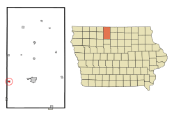
Location of Whittemore, Iowa
|
|
| Country | |
| State | |
| County | Kossuth |
| Area | |
| • Total | 0.41 sq mi (1.05 km2) |
| • Land | 0.41 sq mi (1.05 km2) |
| • Water | 0.00 sq mi (0.00 km2) |
| Elevation | 1,204 ft (367 m) |
| Population
(2020)
|
|
| • Total | 497 |
| • Density | 1,224.14/sq mi (472.45/km2) |
| Time zone | UTC-6 (Central (CST)) |
| • Summer (DST) | UTC-5 (CDT) |
| ZIP code |
50598
|
| Area code(s) | 515 |
| FIPS code | 19-85260 |
| GNIS feature ID | 0463013 |
Whittemore is a small city located in Kossuth County, Iowa, in the United States. In 2020, about 497 people lived there.
Contents
A Look Back at Whittemore's History
Whittemore was planned and laid out in 1878. This happened because people expected a railroad to be built through the area soon.
Geography of Whittemore
Whittemore is a small city in terms of its size. The United States Census Bureau says the city covers about 0.42 square miles (1.09 square kilometers). All of this area is land, meaning there are no large lakes or rivers within the city limits.
How Whittemore's Population Has Changed
| Historical populations | ||
|---|---|---|
| Year | Pop. | ±% |
| 1880 | 105 | — |
| 1890 | 578 | +450.5% |
| 1900 | 522 | −9.7% |
| 1910 | 518 | −0.8% |
| 1920 | 618 | +19.3% |
| 1930 | 604 | −2.3% |
| 1940 | 671 | +11.1% |
| 1950 | 678 | +1.0% |
| 1960 | 741 | +9.3% |
| 1970 | 658 | −11.2% |
| 1980 | 647 | −1.7% |
| 1990 | 535 | −17.3% |
| 2000 | 530 | −0.9% |
| 2010 | 504 | −4.9% |
| 2020 | 497 | −1.4% |
| Source: and Iowa Data Center Source: |
||
Whittemore in 2020: A Snapshot
The census in 2020 counted 497 people living in Whittemore. There were 203 households and 131 families in the city. The population density was about 1,224 people per square mile (472 per square kilometer). This means that many people live in a small area.
Most of the people living in Whittemore were White (94.0%). A small number of people were from other racial backgrounds. About 4.2% of the population identified as Hispanic or Latino.
Out of the 203 households, about 26.6% had children under 18 living with them. More than half (53.7%) were married couples living together. About 35.5% of all households were not families. This means they were made up of individuals or groups of friends. About 30.0% of all households had someone living alone.
The average age in Whittemore was 38.3 years old. About 27.8% of the people were under 20 years old. About 18.1% were 65 years old or older. The city had slightly more males (52.1%) than females (47.9%).
Whittemore in 2010: A Look Back
The census in 2010 showed that 504 people lived in Whittemore. There were 223 households and 135 families. The population density was about 1,200 people per square mile (463 per square kilometer).
Most people were White (98.0%). About 1.6% of the population was Hispanic or Latino.
About 27.8% of households had children under 18. Over half (51.1%) were married couples. About 36.3% of households were made up of individuals. The average age was 39.2 years. About 26.4% of residents were under 18. About 18.5% were 65 or older. The city had slightly more males (51.0%) than females (49.0%).
Education in Whittemore
Students in Whittemore go to schools in the Algona Community School District. This district also runs Algona High School.
Fun Places in Whittemore: Parks and Recreation
Whittemore has two parks for everyone to enjoy: Noah Park and Siems Park.
- Noah Park is in the middle of town. It has a playground with slides and swings. There is also a baseball diamond for playing sports.
- Siems Park is about two miles outside of town. Here, you can go fishing and camping. It has a shelterhouse and a small playground.
The city also has a swimming pool for residents to use.
See also
 In Spanish: Whittemore (Iowa) para niños
 | Aurelia Browder |
 | Nannie Helen Burroughs |
 | Michelle Alexander |

