Windsor (CDP), Vermont facts for kids
Quick facts for kids
Windsor, Vermont
|
|
|---|---|

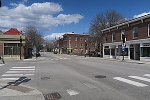
Main Street
|
|

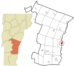
Location in Windsor County and the state of Vermont.
|
|
| Country | United States |
| State | Vermont |
| County | Windsor |
| Area | |
| • Total | 1.3 sq mi (3.4 km2) |
| • Land | 1.2 sq mi (3.1 km2) |
| • Water | 0.1 sq mi (0.3 km2) |
| Elevation | 341 ft (104 m) |
| Population
(2010)
|
|
| • Total | 2,066 |
| • Density | 1,574/sq mi (608/km2) |
| Time zone | UTC-5 (Eastern (EST)) |
| • Summer (DST) | UTC-4 (EDT) |
| ZIP code |
05089
|
| Area code(s) | 802 |
| FIPS code | 50-85000 |
| GNIS feature ID | 1460299 |
Windsor is a special community in Vermont, United States. It is called a census-designated place (CDP). This means it's an area that the government defines for counting people. Windsor is located in Windsor County. In 2010, about 2,066 people lived in the CDP. The larger town of Windsor had a total population of 3,553 people.
Geography
Where is Windsor Located?
Windsor is in the state of Vermont. The community covers a total area of about 3.4 square kilometers (1.3 square miles). Most of this area is land, about 3.1 square kilometers (1.2 square miles). The rest is water, which is about 0.3 square kilometers (0.1 square miles).
Windsor is right next to the Connecticut River. This river forms the natural border between Vermont and the state of New Hampshire.
Roads and Bridges in Windsor
You can travel through Windsor using U.S. Route 5. This main road goes north to places like White River Junction. It also goes south to towns such as Springfield and Bellows Falls. Another road, Vermont Route 44, starts in the center of Windsor. It heads west towards Brownsville and South Reading.
A larger highway, Interstate 91, passes west of Windsor. However, you cannot get onto Interstate 91 directly from the village. The closest place to access it is Exit 9 in Hartland.
One of the most famous landmarks here is the Cornish–Windsor Covered Bridge. This bridge crosses the Connecticut River from Windsor into Cornish, New Hampshire. It is known for being one of the longest covered bridges in the entire world.
See also
 In Spanish: Windsor (condado de Windsor) para niños
 | Dorothy Vaughan |
 | Charles Henry Turner |
 | Hildrus Poindexter |
 | Henry Cecil McBay |

