
Woodmont, Connecticut facts for kids
Quick facts for kids
Woodmont, Connecticut
|
||
|---|---|---|
| Borough of Woodmont | ||

Vintage postcard of Merwin Ave.
|
||
|
||

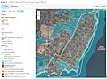
U.S. Census Map
|
||

Woodmont, Connecticut
Location in Connecticut
|
||
| Country | ||
| U.S. state | ||
| County | New Haven | |
| Region | South Central CT | |
| Town | Milford | |
| Area | ||
| • Total | 0.99 sq mi (2.58 km2) | |
| • Land | 0.28 sq mi (0.71 km2) | |
| • Water | 0.72 sq mi (1.86 km2) | |
| Elevation | 39 ft (12 m) | |
| Population
(2020)
|
||
| • Total | 1,486 | |
| • Density | 5,643.64/sq mi (2,182.43/km2) | |
| Time zone | UTC-5 (EST) | |
| • Summer (DST) | UTC-4 (EDT) | |
| FIPS code | 09-88050 | |
| GNIS feature ID | 0212247 | |

Woodmont is a special kind of town area called a borough. It is part of the larger city of Milford, located in New Haven County, Connecticut. In 2020, about 1,486 people lived there.
Woodmont started in 1893 as the Woodmont Improvement Association. It was created by a special law from the Connecticut General Assembly. Later, in 1903, it became the Woodmont Association. In 1957, another law changed it into a full municipality, or a self-governing area, known as a borough.
Woodmont is one of nine boroughs in Connecticut. The local government in Woodmont works closely with the city of Milford. They share responsibilities for things like keeping roads in good shape, clearing snow, and maintaining beaches. They also help with police services. Residents in the borough pay a bit extra in taxes each year. This extra money helps pay for services that Woodmont provides beyond what the city of Milford offers to other parts of Milford.
Contents
Exploring Woodmont's Location and Landscape
Woodmont is a small area. It covers about 2.58 square kilometers (1.0 square mile). Most of this area, about 1.86 square kilometers (0.7 square miles), is water. The land area is only about 0.71 square kilometers (0.3 square miles). This means a lot of Woodmont is covered by water!
Most of the land in Woodmont is high enough to be safe from the sea. However, some lower areas can flood during very big storms, like Hurricanes. Maps from 2013 show these flood-prone areas.
Who Lives in Woodmont?
The number of people living in Woodmont has changed over time. Here's a quick look at the population from different years:
| Historical population | |||
|---|---|---|---|
| Census | Pop. | %± | |
| 1910 | 194 | — | |
| 1920 | 220 | 13.4% | |
| 1930 | 531 | 141.4% | |
| 1940 | 748 | 40.9% | |
| 1970 | 2,114 | — | |
| 1980 | 1,797 | −15.0% | |
| 1990 | 1,770 | −1.5% | |
| 2000 | 1,711 | −3.3% | |
| 2010 | 1,488 | −13.0% | |
| 2020 | 1,486 | −0.1% | |
| U.S. Decennial Census | |||
In 2010, there were 1,488 people living in Woodmont. There were 691 households, which are groups of people living together in one home. About 406 of these were families. The area had about 4,960 people per square mile of land.
Most people in Woodmont are White (97.4%). There are also smaller groups of African American (1.1%), Native American (0.1%), and Asian (1.3%) residents. Some people (0.7%) are from other races, and 0.64% are from two or more races. About 5.8% of the population identified as Hispanic or Latino.
In terms of households, about 23.8% had children under 18 living there. Many households (45.1%) were married couples. About 10.1% had a female head of household without a husband. About 34.4% of all households were made up of single individuals. Around 9.3% of households had someone aged 65 or older living alone. On average, there were 2.25 people per household and 2.91 people per family.
The population in Woodmont is spread out by age. About 19.5% of residents were under 18. About 5.8% were between 18 and 24. The largest group, 33.0%, was between 25 and 44. People aged 45 to 64 made up 27.8%, and 13.9% were 65 or older. The average age in Woodmont was 41 years old. For every 100 females, there were about 94.9 males.
Images for kids
-
FEMA flood map for Woodmont, showing areas that might flood.

See also
 In Spanish: Woodmont (Connecticut) para niños
