Woodston, Kansas facts for kids
Quick facts for kids
Woodston, Kansas
|
|
|---|---|

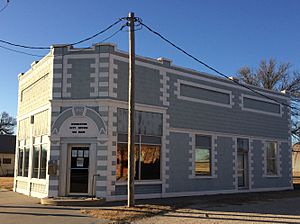
Woodston City Office est 1910 (2016)
|
|

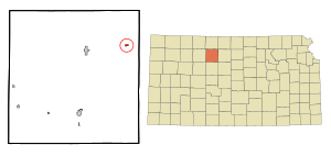
Location within Rooks County and Kansas
|
|

|
|
| Country | United States |
| State | Kansas |
| County | Rooks |
| Founded | 1885 |
| Incorporated | 1905 |
| Named for | Charles Woods |
| Area | |
| • Total | 0.21 sq mi (0.55 km2) |
| • Land | 0.21 sq mi (0.55 km2) |
| • Water | 0.00 sq mi (0.00 km2) |
| Elevation | 1,709 ft (521 m) |
| Population
(2020)
|
|
| • Total | 94 |
| • Density | 448/sq mi (170.9/km2) |
| Time zone | UTC-6 (CST) |
| • Summer (DST) | UTC-5 (CDT) |
| ZIP code |
67675
|
| Area code | 785 |
| FIPS code | 20-80450 |
| GNIS ID | 2397374 |
Woodston is a small city located in Rooks County, Kansas, in the United States. In 2020, about 94 people lived there.
Contents
History of Woodston
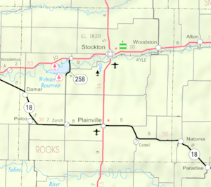
Woodston started as a railroad town in 1885. It was built along the Missouri Pacific Railroad line. The town was located between Bull City (now Alton) and Stockton.
The city got its name from Charles C. Woods. He was a businessman from Stockton. Mr. Woods played a big part in bringing the railroad to Stockton.
The Rooks Centre Post Office opened in 1872. It later moved to Woodston in 1886. Woodston officially became an incorporated city in 1905. This means it formed its own local government.
Geography and Location
Woodston is a small city with a total area of about 0.24 square miles (0.62 square kilometers). All of this area is land. The city does not have any large bodies of water within its borders.
Population Changes Over Time
The number of people living in Woodston has changed quite a bit over the years. Here's a look at the population counts from different years:
| Historical population | |||
|---|---|---|---|
| Census | Pop. | %± | |
| 1910 | 299 | — | |
| 1920 | 314 | 5.0% | |
| 1930 | 287 | −8.6% | |
| 1940 | 286 | −0.3% | |
| 1950 | 296 | 3.5% | |
| 1960 | 332 | 12.2% | |
| 1970 | 211 | −36.4% | |
| 1980 | 157 | −25.6% | |
| 1990 | 121 | −22.9% | |
| 2000 | 116 | −4.1% | |
| 2010 | 136 | 17.2% | |
| 2020 | 94 | −30.9% | |
| U.S. Decennial Census | |||
What the 2010 Census Showed
In 2010, there were 136 people living in Woodston. These people lived in 53 different homes. About 38 of these homes were families.
The city had about 567 people per square mile. There were 82 housing units in total. Most of the people living in Woodston were White (94.9%). A small number were African American (1.5%) or Asian (2.9%). Less than 1% were from two or more races. Also, 0.7% of the population was Hispanic or Latino.
Many homes (34%) had children under 18 living there. About half of the homes (50.9%) were married couples. Some homes had a single parent, either a mother (11.3%) or a father (9.4%). About 28.3% of homes were not families.
The average age of people in Woodston was 34.5 years old.
- 26.5% of residents were under 18.
- 11% were between 18 and 24.
- 20.6% were between 25 and 44.
- 24.3% were between 45 and 64.
- 17.6% were 65 or older.
There were slightly more males (54.4%) than females (45.6%) in the city.
Education in Woodston
Woodston is part of Unified School District 271. This school district does not have any schools located directly in Woodston.
Woodston used to have its own high school, called Woodston High School. Its mascot was the Woodston Coyotes. This high school closed in 1968. The grade school in Woodston closed a few years later, in 1974.
See also
 In Spanish: Woodston (Kansas) para niños
 | Kyle Baker |
 | Joseph Yoakum |
 | Laura Wheeler Waring |
 | Henry Ossawa Tanner |

