
Wyalong facts for kids
|
||||||||||||||||||||||||||||||


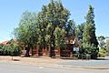
Wyalong is a small, historic town in the Riverina region of New South Wales, Australia. It's part of the Bland Shire. Wyalong started as a busy gold mining town. Today, it's a peaceful place with many old buildings. It's located a few kilometers east of West Wyalong, which is a bigger town nearby. In 2021, about 620 people lived in Wyalong.
Contents
Wyalong's Gold Rush Story
The town of Wyalong began in 1884. It became famous when gold was found there.
Finding Gold in Wyalong
In September 1893, a man named Joseph Neeld discovered gold in Wyalong. Soon, a main camp was set up on the eastern side of the gold digging area. Important government buildings were built there. These buildings are now considered historic and worth protecting. The goldfield was named Wyalong by a mining official named William Henry John Slee.
Life as a Gold Miner
At its busiest time in May 1894, over 12,000 miners worked on the goldfields. They dug deep shafts and tunnels to reach the gold hidden in quartz rocks. By the end of 1894, the number of miners had dropped to about 4,200. Miners formed groups like the Amalgamated Miners' Association of Australasia. This group helped miners work together. They even held parades to celebrate the "eight-hour day," which meant working only eight hours a day.
Building the Community
The Catholic Sisters of Mercy opened their first school in Wyalong in 1896. It was called St. Patrick's and started with 196 students and six Sisters. In 1899, Wyalong became a municipality. This meant it had its own local government. Buildings like council chambers, a courthouse, a police station, a post office, and a school of arts were built.
Wyalong and West Wyalong
At first, homes and shops were built close to the main mining area in Wyalong. But in 1895, West Wyalong started to grow a bit further west. As gold mining slowed down in Wyalong, West Wyalong became the main center for farming in the area. For many years, the two towns were rivals. Both wanted the Temora railway line, which was built in 1903. They agreed to have a station called Wyalong Central, located between the two towns.
Gold Mining Today
Gold mining in the immediate Wyalong area slowed down after 1910 and stopped by 1921. In the 1930s, old mining waste was reprocessed to get more gold using a method called cyanide processing. Today, a company named Barrick Gold is mining gold about 43 kilometers west of Wyalong, near Lake Cowal. They use a method called in situ cyanide leaching.
Modern Wyalong
Since the 1970s, Wyalong has grown closer to West Wyalong. Several motels have been built in the area known as Central Wyalong. In 1994, a path for bicycles and walkers was built to connect Wyalong with West Wyalong.
Images for kids
-
Wyalong Anglican Church

