Yegua Creek facts for kids
Quick facts for kids Yegua Creek |
|
|---|---|

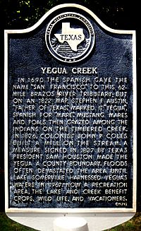
Yegua Creek Historical Marker
|
|
| Country | United States |
| Physical characteristics | |
| Main source | Texas |
Yegua Creek is a river in Central Texas. It is part of the Brazos River system. The name "Yegua" means "mare" in Spanish.
Yegua Creek starts in Lee County. It forms where the Middle Yegua Creek and East Yegua Creek meet. This is about three miles west of Somerville Lake. Yegua Creek is the main stream that helps create Somerville Lake.
The Yegua flows east. It becomes part of the Burleson County border for about 31 miles. Then, it joins the Brazos River in southeastern Washington County. Below the Somerville Dam, the Yegua is a calm, slow-moving river. People sometimes use it for fun activities like canoeing and kayaking.
The Yegua, or its smaller streams, has several dams. These dams create small lakes like Wilkins, Ward, and Baker lakes. The Yegua flows through flat land. It has trees like hardwoods and conifers, plus grasses. The soil is mostly clay and sandy.
After the Somerville Dam was built in 1967, people wondered about how much dirt and sand (sediment) would move in the creek. But it seems the river has found a balance. Most of the sediment from the upper part of the creek is now caught by the dam. Yegua Creek was identified as the stream Alonso de León named San Francisco in 1690.
East Yegua Creek: Where It Begins
East Yegua Creek starts about nine miles southwest of Rockdale, Texas. This is in southern Milam County. It begins as a small stream in farm and ranch areas.
The East Yegua is not always flowing. It is very shallow in its upper parts. It usually has a lot of water only after it rains. It flows southeast for about 45 miles. It then joins the Middle Yegua. This is where Yegua Creek officially begins. This spot is on the border of Burleson County and Lee County. It is about 15 miles south of Caldwell.
The East Yegua flows through flat land. It has shallow dips in the ground. The soil is clay and sandy. Water-loving hardwood trees, conifers, and grasses grow here.
Alcoa Lake: A Man-Made Lake
Alcoa Lake was made by building a dam on Sandy Creek. It is seven miles southwest of Rockdale in Milam County. Sandy Creek joins the East Yegua Creek at the base of the dam.
The Aluminum Company of America (Alcoa) owns and runs Alcoa Lake. They used the water for their factory. In recent years, people also use it for fun activities. Building the lake started in February 1952. The dam was finished in October 1952. In 1966, the lake could hold 10,500 acre-feet of water. Its surface area was 703 acres. The company used the water to cool their power plant. The Alcoa plant closed in 2009.
Middle Yegua Creek: The Other Branch
Middle Yegua Creek is also called Second Yegua Creek. It starts five miles southeast of Coupland. This is in southeastern Williamson County, near the Lee County line.
This stream also does not always flow. It is very shallow in its upper parts. It flows southeast for 53 miles. It goes through Williamson and Lee counties. Then, it joins the East Yegua Creek. This meeting point is about five miles southeast of Dime Box, Texas in Lee County.
When the two creeks meet, Yegua Creek is formed. This is about three miles west of Somerville Lake. The Middle Yegua has four small dams. These dams create small lakes named Round, Shaw, Little, and Mourn. The banks of the Middle Yegua have many trees, like post oak and other hardwoods. The creek flows through flat land. The topsoil is clay and sandy loam.
 | DeHart Hubbard |
 | Wilma Rudolph |
 | Jesse Owens |
 | Jackie Joyner-Kersee |
 | Major Taylor |

