Youngsville, Louisiana facts for kids
Quick facts for kids
Youngsville, Louisiana
|
|
|---|---|
| City of Youngsville | |

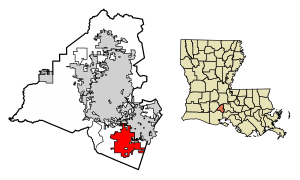
Location in Lafayette Parish, Louisiana
|
|

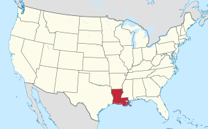
Location of Louisiana in the United States
|
|
| Country | United States |
| State | Louisiana |
| Parish | Lafayette |
| Area | |
| • Total | 12.45 sq mi (32.25 km2) |
| • Land | 12.45 sq mi (32.25 km2) |
| • Water | 0.00 sq mi (0.00 km2) |
| Elevation | 26 ft (8 m) |
| Population
(2020)
|
|
| • Total | 15,929 |
| • Density | 1,279.23/sq mi (493.90/km2) |
| Time zone | UTC-6 (CST) |
| • Summer (DST) | UTC-5 (CDT) |
| ZIP code |
70592
|
| Area code(s) | 337 |
| FIPS code | 22-83335 |
Youngsville is a city located in Lafayette Parish, Louisiana, in the United States. It is part of the larger Lafayette area. In 2010, about 8,105 people lived there. By 2020, the population had grown to 15,929.
A well-known person from Youngsville was Dudley J. LeBlanc. He was a businessman and politician in Louisiana. Another politician, Bernard LeBas, who has served in the Louisiana House of Representatives, used to live in Youngsville.
Contents
History of Youngsville
Youngsville was first settled in the early 1800s. French Acadian farmers were among the first people to live here. Before 1839, George Roy and his son, Desire, planned the area. They named the community "Royville."
By 1859, the settlement was big enough for a church. St. Anne Church was built, becoming one of the oldest Catholic churches in Lafayette Parish. It is on Church Street, the community's oldest street.
In 1908, the U.S. Postal Service asked for a name change. This was because "Royville" was often confused with "Rayville" in northern Louisiana. So, in 1908, the village was officially named Youngsville. The name means "young village." At that time, it was governed by a mayor and three aldermen.
On January 20, 1983, Louisiana Governor David C. Treen announced Youngsville was now a town. To handle its growing population, the town's government changed. It then had a mayor and five aldermen.
Youngsville grew very quickly between 1990 and 2005. Its population increased by over 300 percent. From 2000 to 2010, it grew by 103%. In 2006, Governor Kathleen Blanco declared Youngsville a city.
Even though the city has grown, it still has many sugarcane farms around it. Youngsville is also home to several fun places. These include the Youngsville Sports Complex, Youngsville Recreation Center, Sugar Beach, Pixus Splash Park, and the Youngsville Amphitheater. These places welcome over 1.2 million visitors and sports players each year.
Geography and Location
Youngsville is in the southeastern part of Lafayette Parish. It is located at 30°6′2″N 91°59′27″W / 30.10056°N 91.99083°W. To the north, it borders Lafayette, which is the main city of the parish. To the east, it borders the city of Broussard.
The center of Lafayette is about 10 miles (16 km) north of Youngsville. Abbeville is 16 miles (26 km) to the southwest. New Iberia is 16 miles (26 km) to the southeast. The United States Census Bureau says Youngsville has a total land area of about 12.07 square miles (31.26 km²). All of this area is land.
Population Information
| Historical population | |||
|---|---|---|---|
| Census | Pop. | %± | |
| 1900 | 200 | — | |
| 1910 | 328 | 64.0% | |
| 1920 | 361 | 10.1% | |
| 1930 | 536 | 48.5% | |
| 1940 | 647 | 20.7% | |
| 1950 | 769 | 18.9% | |
| 1960 | 946 | 23.0% | |
| 1970 | 1,002 | 5.9% | |
| 1980 | 1,053 | 5.1% | |
| 1990 | 1,195 | 13.5% | |
| 2000 | 3,992 | 234.1% | |
| 2010 | 8,105 | 103.0% | |
| 2020 | 15,929 | 96.5% | |
| U.S. Decennial Census | |||
Youngsville has a diverse population. The table below shows the different racial groups living in Youngsville in 2020.
| Race | Number | Percentage |
|---|---|---|
| White (not Hispanic) | 12,496 | 78.45% |
| Black or African American (not Hispanic) | 1,446 | 9.08% |
| Native American | 49 | 0.31% |
| Asian | 350 | 2.2% |
| Pacific Islander | 6 | 0.04% |
| Other/Mixed | 573 | 3.6% |
| Hispanic or Latino | 1,009 | 6.33% |
As of July 1, 2023, the U.S. Census estimates there were 18,002 people. In 2020, there were 15,929 people living in the city. There were 4,396 households and 3,883 families. The average age of people in Youngsville was 33.1 years old. About 11.2% of the population lived at or below the poverty line. The average household income was $89,038.
Schools in Youngsville
Youngsville is part of the Lafayette Parish School System. This means public schools are managed by the parish.
Public Schools
There are two public elementary schools in Youngsville. These are Green T. Lindon Elementary School and Ernest Gallet Elementary School. Youngsville Middle School teaches students from sixth to eighth grade. All public high school students from Youngsville go to Southside High in Youngsville. Some also attend Ovey Comeaux High School in southern Lafayette.
Private Schools
Youngsville also has private schools. These include Westminster Christian Academy and Youngsville Christian School. Youngsville Christian School offers classes from Kindergarten to 12th grade. Ascension Episcopal School is a private high school located near the Youngsville Sports Complex.
Transportation and Roads
The city of Youngsville started a big road project in 2007. It was called the Chemin Metairie Parkway Project. This project aimed to make roads better in and around Youngsville.
The first part of the parkway opened in early 2009. It connects Highway 92 and Chemin Metairie to central Youngsville. The road was first called the Youngsville Parkway. But its name was changed to Chemin Metairie Parkway. This was to avoid confusion with the existing Youngsville Highway, also known as Highway 89.
Chemin Metairie Parkway connects to Highway 90. This is near the Baker Hughes Complex in Broussard. A part of the parkway goes through the Sugar Mill Pond area. It also passes a new shopping center. This center includes Lafayette Parish's first Rouse's Grocery Store.
See also
 In Spanish: Youngsville (Luisiana) para niños
 | Jackie Robinson |
 | Jack Johnson |
 | Althea Gibson |
 | Arthur Ashe |
 | Muhammad Ali |

